When Theodore Roosevelt came to Dakota Territory to hunt bison in 1883, he was a skinny, young, spectacled dude from New York. He could not have imagined how his adventure in this remote and unfamiliar place would forever alter the course of the nation. The rugged landscape and strenuous life that TR experienced here would help shape a conservation policy that we still benefit from today.
70.4Kacres of parkland
729.9Krecreation visits, 2025
Jul · Aug · Sepnearby climate picks
Seasonal access & reservations
No reviewed guidance for this selection. Check the park's official planning pages; missing coverage does not establish access.
Selected guidance only; separate from climate comfort and current conditions.
Official conditions Not checked
The conditions feed has not been connected for this park.
Editorial recommendations, reviewed 2026-10-17. Full park days, excluding travel to and from the region. A first-visit outline for a general traveler; adapt to mobility, fitness, season, reservations, and current conditions. These are suggested days, not reserved activities or guaranteed routes.
Feel the wind in your hair high atop Johnson's Plateau. This flat, paved nature trail is perfect for those who want to step out for just a moment.
Boicourt Overlook Trail
0.2 mi / 0.3 km
One of the most beautiful South Unit overlooks is accessible by this easy nature trail with slight grade. This overlook is a ranger favorite for sunsets over the badlands!
Little Mo Trail
30 - 45 minutes
0.7 mi / 1.1 km (paved inner loop) 1.1 mi / 1.8 km (unpaved outer loop)
Explore the river bottom habitat along a paved nature trailwith slight grades. Take along a trail brochure, available at the trailhead, to learn as you adventure.
You'll be on top of the world when you climb to the highest accessible point in the park. This is a short, but steep trail. The view from the top is worth every step.
Wind Canyon Trail
0.4 mi / 0.6 km
Enjoy hiking this nature trail alongside a wind-sculpted canyon as you climb to the best view of the Little Missouri River the South Unit has to offer. Another ranger favorite for sunsets!
Easy to Moderate
Ridgeline Trail
Explore the badlands environment along a nature trail with moderate to steep grades. Take along a trail brochure, available at the trailhead, to learn as you adventure. This trail has stairs.
Download the Ridgeline Trail brochure
Coal Vein Trail
0.6 mi / 1 km (inner loop)
0.8 mi / 1.3 km (outer loop)
Although the coal vein is no longer burning, this nature trail is an excellent place to learn about badlands geology and ecology. Take along a trail brochure, available at the trailhead. This trail has stairs.
Download the Coal Vein Trail Brochure
0.9 mi / 1.4 km
The canyon looks amazing from the rim, but wait until you experience a hike down into it! Get up close and personal with the rock layers, junipers, and wildlife. Remember, every step down means a step back up on the return.
1.5 mi / 2.4 km
Hike through badlands terrain and dry washes as you experience a variety of habitats. Take along a trail brochure, available at the trailhead, to learn as you adventure. View the Caprock Coulee Nature Trail Guide.
Prairie Dog Town via the
Start at the Caprock Coulee Trailhead and follow the Buckhorn Trail to a prairie dog town. Be sure to plan some extra time for wildlife viewing; where
there are prairie dogs, there are often lots of other animals, too!
Sperati Point via the
Achenbach Trail
Begin at Oxbow Overlook. A gently rolling walk leads to an overlook of the Little Missouri River. Along the way, pay attention to the wide variety of forbs and grasses. The prairie ecosystem is one of the most diverse on the planet!
Moderate to Strenuous
4.3 mi / 6.9 km
The first 0.75 miles of this trail consists of the Caprock Coulee Nature Trail. The trail becomes more strenuous as it climbs to the top of a grassy butte, follows a ridgeline with incredible views, and descends back down.
3 - 4 hours (one way)
7.1 mi / 11.4 km (one way)
The Maah Daah Hey Trail stretches 96 miles across the National Grassland connecting all three units of the park. This portion of the trail runs through
the South Unit.
9.6 mi / 15.4 km
You can begin this trail at Peaceful Valley Ranch by following the Ekblom Trail. To avoid a river crossing, access the loop via the Maah Daah Hey Trail. Thiswill add 3.2 miles round trip. Be aware of difficult stream crossings.
Petrified Forest Loop
10.3 mi / 16.6 km
Located in the remote northwest corner of the South Unit, this hike takes you through ancient petrified forests and badlands wilderness. The loop includes the North and South Petrified Forest Trails as well as the Maah Daah Hey.
11.4 mi / 18.3 km
Hike through prairie dog towns, sagebrush terraces, deep canyons, and high open prairies. Experience the diversity of plant and animal life in these distinct habitats.
Jones/Lower Talkington/
Lower Paddock Loop
This loop combines the Jones Creek Trail, the Lower Talkington Trail, and the Lower Paddock Creek Trail. Add it to the Upper Paddock/Talkington Loop for an epic adventure of 23.4 miles.
Talkington Loop
15.4 mi / 24.8 km
19.4 mi / 31.2 km (Painted Canyon)
This trail combines part of the Lower Talkington Trail with the Upper Talkington and Upper Paddock Creek Trails. Accessing the loop from Painted Canyon will add 4 miles round trip to your hike.
Steep climbs and descents and two river crossings await you on a trail that leads deep into the heart of the Theodore Roosevelt Wilderness. Cross the Little Missouri River at daybreak and climb the buttes to greet the rising sun.
Please keep the following in mind as you hike:
All plants, wildlife, and natural and cultural features are protected. This includes animal bones, rocks, flowers, cultural items, and anything else you may discover while hiking. Do not disturb or remove these things.
Watch wildlife from a safe distance of 25 yards or more.
Pets, bicycles and motorized equipment are prohibited on all trails and in the backcountry.
Backcountry camping requires a free permit.
All trash and other materials, including toilet paper, must be packed out. Human waste should be buried in a hole 6-8 inches deep and at least 200 feet from any water source.
Hikers should yield the right-of-way to horseback riders.
Respect wildlife and other visitors by keeping noise low while on trail.
Hiking Trail
Round-Trip Time and Distance
Trail Description
Skyline Vista South Unit
10 minutes 0.1 mi / 0.16 km
Feel the wind in your hair high atop Johnson's Plateau. This flat, paved nature trail is perfect for those who want to step out for just a moment.
Boicourt Overlook Trail South Unit
15 minutes 0.2 mi / 0.3 km
One of the most beautiful South Unit overlooks is accessible by this easy nature trail with slight grade. This overlook is a ranger favorite for sunsets over the badlands!
Little Mo Trail North Unit
30 - 45 minutes 0.7 mi / 1.1 km (paved inner loop) 1.1 mi / 1.8 km (unpaved outer loop)
Explore the river bottom habitat along a paved nature trailwith slight grades. Take along a trail brochure, available at the trailhead, to learn as you adventure.
Buck Hill South Unit
15 minutes 0.2 mi / 0.3 km
You'll be on top of the world when you climb to the highest accessible point in the park. This is a short, but steep trail. The view from the top is worth every step.
Wind Canyon Trail South Unit
20 minutes 0.4 mi / 0.6 km
Enjoy hiking this nature trail alongside a wind-sculpted canyon as you climb to the best view of the Little Missouri River the South Unit has to offer. Another ranger favorite for sunsets!
Ridgeline Trail South Unit
30 minutes 0.6 mi / 1 km
Explore the badlands environment along a nature trail with moderate to steep grades. Take along a trail brochure, available at the trailhead, to learn as you adventure. This trail has stairs. Download the Ridgeline Trail brochure
Coal Vein Trail South Unit
30 - 45 minutes 0.6 mi / 1 km (inner loop) 0.8 mi / 1.3 km (outer loop)
Although the coal vein is no longer burning, this nature trail is an excellent place to learn about badlands geology and ecology. Take along a trail brochure, available at the trailhead. This trail has stairs. Download the Coal Vein Trail Brochure
Painted Canyon Nature Trail South Unit
45 minutes 0.9 mi / 1.4 km
The canyon looks amazing from the rim, but wait until you experience a hike down into it! Get up close and personal with the rock layers, junipers, and wildlife. Remember, every step down means a step back up on the return.
Caprock Coulee Nature Trail North Unit
1 hour 1.5 mi / 2.4 km
Hike through badlands terrain and dry washes as you experience a variety of habitats. Take along a trail brochure, available at the trailhead, to learn as you adventure. View the Caprock Coulee Nature Trail Guide.
Prairie Dog Town via the Buckhorn Trail North Unit
1 hour 1.5 mi / 2.4 km
Start at the Caprock Coulee Trailhead and follow the Buckhorn Trail to a prairie dog town. Be sure to plan some extra time for wildlife viewing; where there are prairie dogs, there are often lots of other animals, too!
Sperati Point via the Achenbach Trail North Unit
1 hour 1.5 mi / 2.4 km
Begin at Oxbow Overlook. A gently rolling walk leads to an overlook of the Little Missouri River. Along the way, pay attention to the wide variety of forbs and grasses. The prairie ecosystem is one of the most diverse on the planet!
Caprock Coulee North Unit
2 - 3 hours 4.3 mi / 6.9 km
The first 0.75 miles of this trail consists of the Caprock Coulee Nature Trail. The trail becomes more strenuous as it climbs to the top of a grassy butte, follows a ridgeline with incredible views, and descends back down.
Maah Daah Hey South Unit
3 - 4 hours (one way) 7.1 mi / 11.4 km (one way)
The Maah Daah Hey Trail stretches 96 miles across the National Grassland connecting all three units of the park. This portion of the trail runs through the South Unit.
Lone Tree Loop South Unit
5 - 6 hours 9.6 mi / 15.4 km
You can begin this trail at Peaceful Valley Ranch by following the Ekblom Trail. To avoid a river crossing, access the loop via the Maah Daah Hey Trail. Thiswill add 3.2 miles round trip. Be aware of difficult stream crossings.
Petrified Forest Loop South Unit
5 - 6 hours 10.3 mi / 16.6 km
Located in the remote northwest corner of the South Unit, this hike takes you through ancient petrified forests and badlands wilderness. The loop includes the North and South Petrified Forest Trails as well as the Maah Daah Hey.
Buckhorn North Unit
6 - 8 hours 11.4 mi / 18.3 km
Hike through prairie dog towns, sagebrush terraces, deep canyons, and high open prairies. Experience the diversity of plant and animal life in these distinct habitats.
Jones/Lower Talkington/ Lower Paddock Loop South Unit
6 - 8 hours 11.4 mi / 18.3 km
This loop combines the Jones Creek Trail, the Lower Talkington Trail, and the Lower Paddock Creek Trail. Add it to the Upper Paddock/Talkington Loop for an epic adventure of 23.4 miles.
Upper Paddock/ Talkington Loop South Unit
8 - 10 hours 15.4 mi / 24.8 km 19.4 mi / 31.2 km (Painted Canyon)
This trail combines part of the Lower Talkington Trail with the Upper Talkington and Upper Paddock Creek Trails. Accessing the loop from Painted Canyon will add 4 miles round trip to your hike.
Achenbach North Unit
10 - 12 hours 18 mi / 30 km
Steep climbs and descents and two river crossings await you on a trail that leads deep into the heart of the Theodore Roosevelt Wilderness. Cross the Little Missouri River at daybreak and climb the buttes to greet the rising sun.
"...We get exactly as much in hunting with the camera as in hunting with the rifle; and of the two, the former is the kind of sport which calls for the higher degree of skill, patience, resolution, and knowledge of the life history of the animal sought." Theodore Roosevelt, 1901
Theodore Roosevelt National Park has abundant watchable wildlife. What you see depends on the season, your patience and luck. Binoculars are helpful, but not essential.
Remember: all wildlife in the park are wild and potentially dangerous. Keep a safe distance from all wildlife. Some animals like bison, feral horses, and prairie dogs may seem tame, but they are wild animals and can be dangerous. People who get too close to them may be gored by antlers and horns, trampled by hooves, or bitten by sharp teeth. Maintain at least 25 yards distance from all wildlife. Use binoculars, spotting scopes, or telephoto lenses for safe viewing and to avoid disturbing them. If an animal moves away from you as you approach, you are too close! Respect all wildlife. The park is their home.
Keep pets in your vehicle. Pets may scare wildlife, and wild animals can hurt pets.
Use of wildlife calls and spotlights is illegal. They stress animals and alter their natural behavior.
Drive slowly. Watch for animals crossing the road. Deer, elk, pronghorn, and feral horses are seldom alone. If you see one animal, look for others that may follow.
Below is a list of some of the animals you might find in the park and some guidelines for where and when to look. What will you discover on your visit?
Bison roam throughout the North and South units of the park, and most visitors see them as they drive the park roads. They should be given a wide berth if met along the trail. Check at the visitor centers for recent sightings!
More common than their white-tailed cousins, mule deer are often seen between dusk and dawn anywhere along the park road in open areas. They usually seek shade in dense juniper groves during the heat of the day.
Deer prefer thick wooded areas and river bottomlands and may be seen in the campgrounds and picnic areas in the evening and early morning hours.
In the South Unit only, elk are most often seen feeding in early morning or evening on open grassland sites in the Buck Hill area and in the southeastern quarter of the park visible from I-94. Elk generally seek the shade of hardwood and juniper draws during the day.
Feral horses inhabit the South Unit only. Originally descended from domestic stock, horses are maintained in the park today as a cultural resource. They are often visible from the Scenic Loop Drive and from I-94.
A small demonstration herd is kept in the North Unit as a cultural resource. They may be spotted around mile marker two of the scenic drive as they graze across the open grassland.
The fastest land animal in North America, pronghorn are often sighted in the greater Little Missouri Grasslands. Small groups or individuals will occasionally enter the park, so keep your eyes open!
These wild canines are more often heard than seen. Listen for their howl after night falls or look for them in prairie dog towns during twilight hours.
Consider yourself very lucky if you see a bobcat! Only a few are seen each summer. Look for them on the barren rocky slopes, especially at night.
Badgers feed on rodents and are most often seen near prairie dog towns at dawn or dusk.
These aquatic rodents may be seen in the North Unit's Squaw Creek and along the Little Missouri River.
Porcupines are often found in trees and bushes feeding on twigs and cambium. They come to the ground more often at night and are frequently observed along the park roads.
The park road passes through three large prairie dog towns in the South Unit. No dog towns can be seen from the North Unit road; the nearest is a one-mile hike from the Caprock-Coulee parking area - be sure to follow the signs.
Always check the sky for glimpses of soaring golden eagles along the Little Missouri River floodplain and at the North Unit's River Bend Overlook.
Many different species of birds inhabit the park campgrounds where there is plenty of food and shelter in the thick brush and trees adjacent to the Little Missouri River. Mornings and evenings provide the best viewing times. It is also good birding where two habitat zones meet such as the edge of the trees and the grasslands.
Snakes enjoy the tall grass and shrubs of the prairie ecosystem. It is also common to see them on the park roads, so please drive carefully. The park is home to one species of venomous snake (prairie rattlesnake), but bullsnakes and racers are most commonly seen.
Wildlife
Details
Bison
Bison roam throughout the North and South units of the park, and most visitors see them as they drive the park roads. They should be given a wide berth if met along the trail. Check at the visitor centers for recent sightings!
Mule deer
More common than their white-tailed cousins, mule deer are often seen between dusk and dawn anywhere along the park road in open areas. They usually seek shade in dense juniper groves during the heat of the day.
White-tailed deer
Deer prefer thick wooded areas and river bottomlands and may be seen in the campgrounds and picnic areas in the evening and early morning hours.
Elk
In the South Unit only, elk are most often seen feeding in early morning or evening on open grassland sites in the Buck Hill area and in the southeastern quarter of the park visible from I-94. Elk generally seek the shade of hardwood and juniper draws during the day.
Horses
Feral horses inhabit the South Unit only. Originally descended from domestic stock, horses are maintained in the park today as a cultural resource. They are often visible from the Scenic Loop Drive and from I-94.
Longhorns
A small demonstration herd is kept in the North Unit as a cultural resource. They may be spotted around mile marker two of the scenic drive as they graze across the open grassland.
Pronghorns
The fastest land animal in North America, pronghorn are often sighted in the greater Little Missouri Grasslands. Small groups or individuals will occasionally enter the park, so keep your eyes open!
Coyotes
These wild canines are more often heard than seen. Listen for their howl after night falls or look for them in prairie dog towns during twilight hours.
Bobcats
Consider yourself very lucky if you see a bobcat! Only a few are seen each summer. Look for them on the barren rocky slopes, especially at night.
Badgers
Badgers feed on rodents and are most often seen near prairie dog towns at dawn or dusk.
Beavers
These aquatic rodents may be seen in the North Unit's Squaw Creek and along the Little Missouri River.
Porcupines
Porcupines are often found in trees and bushes feeding on twigs and cambium. They come to the ground more often at night and are frequently observed along the park roads.
Prairie dogs
The park road passes through three large prairie dog towns in the South Unit. No dog towns can be seen from the North Unit road; the nearest is a one-mile hike from the Caprock-Coulee parking area - be sure to follow the signs.
Golden eagles
Always check the sky for glimpses of soaring golden eagles along the Little Missouri River floodplain and at the North Unit's River Bend Overlook.
Birds
Many different species of birds inhabit the park campgrounds where there is plenty of food and shelter in the thick brush and trees adjacent to the Little Missouri River. Mornings and evenings provide the best viewing times. It is also good birding where two habitat zones meet such as the edge of the trees and the grasslands.
Snakes
Snakes enjoy the tall grass and shrubs of the prairie ecosystem. It is also common to see them on the park roads, so please drive carefully. The park is home to one species of venomous snake (prairie rattlesnake), but bullsnakes and racers are most commonly seen.
Questions?
If you have any questions about viewing wildlife, please stop in any of the visitor centers and ask a ranger. Please remember to view wildlife from a safe distance. All wildlife is protected in the park and cannot be hunted, fed or harassed. Come often and enjoy the unique opportunity to view wildlife in their natural habitat!
The park has two campgrounds (both have one group site and many standard sites) and one group site for camping with horses. All campgrounds are primitive (no hookups, no showers). All sites are by reservation at recreation.gov. More information about reservations below.
Choosing a Campground
When choosing a campground, first consider which park unit(s) you plan to visit. It may be helpful to look at a map .
Cottonwood Campground
Juniper Campground
Roundup Group Horse Camp
Backpack Camping
Hikers and horseback riders who choose to spend the night in the park's backcountry can do so by filling out a free Backcountry Permit in the North or South Unit Visitor Centers. There are no developed backcountry campsites or facilities. For more information, see backcountry permit for backpack camping .
Please note that the North and South Units of the park are in different time zones. Times for North Unit programs are listed in Central Time, while times for South Unit programs are listed in Mountain Time.
For example, 9:00 AM Central Time is 8:00 AM Mountain Time.
Take a look at four well known objects in the North Dakota night sky. Nebula, clusters and galaxies, oh my!
The Navajo have a deep connection to the night sky, especially the constellations in the northern sky.
Discover the Earth has a “wobble” and find out why Polaris hasn’t always been our north star.
Join Brad Nasset, NASA Solar System Ambassador as he talks about the many missions to the red planet, Mars.
Curious about which planets are currently in the night sky? Join Brad Nasset as he shows you when and where to see the visible planets.
What is a star cluster and how are they different from each other.
Twinkle, twinkle little star! Which star is closest and what are its properties?
Owls are the ultimate nocturnal hunters. But how are they able to sneak up on their prey?
Spot animals on the side of the road at night by the shine of their eyes? What causes eyeshine and how does it help animals see in the dark?
Have you ever wondered about how astronomers learned about the movement of Earth and the placement of constellations throughout the galaxy?
Have you ever wondered why the moon looks a little bit different every night?
What does it look like when an asteroid crashes into the moon and how are craters formed?
Cassiopeia and Cepheus: Vanity Gets You Nowhere Nearly all constellations have stories to tell. Learn why Cassiopeia spends half of the year on her head! Credit / Author: Brenda Nejedlo Date created: 08/07/2020 Audio Transcript Cassiopeia and Cepheus: Vanity Gets You Nowhere The northern sky holds many familiar constellations and asterisms such as Ursa Major, the Big Dipper, and the Little Dipper. These circumpolar constellations are always visible in the night sky if you live in the northern hemisphere. Nearly all constellations have some sort of story to tell. Different cultures from various ages all around the world look up at their sky and tell the stories of what they see. They might see a grouping of stars in a slightly different way than another culture and thus have different stories. Stories evolve, change and morph into new stories. Cultures build upon other cultures lore. There may be more than one story for a constellation, even among the same culture. Oftentimes, star lore can combine not just one, but several constellations into a larger story. Such is the case with the constellations of Cepheus and Cassiopeia. Both constellations are best seen in late summer and fall, when they are high in the northern sky. Both constellations lie along the northern Milky Way, and are rich with many deep sky objects. Cassiopeia is easily recognized as it looks like the letter ‘W’. Cepheus looks like a lopsided house drawn by a child. In Greek mythology, Cepheus and Cassiopeia were the king and queen of Ethiopia. Cassiopeia was very beautiful, but also boastful and vain about her beauty. She was not afraid to tell people how beautiful she was. One day, she dared to say that she, along with her daughter, Andromeda, were more beautiful than the sea nymphs, known as the Nerei
North Dakota Travel & Tourism Find out where to go in North Dakota and what to do when you get there. The site includes information on state historic sites and area museums.
McKenzie County Information on Watford City and the area near the North Unit of TRNP.
Medora Chamber of Commerce e-mail address: medorachamber@midstate.net Information on Medora and the area near the South Unit of TRNP.
Western North Dakota Weather Check on the current weather conditions in western North Dakota.
Maah Daah Hey Trail - U.S. Forest Service Information and printable maps for the 96-mile trail connecting Sully Creek State Park to Theodore Roosevelt National Park's North Unit.
Northern Prairie Wildlife Research Center Mammals of Southwestern North Dakota are featured at this web site.
North Dakota Scenic Byways - America's Byways Scenic route itineraries and sites to visit along the route.
Official NPS features and USGS park boundaries, imported 2026-10-17. An inventory snapshot, not live trail or parking availability.
Loading official park features…
TrailsPoints of interestParkingZoom with buttons or pinch. Toggle layers on the map.
Map coverage varies. Trail names may represent segments, connectors, or shared park units; mapped lines are not a hiking recommendation. Use official conditions and navigation resources before heading out.
Achenbach Trail Inventory record · 7 source segments; not a route distance.Official trail details
Field 1: Sperati Point via the Achenbach Trail North Unit
Field 2: 1 hour 1.5 mi / 2.4 km
Field 3: Begin at Oxbow Overlook. A gently rolling walk leads to an overlook of the Little Missouri River. Along the way, pay attention to the wide variety of forbs and grasses. The prairie ecosystem is one of the most diverse on the planet!
Big Plateau Trail Inventory record · 1 source segments; not a route distance.
Unknown
Unknown
Buckhorn Trail Inventory record · 7 source segments; not a route distance.Official trail details
Field 1: Prairie Dog Town via the Buckhorn Trail North Unit
Field 2: 1 hour 1.5 mi / 2.4 km
Field 3: Start at the Caprock Coulee Trailhead and follow the Buckhorn Trail to a prairie dog town. Be sure to plan some extra time for wildlife viewing; where there are prairie dogs, there are often lots of other animals, too!
Lone Tree Trail Inventory record · 2 source segments; not a route distance.
Unknown
Unknown
Page 1 of 3
NPS public GIS inventory, imported 2026-10-17. “Existing” is an inventory classification, not confirmation that a trail is open. Segment counts are not route distances. Parking records do not indicate space availability, fees, or accessibility certification. View government source ↗
Climate for Dickinson, 51 km from the park reference point. 1991–2020 normals. Source elevation: 735 m.
Daytime highNighttime lowOctober: 55° / 34°
Daytime high55°
Precipitation39 mm
Daylight10.6 hrs
Wind17.9 km/h
Mountain, rim, valley, and coastal conditions can differ sharply from the source town. Check park forecasts and current conditions before travel.
Monthly climate data 12 months · °F
Month
High
Low
Rain / snow water
Wet days
Daylight
25°
8°
14 mm
4.3
8.8 h
28°
11°
16 mm
4.0
10.0 h
40°
20°
24 mm
5.9
11.6 h
52°
31°
51 mm
8.4
13.3 h
64°
43°
72 mm
10.8
14.8 h
74°
53°
82 mm
11.1
15.6 h
81°
58°
69 mm
8.9
15.3 h
81°
56°
56 mm
7.5
14.0 h
70°
46°
50 mm
6.2
12.4 h
55°
34°
39 mm
5.9
10.6 h
39°
21°
20 mm
3.7
9.2 h
28°
12°
16 mm
4.1
8.4 h
RESEARCH WITH THE SOURCE IN VIEW
The practical field guide.
Official NPS excerpts imported 2026-10-17. Fees, permits, road access, and operations can change; use the source link to confirm the latest information.
Theodore Roosevelt National Park preserves three areas of rugged, beautiful badlands in southwestern North Dakota. It was established in honor of the landscape's influence on Theodore Roosevelt who, as a young man, hunted and ranched in the Little Missouri Badlands. The park is open year-round.
Scenic drives explore the colorful landscape and usually offer glimpses of bison, prairie dogs, deer, and more .
Hiking trails range from paved walking paths to rugged wilderness routes.
Get started planning your visit now!
Physical Address
Operating Hours & Seasons
An entrance fee is required to visit Theodore Roosevelt National Park year-around. Fees are collected at entrance stations May through September and in visitor centers the rest of the year. The park does not issue timed entry permits. Self-pay stations are available when visitor centers and entrance stations are closed. Passes can be purchased online. The South Unit entrance station is in the town of Medora. The North Unit entrance station is 15 minutes south of Watford City. During the winter season (usually October through May) entrance fees can be paid or passes presented in the South or North Unit Visitor Center. If the visitor center is not open, there is a drop box near the flagpole where entrance fees can be deposited.
The park has two campgrounds (both have one group site and many standard sites) and one group site for camping with horses. All campgrounds are primitive (no hookups, no showers). All sites are by reservation at recreation.gov. More information about reservations below.
Choosing a Campground
When choosing a campground, first consider which park unit(s) you plan to visit. It may be helpful to look at a map .
Cottonwood Campground
Juniper Campground
Roundup Group Horse Camp
Backpack Camping
Hikers and horseback riders who choose to spend the night in the park's backcountry can do so by filling out a free Backcountry Permit in the North or South Unit Visitor Centers. There are no developed backcountry campsites or facilities. For more information, see backcountry permit for backpack camping .
All three park visitor centers are wheelchair accessible, as is the Maltese Cross Cabin. Park films shown at the North and South Unit Visitor Centers offer closed captioning
Campground & Picnic Area
The South Unit's Cottonwood Campground has four accessible campsites and two restrooms that meet ADA access requirements. The Roundup Horse Camp also has accessible toilets and a picnic pavilion.
The North Unit's Juniper Campground has two accessible sites and two restrooms meeting ADA requirements. The group campsite also has accessible restrooms.
Picnic areas in both the North and South Unit have accessible restrooms and pavilions.
Restrooms on Scenic Drives
The North Unit Scenic Drive has no restrooms, but restrooms are located in Juniper Campground and Picnic Area as mentioned above. The South Unit Scenic Loop Drive has an accessible restroom near the road to Buck Hill, about midway around the loop, and also at the Halliday Well Trailhead.
Scenic Drive Points of Interest
Wheelchair accessible pullouts and overlooks along the scenic drives:
Skyline Vista - 0.1 mile trail
River Woodland Overlook - sidewalk with view of the Little Missouri River
Prairie Dog Town near the loop road junction - sidewalk and exhibits
Scoria Point Overlook - sidewalk, exhibit, and viewing area
Badlands Overlook - sidewalk, exhibit and viewing area
Buck Hill - sidewalk and exhibit (trail is paved and gravel with stairs)
Beef Corral Prairie Dog Town - sidewalk with prairie dog viewing
Wind Canyon Trail Parking Area - sidewalk only, trail is dirt and gravel surfaced with stairs
Boicourt Overlook - sidewalk and exhibit
Longhorn Steer Pullout - sidewalk and exhibit
Slump Block pullout - sidewalk and exhibit
Cannonball Concretion pullout - sidewalk, exhibit, and cannonball concretion viewing
River Bend Overlook - compacted gravel trail to viewing deck and exhibit
Oxbow Overlook - paved path along the rim of the badlands, exhibits
The short trails at the Skyline Vista Overlook and Boicourt Overlook in the South Unit and the Little Mo Nature Trail in the North Unit are hard-surfaced with minimal slope. All other trails have unmaintained dirt surfaces. More trail information here.
The Access Pass is a free lifetime entrance pass to all federal areas charging an entrance fee. It also provides a 50% reduction of expanded amenity fees for activities such as camping. Passes are available to all U.S. citizens or permanent residents with disabilities. Passes can be obtained in person wherever interagency passes are sold (park entrance stations when open, or in visitor centers during seasonal entrance station closures.)
Get an entrance pass All visitors must have one of these entrance passes: Pass Price Standard Pass $15.00–$30.00 Annual Pass $55.00 America the Beautiful Pass (includes Senior Passes) FREE–$250.00 Help me choose an entrance pass
Choosing an Entrance Pass
Do you have or qualify for a discounted America the Beautiful Pass?
If you already have an America the Beautiful—the National Parks and Federal Recreational Lands Pass, that's the only entrance pass you need. Seniors, military, visitors with a permanent disability, and families with a 4th grader are eligible for a free or discounted America the Beautiful pass.
America the Beautiful Pass
How often do you plan to visit national parks in the next 12 months?
If you don't qualify for a discounted America the Beautiful pass, we recommend choosing an entrance pass based on your trip plans.
Entrance Passes
The Theodore Roosevelt National Park Annual Park Pass is valid for one year from month of purchase. The pass admits the purchaser and passengers in a single, private, non-commercial vehicle, or the pass holder and his/her immediate family (spouse, children, parents) when entry is by other means (foot, bicycle).
Standard Entrance Pass
If you enter the park in a motorized vehicle, your entrance pass covers both you and your passengers. Your passengers do not need a separate pass.
Costs for vehicles with more than 15 passengers are listed below under Organizations and Businesses .
Private Vehicle $30.00
Valid for 7 days for all persons traveling in a single, private, non-commercial vehicle.
Motorcycle $25.00
Valid for 7 days. Admits up to 2 private, non-commercial motorcycles with up to 4 total passengers.
For Individuals without a Vehicle
If you enter the park on a bicycle or on foot and are at least 16 years old, you need your own entrance pass. Children under the age of 16 don't need an entrance pass.
Per Person $15.00
Valid for 7 days for a visitor traveling on foot, bicycle, horse, or other non-motorized means of travel.
For Organizations & Businesses
Commercial Van (7-15 seats) $50.00
In-person Purchase Locations
South Unit Visitor Center Cash or Credit/Debit
North Unit Visitor Center Cash or Credit/Debit
Commercial Mini-bus (16-25 seats) $60.00
Commercial Motor Coach (26+ seats) $150.00
Annual Entrance - Park
US citizens and residents
America the Beautiful—the National Parks and Federal Recreational Lands Pass
Covers entrance fees and standard amenity (day-use) fees at lands managed by
National Park Service
US Fish & Wildlife Service
US Forest Service
Bureau of Land Management
Bureau of Reclamation
US Army of Corps of Engineers
Depending on the type of entrance fee charged at a site, covers One private vehicle fee or Four per person fees
America the Beautiful Passes are non-refundable, non-transferable and cannot be replaced if lost or stolen . Passholders must show valid photo identification (ID) with each pass.
How to Get an America the Beautiful Pass
Physical passes can be purchased or picked up at over 1,000 federal recreation sites.
Purchase and pickup locations
To receive your pass by mail, order online at the USGS Online Store . Online orders are for physical passes, not digital passes, and may take up to three weeks to be processed and delivered. Order receipts may not be used in place of a physical pass. We recommend ordering at least three weeks in advance of your visit, or picking up a pass in person instead.
Skip the wait! Get a Digital America the Beautiful Pass through recreation.gov. Your digital pass can be saved to a mobile device and used immediately.
Get a Digital America the Beautiful Pass
2026 Free Entrance Days in the National Parks
Come experience the national parks! All National Park Service sites that charge an entrance fee will offer free admission to US citizens and residents (other fees, including timed entry or reservation fees, may apply). Mark your calendar for these entrance fee-free dates:
February 16 : Presidents Day (Washington's Birthday)
May 25 : Memorial Day
June 14: Flag Day/President Trump's birthday
July 3–5: Independence Day weekend
August 25: 110th Birthday of the National Park Service
September 17: Constitution Day
October 27 : Theodore Roosevelt's birthday
November 11: Veterans Day
Buy Your Digital Pass on Recreation.gov
Pass
Price
Standard Pass
$15.00–$30.00
Annual Pass
$55.00
America the Beautiful Pass (includes Senior Passes)
FREE–$250.00
I'm visiting...
We recommend
This park, once
Standard Pass
This park, multiple times
Annual Pass
More than one national park or federal recreation site
America the Beautiful Pass
Type
Available to
Price
Resident Annual Pass
US citizens and residents
$80.00
Non-Resident Annual Pass
Non-US residents
$250.00
Senior Annual Pass
US citizens and residents 62+ years old
$20.00
Senior Lifetime Pass
US citizens and residents 62+ years old
$80.00
Military Annual Pass
Current US military and dependents
Free
Military Lifetime Pass
Gold Star Family members and veterans
Free
Access Pass
US citizens and residents with permanent disability
Free
4th Grade Pass
US 4th graders
Free
Volunteer Pass
Federal recreation site volunteers with 250 service hours
Free
Pass
Price
Standard Pass
$15.00–$30.00
Annual Pass
$55.00
America the Beautiful Pass (includes Senior Passes)
FREE–$250.00
I'm visiting...
We recommend
This park, once
Standard Pass
This park, multiple times
Annual Pass
More than one national park or federal recreation site
America the Beautiful Pass
Type
Available to
Price
Resident Annual Pass
US citizens and residents
$80.00
Non-Resident Annual Pass
Non-US residents
$250.00
Senior Annual Pass
US citizens and residents 62+ years old
$20.00
Senior Lifetime Pass
US citizens and residents 62+ years old
$80.00
Military Annual Pass
Current US military and dependents
Free
Military Lifetime Pass
Gold Star Family members and veterans
Free
Access Pass
US citizens and residents with permanent disability
Free
4th Grade Pass
US 4th graders
Free
Volunteer Pass
Federal recreation site volunteers with 250 service hours
The park is comprised of three areas: South Unit, North Unit and Elkhorn Ranch Unit. The park's two most visited units, the North and South Units, are separated by a 1 hour and 10 minute drive. If you're not sure which unit(s) of the park you want to visit, you start here.
The South Unit is 133 miles west of Bismarck, ND and 27 miles east of the Montana state line. The South Unit entrance is located in the town of Medora, ND and accessed via Interstate 94, exits 24 and 27. The South Unit visitor center is just inside the park entrance in Medora. The South Unit's Painted Canyon Visitor Center is located 7 miles east of Medora at exit 32 off of Interstate 94. For GPS directions to the South Unit park entrance in Medora, use this address: 201 East River Road North Medora, ND 58645
The North Unit entrance is on U.S. Highway 85, approximately 14 miles south of Watford City, ND and 50 miles north of Belfield, ND. From I-94, take U.S. Highway 85 north at Exit 42 in Belfield, ND. For GPS directions to the North Unit, use this address: 208 Scenic Drive Watford City, ND 58854
Elkhorn Ranch Unit
Follow directions carefully to the park's most remote unit, accesssed by gravel roads. The last three miles of the route sometimes require 4-wheel drive and/or a high-clearance vehicle, especially in winter or during and after rain showers. Inquire about current road conditions at park visitor centers before you embark. Go directly to the Elkhorn Ranch Unit page for a map and driving directions.
Seasonal Road Closures
Park roads or highways outside of the park may be closed in winter due to snow or icy conditions. Check the current park road status and North Dakota highway status prior to your visit.
All animals in the park are wild and unpredictable. View them from a safe distance. Bison and other large mammals inhabit the park. They generally appear tranquil, but may attack without warning if they are disturbed.
Feeding animals of any kind is prohibited.
Rattlesnakes are present in the park. They do not always give a warning before striking. Be alert while walking, and do not put your hands or feet in a place you cannot see. Rattlesnakes and black widow spiders often live in prairie dog burrows.
Speed limits are posted and enforced on park roads.
Drive cautiously; winding park roads and abundant wildlife may yield unexpected surprises.
Use extra caution while driving at night.
Weather in the North Dakota badlands is harsh, with extremes in temperature and sudden, violent storms. Be prepared for rapidly changing conditions. Click here for more information on weather and climate in the park.
Hikers are advised to stay on established trails. Detailed maps are available for sale at the park visitor centers. Climbing on the steep slopes in the badlands can be dangerous, especially when wet. Slippery clays and soft sediments can yield underfoot.
Watch for poison ivy in wet areas and for ticks in late spring and early summer.
Get drinking water only from approved sources. Backcountry hikers should plan to carry all the water they will need for their entire itinerary; water sources are limited in the backcountry. Water taken from all natural sources must be treated or boiled before use.
Backcountry campers are required to register at the South Unit Visitor Center or North Unit Visitor Center. There is no fee for backcountry camping permits.
Trail Safety at TRNP Ranger Lincoln share tips for hiking in Theodore Roosevelt National Park Audio Transcript Everyone loves to get outside to go on a hike or a walk, to enjoy nature and relax for a little while. At Theodore Roosevelt National Park, we love to see people hiking in the rugged badlands that it is our privilege to steward. So, in honor of June 6 being National Trails Day, we thought we would share some of the best safety tips for hiking in Theodore Roosevelt National Park. Preparing for a hike is important. You want to make sure that you have a plan; knowing where you want to go and sharing your itinerary with a friend or family member not only improves your hiking trip, it gives you the peace of mind that someone knows where you are. Always wear proper footwear and carry a map and first aid kit; you shouldn’t just throw on flip-flops and head out on the trail. The most important thing to have with you on a hike in the North Dakota badlands is water. There is very little shade in the park and during the summer months temperatures can reach into the 90s and above. One water bottle isn’t enough; we recommend around 1 liter of water per person per hour. If you’re planning on a backcountry camping trip, you should try to pack in all the water you’ll need, as sources of water in the backcountry are few and far between. Sadly, we haven’t yet trained our bison to social distance so the responsibly for safety falls on visitors. Be aware while hiking; headphones can prevent you from hearing approaching wildlife. Pay attention when coming around blind curves. By stopping to listen or swinging wide, you may avoid startling an animal. You don’t have to make as much noise in TRNP as you do in a park that has bears, but occasionally making a little noise as you walk is
Feel the wind in your hair high atop Johnson's Plateau. This flat, paved nature trail is perfect for those who want to step out for just a moment.
Boicourt Overlook Trail
0.2 mi / 0.3 km
One of the most beautiful South Unit overlooks is accessible by this easy nature trail with slight grade. This overlook is a ranger favorite for sunsets over the badlands!
Little Mo Trail
30 - 45 minutes
0.7 mi / 1.1 km (paved inner loop) 1.1 mi / 1.8 km (unpaved outer loop)
Explore the river bottom habitat along a paved nature trailwith slight grades. Take along a trail brochure, available at the trailhead, to learn as you adventure.
You'll be on top of the world when you climb to the highest accessible point in the park. This is a short, but steep trail. The view from the top is worth every step.
Wind Canyon Trail
0.4 mi / 0.6 km
Enjoy hiking this nature trail alongside a wind-sculpted canyon as you climb to the best view of the Little Missouri River the South Unit has to offer. Another ranger favorite for sunsets!
Easy to Moderate
Ridgeline Trail
Explore the badlands environment along a nature trail with moderate to steep grades. Take along a trail brochure, available at the trailhead, to learn as you adventure. This trail has stairs.
Download the Ridgeline Trail brochure
Coal Vein Trail
0.6 mi / 1 km (inner loop)
0.8 mi / 1.3 km (outer loop)
Although the coal vein is no longer burning, this nature trail is an excellent place to learn about badlands geology and ecology. Take along a trail brochure, available at the trailhead. This trail has stairs.
Download the Coal Vein Trail Brochure
0.9 mi / 1.4 km
The canyon looks amazing from the rim, but wait until you experience a hike down into it! Get up close and personal with the rock layers, junipers, and wildlife. Remember, every step down means a step back up on the return.
1.5 mi / 2.4 km
Hike through badlands terrain and dry washes as you experience a variety of habitats. Take along a trail brochure, available at the trailhead, to learn as you adventure. View the Caprock Coulee Nature Trail Guide.
Prairie Dog Town via the
Start at the Caprock Coulee Trailhead and follow the Buckhorn Trail to a prairie dog town. Be sure to plan some extra time for wildlife viewing; where
there are prairie dogs, there are often lots of other animals, too!
Sperati Point via the
Achenbach Trail
Begin at Oxbow Overlook. A gently rolling walk leads to an overlook of the Little Missouri River. Along the way, pay attention to the wide variety of forbs and grasses. The prairie ecosystem is one of the most diverse on the planet!
Moderate to Strenuous
4.3 mi / 6.9 km
The first 0.75 miles of this trail consists of the Caprock Coulee Nature Trail. The trail becomes more strenuous as it climbs to the top of a grassy butte, follows a ridgeline with incredible views, and descends back down.
3 - 4 hours (one way)
7.1 mi / 11.4 km (one way)
The Maah Daah Hey Trail stretches 96 miles across the National Grassland connecting all three units of the park. This portion of the trail runs through
the South Unit.
9.6 mi / 15.4 km
You can begin this trail at Peaceful Valley Ranch by following the Ekblom Trail. To avoid a river crossing, access the loop via the Maah Daah Hey Trail. Thiswill add 3.2 miles round trip. Be aware of difficult stream crossings.
Petrified Forest Loop
10.3 mi / 16.6 km
Located in the remote northwest corner of the South Unit, this hike takes you through ancient petrified forests and badlands wilderness. The loop includes the North and South Petrified Forest Trails as well as the Maah Daah Hey.
11.4 mi / 18.3 km
Hike through prairie dog towns, sagebrush terraces, deep canyons, and high open prairies. Experience the diversity of plant and animal life in these distinct habitats.
Jones/Lower Talkington/
Lower Paddock Loop
This loop combines the Jones Creek Trail, the Lower Talkington Trail, and the Lower Paddock Creek Trail. Add it to the Upper Paddock/Talkington Loop for an epic adventure of 23.4 miles.
Talkington Loop
15.4 mi / 24.8 km
19.4 mi / 31.2 km (Painted Canyon)
This trail combines part of the Lower Talkington Trail with the Upper Talkington and Upper Paddock Creek Trails. Accessing the loop from Painted Canyon will add 4 miles round trip to your hike.
Steep climbs and descents and two river crossings await you on a trail that leads deep into the heart of the Theodore Roosevelt Wilderness. Cross the Little Missouri River at daybreak and climb the buttes to greet the rising sun.
Please keep the following in mind as you hike:
All plants, wildlife, and natural and cultural features are protected. This includes animal bones, rocks, flowers, cultural items, and anything else you may discover while hiking. Do not disturb or remove these things.
Watch wildlife from a safe distance of 25 yards or more.
Pets, bicycles and motorized equipment are prohibited on all trails and in the backcountry.
Backcountry camping requires a free permit.
All trash and other materials, including toilet paper, must be packed out. Human waste should be buried in a hole 6-8 inches deep and at least 200 feet from any water source.
Hikers should yield the right-of-way to horseback riders.
Respect wildlife and other visitors by keeping noise low while on trail.
Hiking Trail
Round-Trip Time and Distance
Trail Description
Skyline Vista South Unit
10 minutes 0.1 mi / 0.16 km
Feel the wind in your hair high atop Johnson's Plateau. This flat, paved nature trail is perfect for those who want to step out for just a moment.
Boicourt Overlook Trail South Unit
15 minutes 0.2 mi / 0.3 km
One of the most beautiful South Unit overlooks is accessible by this easy nature trail with slight grade. This overlook is a ranger favorite for sunsets over the badlands!
Little Mo Trail North Unit
30 - 45 minutes 0.7 mi / 1.1 km (paved inner loop) 1.1 mi / 1.8 km (unpaved outer loop)
Explore the river bottom habitat along a paved nature trailwith slight grades. Take along a trail brochure, available at the trailhead, to learn as you adventure.
Buck Hill South Unit
15 minutes 0.2 mi / 0.3 km
You'll be on top of the world when you climb to the highest accessible point in the park. This is a short, but steep trail. The view from the top is worth every step.
Wind Canyon Trail South Unit
20 minutes 0.4 mi / 0.6 km
Enjoy hiking this nature trail alongside a wind-sculpted canyon as you climb to the best view of the Little Missouri River the South Unit has to offer. Another ranger favorite for sunsets!
Ridgeline Trail South Unit
30 minutes 0.6 mi / 1 km
Explore the badlands environment along a nature trail with moderate to steep grades. Take along a trail brochure, available at the trailhead, to learn as you adventure. This trail has stairs. Download the Ridgeline Trail brochure
Coal Vein Trail South Unit
30 - 45 minutes 0.6 mi / 1 km (inner loop) 0.8 mi / 1.3 km (outer loop)
Although the coal vein is no longer burning, this nature trail is an excellent place to learn about badlands geology and ecology. Take along a trail brochure, available at the trailhead. This trail has stairs. Download the Coal Vein Trail Brochure
Painted Canyon Nature Trail South Unit
45 minutes 0.9 mi / 1.4 km
The canyon looks amazing from the rim, but wait until you experience a hike down into it! Get up close and personal with the rock layers, junipers, and wildlife. Remember, every step down means a step back up on the return.
Caprock Coulee Nature Trail North Unit
1 hour 1.5 mi / 2.4 km
Hike through badlands terrain and dry washes as you experience a variety of habitats. Take along a trail brochure, available at the trailhead, to learn as you adventure. View the Caprock Coulee Nature Trail Guide.
Prairie Dog Town via the Buckhorn Trail North Unit
1 hour 1.5 mi / 2.4 km
Start at the Caprock Coulee Trailhead and follow the Buckhorn Trail to a prairie dog town. Be sure to plan some extra time for wildlife viewing; where there are prairie dogs, there are often lots of other animals, too!
Sperati Point via the Achenbach Trail North Unit
1 hour 1.5 mi / 2.4 km
Begin at Oxbow Overlook. A gently rolling walk leads to an overlook of the Little Missouri River. Along the way, pay attention to the wide variety of forbs and grasses. The prairie ecosystem is one of the most diverse on the planet!
Caprock Coulee North Unit
2 - 3 hours 4.3 mi / 6.9 km
The first 0.75 miles of this trail consists of the Caprock Coulee Nature Trail. The trail becomes more strenuous as it climbs to the top of a grassy butte, follows a ridgeline with incredible views, and descends back down.
Maah Daah Hey South Unit
3 - 4 hours (one way) 7.1 mi / 11.4 km (one way)
The Maah Daah Hey Trail stretches 96 miles across the National Grassland connecting all three units of the park. This portion of the trail runs through the South Unit.
Lone Tree Loop South Unit
5 - 6 hours 9.6 mi / 15.4 km
You can begin this trail at Peaceful Valley Ranch by following the Ekblom Trail. To avoid a river crossing, access the loop via the Maah Daah Hey Trail. Thiswill add 3.2 miles round trip. Be aware of difficult stream crossings.
Petrified Forest Loop South Unit
5 - 6 hours 10.3 mi / 16.6 km
Located in the remote northwest corner of the South Unit, this hike takes you through ancient petrified forests and badlands wilderness. The loop includes the North and South Petrified Forest Trails as well as the Maah Daah Hey.
Buckhorn North Unit
6 - 8 hours 11.4 mi / 18.3 km
Hike through prairie dog towns, sagebrush terraces, deep canyons, and high open prairies. Experience the diversity of plant and animal life in these distinct habitats.
Jones/Lower Talkington/ Lower Paddock Loop South Unit
6 - 8 hours 11.4 mi / 18.3 km
This loop combines the Jones Creek Trail, the Lower Talkington Trail, and the Lower Paddock Creek Trail. Add it to the Upper Paddock/Talkington Loop for an epic adventure of 23.4 miles.
Upper Paddock/ Talkington Loop South Unit
8 - 10 hours 15.4 mi / 24.8 km 19.4 mi / 31.2 km (Painted Canyon)
This trail combines part of the Lower Talkington Trail with the Upper Talkington and Upper Paddock Creek Trails. Accessing the loop from Painted Canyon will add 4 miles round trip to your hike.
Achenbach North Unit
10 - 12 hours 18 mi / 30 km
Steep climbs and descents and two river crossings await you on a trail that leads deep into the heart of the Theodore Roosevelt Wilderness. Cross the Little Missouri River at daybreak and climb the buttes to greet the rising sun.
Hiking Trail
Round-Trip Time and Distance
Trail Description
Skyline Vista South Unit
10 minutes 0.1 mi / 0.16 km
Feel the wind in your hair high atop Johnson's Plateau. This flat, paved nature trail is perfect for those who want to step out for just a moment.
Boicourt Overlook Trail South Unit
15 minutes 0.2 mi / 0.3 km
One of the most beautiful South Unit overlooks is accessible by this easy nature trail with slight grade. This overlook is a ranger favorite for sunsets over the badlands!
Little Mo Trail North Unit
30 - 45 minutes 0.7 mi / 1.1 km (paved inner loop) 1.1 mi / 1.8 km (unpaved outer loop)
Explore the river bottom habitat along a paved nature trailwith slight grades. Take along a trail brochure, available at the trailhead, to learn as you adventure.
Buck Hill South Unit
15 minutes 0.2 mi / 0.3 km
You'll be on top of the world when you climb to the highest accessible point in the park. This is a short, but steep trail. The view from the top is worth every step.
Wind Canyon Trail South Unit
20 minutes 0.4 mi / 0.6 km
Enjoy hiking this nature trail alongside a wind-sculpted canyon as you climb to the best view of the Little Missouri River the South Unit has to offer. Another ranger favorite for sunsets!
Ridgeline Trail South Unit
30 minutes 0.6 mi / 1 km
Explore the badlands environment along a nature trail with moderate to steep grades. Take along a trail brochure, available at the trailhead, to learn as you adventure. This trail has stairs. Download the Ridgeline Trail brochure
Coal Vein Trail South Unit
30 - 45 minutes 0.6 mi / 1 km (inner loop) 0.8 mi / 1.3 km (outer loop)
Although the coal vein is no longer burning, this nature trail is an excellent place to learn about badlands geology and ecology. Take along a trail brochure, available at the trailhead. This trail has stairs. Download the Coal Vein Trail Brochure
Painted Canyon Nature Trail South Unit
45 minutes 0.9 mi / 1.4 km
The canyon looks amazing from the rim, but wait until you experience a hike down into it! Get up close and personal with the rock layers, junipers, and wildlife. Remember, every step down means a step back up on the return.
Caprock Coulee Nature Trail North Unit
1 hour 1.5 mi / 2.4 km
Hike through badlands terrain and dry washes as you experience a variety of habitats. Take along a trail brochure, available at the trailhead, to learn as you adventure. View the Caprock Coulee Nature Trail Guide.
Prairie Dog Town via the Buckhorn Trail North Unit
1 hour 1.5 mi / 2.4 km
Start at the Caprock Coulee Trailhead and follow the Buckhorn Trail to a prairie dog town. Be sure to plan some extra time for wildlife viewing; where there are prairie dogs, there are often lots of other animals, too!
Sperati Point via the Achenbach Trail North Unit
1 hour 1.5 mi / 2.4 km
Begin at Oxbow Overlook. A gently rolling walk leads to an overlook of the Little Missouri River. Along the way, pay attention to the wide variety of forbs and grasses. The prairie ecosystem is one of the most diverse on the planet!
Caprock Coulee North Unit
2 - 3 hours 4.3 mi / 6.9 km
The first 0.75 miles of this trail consists of the Caprock Coulee Nature Trail. The trail becomes more strenuous as it climbs to the top of a grassy butte, follows a ridgeline with incredible views, and descends back down.
Maah Daah Hey South Unit
3 - 4 hours (one way) 7.1 mi / 11.4 km (one way)
The Maah Daah Hey Trail stretches 96 miles across the National Grassland connecting all three units of the park. This portion of the trail runs through the South Unit.
Lone Tree Loop South Unit
5 - 6 hours 9.6 mi / 15.4 km
You can begin this trail at Peaceful Valley Ranch by following the Ekblom Trail. To avoid a river crossing, access the loop via the Maah Daah Hey Trail. Thiswill add 3.2 miles round trip. Be aware of difficult stream crossings.
Petrified Forest Loop South Unit
5 - 6 hours 10.3 mi / 16.6 km
Located in the remote northwest corner of the South Unit, this hike takes you through ancient petrified forests and badlands wilderness. The loop includes the North and South Petrified Forest Trails as well as the Maah Daah Hey.
Buckhorn North Unit
6 - 8 hours 11.4 mi / 18.3 km
Hike through prairie dog towns, sagebrush terraces, deep canyons, and high open prairies. Experience the diversity of plant and animal life in these distinct habitats.
Jones/Lower Talkington/ Lower Paddock Loop South Unit
6 - 8 hours 11.4 mi / 18.3 km
This loop combines the Jones Creek Trail, the Lower Talkington Trail, and the Lower Paddock Creek Trail. Add it to the Upper Paddock/Talkington Loop for an epic adventure of 23.4 miles.
Upper Paddock/ Talkington Loop South Unit
8 - 10 hours 15.4 mi / 24.8 km 19.4 mi / 31.2 km (Painted Canyon)
This trail combines part of the Lower Talkington Trail with the Upper Talkington and Upper Paddock Creek Trails. Accessing the loop from Painted Canyon will add 4 miles round trip to your hike.
Achenbach North Unit
10 - 12 hours 18 mi / 30 km
Steep climbs and descents and two river crossings await you on a trail that leads deep into the heart of the Theodore Roosevelt Wilderness. Cross the Little Missouri River at daybreak and climb the buttes to greet the rising sun.
Pets are welcome in Theodore Roosevelt National Park. If you are planning to visit with your pet, you will need to make a few special considerations.
The park is home to all kinds of animals, big and small. Because the park is their home and we and our pets are the visitors, regulations are in place to minimize our impacts on wildlife. When in the park, pets should always be leashed when not otherwise contained in a vehicle or tent. To maintain proper control, leashes should be 6 feet or shorter. Be aware that dogs can agitate bison, horses, and other animals, creating unsafe situations. Maintain extra distance from wildlife when enjoying the park with your dog. Never leave pets unattended.
Where can I walk my Dog?
Leashed pets may be walked along roads and road shoulders, sidewalks, parking areas, and in campgrounds and picnic areas. The sidewalk at the Painted Canyon Visitor Center (I-94, exit 32) is a good place to walk dogs and has fantastic views of the badlands all along the way. Be sure to clean up after your pet. Helpful hint: On hot days, the best places to walk pets are campgrounds and picnic areas where there is shade. Other areas of the park are fully exposed to the sun.
Hiking with Your Dog (outside the park)
While dogs are not permitted on trails within the park, there are nearby trails where you can take your dogs for some exercise. In Medora, a paved path leads from the park's entrance, west along the little Missouri River to the Maah Daah Hey Trail. The paved path is about 1 mile long (one-way). The Maah Daah Hey Trail (MDHT) is a 150 mile long path open to horseback riders, hikers, mountain bikers, and PETS! (Pets and bikes are not permitted on sections of the MDHT that lie within the national park.) You and your dog can hike south on the MDHT where the bike path ends, west of Medora, or pick up the trail from one of many other trailheads. Near the park's North Unit, the USFS CCC Campground has access to the MDHT and the Long X Trail , both open to pets.
Horseback Riding
What better way to see the badlands than from the back of a horse, as Roosevelt did?
Horseback riding is permitted on all backcountry trails as well as cross country (off-trail travel). For safety reasons, horses are not permitted on nature trails (trails under 1 mile), or in general-use campgrounds and picnic areas. Roundup Group Horse Camp is available by reservation. Horse users can camp in the backcountry , which requires a free permit. Horseback riders must abide by regulations regarding horse use. Certified weed-free forage is required in the park. The park no longer offers guided trail rides.
Summers are warm with average high temperatures in the 70s and 80s°F. Winters are cold with average lows in the single digits December through February. Wind is considerable year-round. Conditions can change quickly.
The park receives an average of 15 inches of precipitation per year; this includes an average of 30 inches of snow during winter months. Rains are infrequent, but a single storm can produce considerable precipitation. Travelers should be aware of the potential for violent thunderstorms in the summer and blizzard conditions in the winter.
Dark purple chokecherries hang from these branches in late summer. Plains Indians enjoyed the fresh berries and also ground and dried them for winter use. Beware! The leaves, roots, and seeds are poisonous.
5 Badlands Slopes
6 Differential Erosion
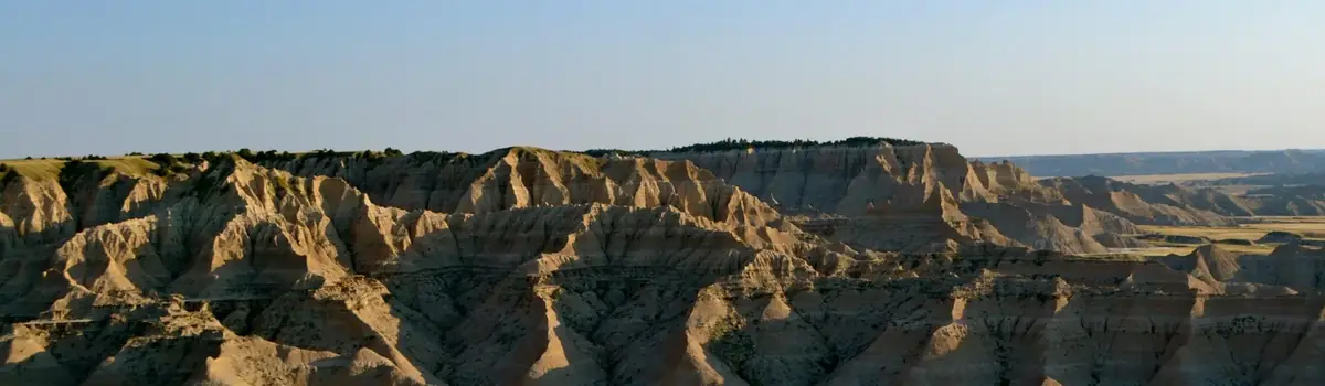
The thin layers of rust-red rock on the butte in front of you are iron-impregnated sandstone. Because they are harder than the soft gray sediments that make of up the rest of the butte, they erode more slowly. Notice how these hard layers form shelves that protect soft sediments below. This type of erosion, called differential erosion, is the main shaping force of the badlands.
"Nothing could be more lonely and nothing more beautiful than the view at nightfall across the prairies to these huge hill masses, when the lengthening shadows had at last merged into one and the faint after-glow of the red sunset filled the west." Theodore Roosevelt
Backcountry Permits
For the South Unit and the Elkhorn Ranch Unit
Permits can be obtained at the South Unit Visitor Center in Medora. Permits are not issued at the Painted Canyon Visitor Center.
For the North Unit
Permits can be obtained at the North Unit Visitor Center.When you have completed your backcountry trip, please stop by the visitor center to advise rangers of your safe return, if possible. Before obtaining a backcountry permit, some helpful information on hand that will make the process faster:
Planned itinerary (how many in group, how many nights, entry/exit points, and route) – check out the park map on the icon in the banner if unfamiliar with the park.
Vehicle information (make, model, year, and license plate).
Emergency contact (name and number).
When you have completed your backcountry trip, please call stop by the Visitor Center and/or call (701)623-4730 ext.1422 to advise rangers of your safe return, thank you.
Safety Messages
It is highly suggested to carry a map with you in the backcountry. If you are in need of purchasing a topographic map of the park , contact our cooperating association, Theodore Roosevelt Nature and History Association (TRNHA). TRNHA is currently selling them via phone (701)623-4884 or via website https://www.shoptrnha.org . They can either do mail or curbside pickup; whatever is easiest for you. There are no approved drinking water sources in the backcountry. There are springs and wells, which supply water for wildlife, but none are certified safe for human consumption. Plan to carry in all your drinking and cooking water.
Weather can be unpredictable and sometimes dangerous. Both summer and winter backcountry users must be prepared for rapid and often violent changes in the weather. Winter storms and summer thunderstorms can build rapidly and be upon you in a very short time. Choose campsites wisely as flash floods may occur. Be prepared to protect yourself in severe weather or plan on a hasty evacuation to a place of safety or shelter.
To insure that your winter experience is as safe and pleasant as possible you must be well prepared for your trip. Low temperatures and strong winds can result in hypothermia and frostbite if hikers and campers are not properly equipped and knowledgeable about winter survival. Special attention must be given to footwear, outer clothing, sleeping gear, and stoves that are operable at extremely low temperatures. Plan your trip well. Know your limitations. Keep your group together. Err to the side of caution.
It is especially important during this time of year to register with park rangers to ensure that they know where to start looking should you not return when indicated.
Backcountry Use Regulations
Overnight parties in the backcountry are limited to a maximum of 10 persons without horses, or 8 persons and 8 horses.
Backcountry camping is prohibited within 1/4 mile of roads and trailheads and within 200 feet of any water source. Campsites must not be visible from any roadway or trail.
Open fires (wood, charcoal, etc.) are not permitted in the backcountry. Cooking must be done on a self-contained stove fueled by a commercial product. Use of stoves may be restricted in times of high fire danger.
All trash and other material packed in, including toilet paper, must be packed out. Burying trash is prohibited.
Do not wash dishes or use detergents in water sources.
Bury human waste in a shallow hole 6-8 inches deep and at least 200 feet from any water source. Carry out all toilet paper.
All plants, wildlife, natural, and cultural features are protected. Do not disturb or remove them. Collection is not permitted. Hunting, feeding wildlife, and chasing or harassing wildlife, including approaching wildlife on horseback, is prohibited. Fireworks are not allowed in the park.
Pets, bicycles, and motorized equipment are prohibited in the backcountry.
Know where you are and where you are going. If you plan foot or horseback travel into the backcountry, know your destination and the route you plan to follow. Although some trails are marked, it is easy to confuse a designated route with a wildlife trail. Carry a topographic map and compass. Do not rely solely on GPS units. Leave your trip itinerary with someone so they can contact the park if you are overdue. Cell phones do not work in many areas of the park or surrounding localities.
Boating opportunities on the Little Missouri River are quite seasonal, with May and June usually being the best months. Canoes or kayaks are recommended. Boaters intending to camp overnight in the park must obtain a free backcountry permit and observe backcountry regulations. Boaters are advised to portage around the wildlife river barriers along all boundaries in the North and the South Unit. Attempting to cross under or through the barrier can result in a capsize. Fences may cross the river outside the park. See Canoeing/Kayaking section for more information.
A FEW REASONS TO GO
A closer look.
16 official park photos
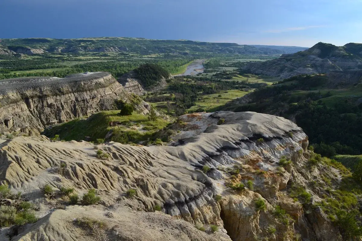
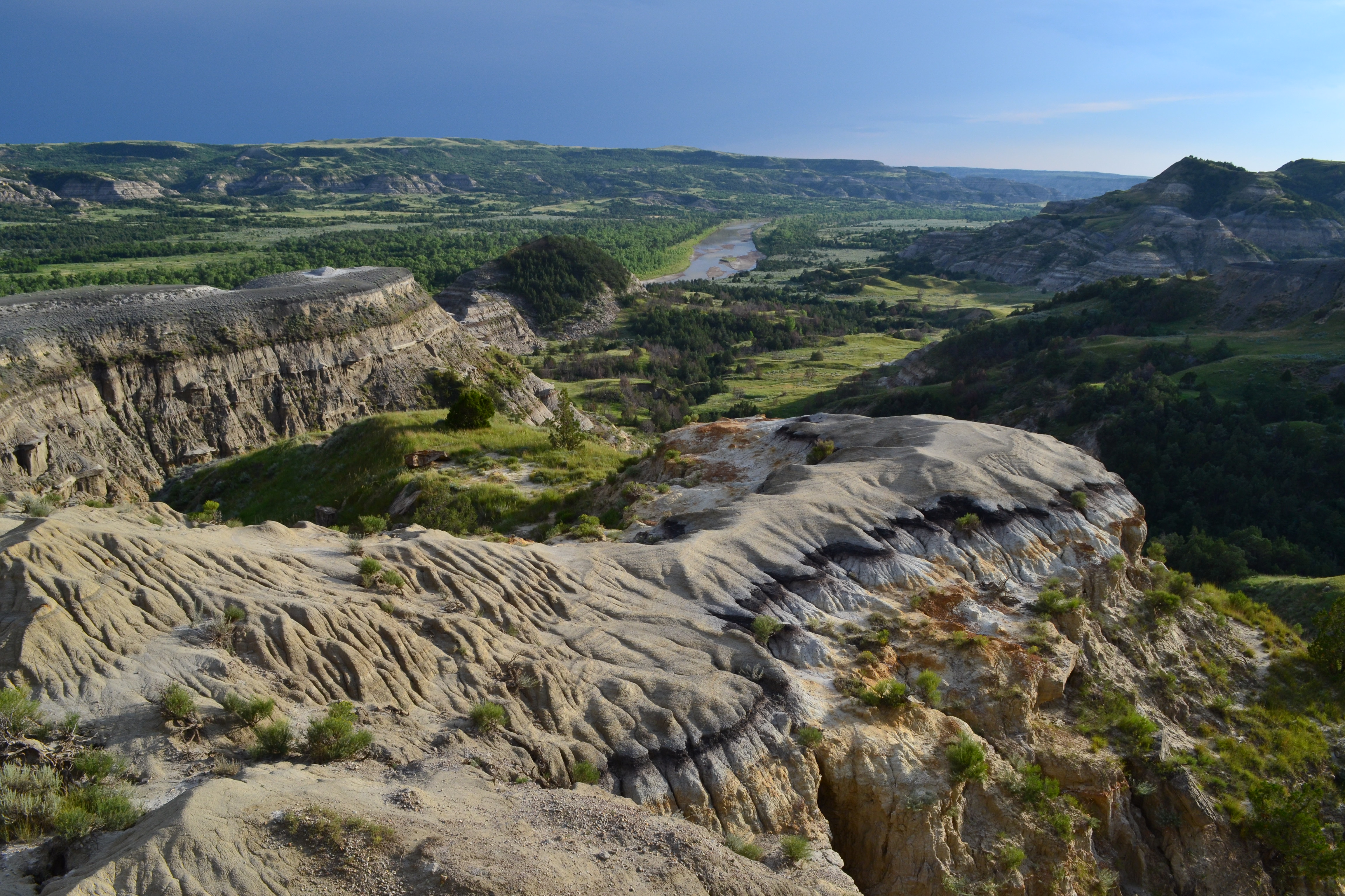
The River Bend Overlook offers one of the most popular views in the park's North Unit.NPS Photo / Mark Meyers Images link to the original government source.The Maah Daah Hey Trail follows the Little Missouri River for several miles before it enters the Theodore Roosevelt Wilderness.NPS Photo / Laura Thomas The Ekblom Trail is the gateway to the Theodore Roosevelt Wilderness. All you have to do is make it across the river!NPS Photo / Laura Thomas In the summer, bull bison wage furious battles over the right to breed.NPS Photo / Teresina Wheaten Though light pollution in the area is increasing, the night sky over Theodore Roosevelt National Park remains beautiful and inspiring.NPS Photo / Jeff Zylland Bison roam the badlands from top to bottom, surprising visitors with their agility and ability to cross even the most rugged terrain.NPS Photo / Roland and Lisa Honeyman A short climb to the top of Buck Hill in the park's South Unit rewards hikers with a sweeping panorama and a fantastic place to watch the sun rise or set.NPS Photo / Laura Thomas The ghostly bugles of bull elk can be heard wafting through the badlands in the fall.NPS Photo / Rolan and Lisa Honeyman Theodore Roosevelt described the badlands as "so fantastically broken in form and so bizarre in color as to seem hardly properly to belong to this earth."NPS Photo / Laura Thomas Imagine waking up on a crisp winter morning in Roosevelt's Maltese Cross Cabin. It is no wonder that his heart was captured by the romance of life in the West.NPS Photo Dakota Nights Astronomy FestivalNPS Graphic Tan and grey stripped buttes rise up from a wide green valley with a blue, winding river.NPS / Laura Thomas
The rugged beauty of the Badlands draws visitors from around the world. These striking geologic deposits contain one of the world’s richest fossil beds. Ancient horses and rhinos once roamed here. The park’s 244,000 acres protect an expanse of mixed-grass prairie where bison, bighorn sheep, prairie dogs, and black-footed ferrets live today.
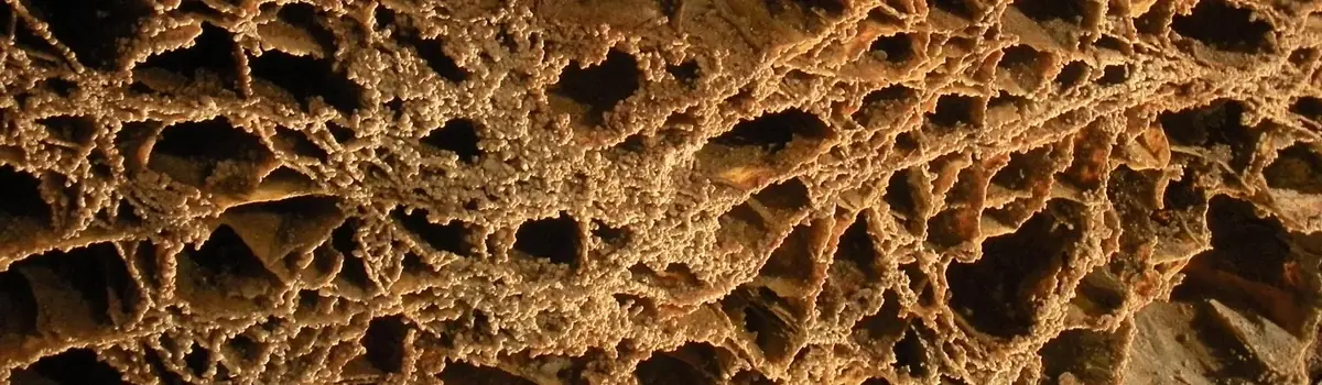
Wind Cave National Park protects two very different worlds - one deep within the earth, the other a sunlit world of many resources. Bison, elk, and other wildlife roam the rolling prairie grasslands and forested hillsides of one of America's oldest national parks. Below the remnant island of intact prairie sits Wind Cave, one of the longest and most complex caves in the world.
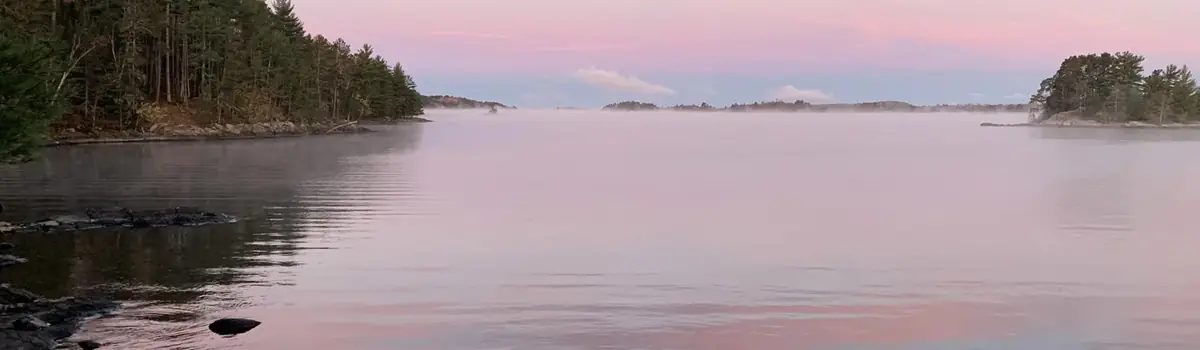
Voyageurs National Park spans 218,000 acres of lakes, forests, and streams in northern Minnesota. Established in 1975, the park is named after the French-Canadian Voyageurs who once navigated these abundant waters. Voyageurs National Park provides exceptional opportunities for recreation and exploration amidst landscapes rich in natural beauty, history, and cultural heritage.


 Desert