This vast landscape does not contain any roads or trails. Visitors discover intact ecosystems where people have lived with the land for over ten thousand years. Wild rivers meander through glacier-carved valleys, caribou migrate along age-old trails, endless summer light fades into aurora-lit night skies of winter. Virtually unchanged, except by the forces of nature.
7.5Macres of parkland
14.9Krecreation visits, 2025
Regional datanearby climate picks
Seasonal access & reservations
No reviewed guidance for this selection. Check the park's official planning pages; missing coverage does not establish access.
Selected guidance only; separate from climate comfort and current conditions.
Official conditions Not checked
The conditions feed has not been connected for this park.
Allow 4–6 days for a first look. A useful base: Fairbanks / authorized air-service gateway.
Remote expedition planning is essential. No standard road-based sightseeing itinerary exists; operator, access permissions, skills, and weather shape every day.
A day-by-day starting point
01
DAY 1
Plan with the gateway experts
Meet your authorized outfitter or air service, review permits and land access, and confirm a weather-dependent route and emergency arrangements.
Editorial recommendations, reviewed 2026-10-17. Full park days, excluding travel to and from the region. A first-visit outline for a general traveler; adapt to mobility, fitness, season, reservations, and current conditions. These are suggested days, not reserved activities or guaranteed routes.
Traveling through the park on foot affords opportunities of exploration and discovery. Mountain ridges and passes reveal splendid vistas and can take you to the most remote and least traveled areas of the Park and Preserve.
Detailed route planning is not addressed on this website, because Congress set this land aside as a trail-less wilderness area, specifically so that each visitor can find their own experience here. The park does not provide route planning for several other reasons: Due to the fragile nature of the arctic groundcover, repeated use of a route tends to impact it very quickly, and it can take a long time to recover. Also, we cannot effectively evaluate the skill-level of our visitors, and the fluctuating conditions of the area will have a great effect on the route chosen. Experienced hikers in the Gates of the Arctic National Park & Preserve consider six miles a good day's travel. There are no established trails, and the dense vegetation, tussocks, boggy ground and frequent stream and river crossings significantly slow your progress and pose multiple safety concerns, alongside the unpredictable and diverse weather conditions.
It is recommended that visitors have at least one alternate route planned. In the event of bad weather, high or low water, or smoke from wildfires, visitors have a better chance having an enjoyable trip if there is some flexibility built into their itinerary. Risks to keep in mind when planning your trip are harsh weather, rugged terrain, wildlife, swift rivers, cold water, extreme isolation, mental/physical exhaustion, hypothermia, and giardia. Firearms are legal in the park but can only be discharged in the defense of life or property. You will be held accountable for inappropriate dischargement.
Crossing rivers is one of the most dangerous activities done in the park. You will find easiest walking above the tree line or in the streambeds, if the water level is low. There are so many rivers in this area that you are likely to have to cross one or more during your trip. The water levels fluctuate continuously due to weather conditions, but the highest levels are generally in the spring during the run-off. The best strategy is to take your time, wait for the river to ebb, use group crossing techniques, utilize eddies and gravel bars, and face upstream if crossing solo.
The water temperature is always cold and a swim in the river can be deadly. Highest risks when boating include sweepers, strainers, and deceptive rapids. Always wear a PFD, always carry a throw bag, always secure your boat, and never camp on an island.
Gates is home to a variety of dangerous wildlife, including both grizzly and black bears. It is important to know bear safety rules, what to do in the case of an encounter, and how to use bear spray and/or a firearm. Visit our Bear Safety page for the best tips and information in order to be fully prepared. If you have a negative encounter with a bear, fill out a Bear-Human Encounter Report Form at a visitor center. BRFCs are required in gates. Scroll down to the Reducing Impact section for more information on BRFCs.
Communication and Wayfinding
Cell phones do not work in Gates. Ground to air radios, Iridium satellite phones, and Personal Locator Beans may provide help in emergency communication. Two-way communication devices are strongly recommended. Search and Rescue (SAR) is not readily available and is not initiated until a missing person is reported. It is important to file a Backcountry Visitor Registration and leave it with a dependable person in order for your safety. Topographic maps are essential in planning your course of travel. Carry your maps and a good compass (and a GPS unit is strongly encouraged if you have access to one) with you in the field. Aside from necessary devices, planning your route ahead is also essential. Air taxi operators should also be consulted before finalizing a route, since they have specific places that they can pick up and drop off people and gear. For visitors who are not comfortable looking at a topo map and devising a route, there are several guides and outfitters who take visitors into the park. A complete list of guides, outfitters, and air taxis is available on our website .
Reducing Impact
This ecosystem is extremely fragile and easily impacted. Damaged lands may never recover. It is important to:
Travel and camp on durable surfaces including gravel bars and hardy plants like grasses and sedges, not fragile lichens and mosses
Wear soft soled shoes around camp
Move camp every 2-3 days
Leave the site as you found it
If a site is already impacted, camp there
Leave all natural, cultural, and historical resources where you found them
When disposing of waste:
Pack it in, pack it out
Do not burn or bury garbage
Check with residents before disposing of waste in rural communities
Strain the food bits from your cooking gray water and scatter the fluid, pack out the food
Bathe and wash dishes 100 feet from water sources
If you use soap, use only biodegradable products
For human waste, dig a cat hole in soil, 200 feet from any water source 6-8 inches deep
Pack out or safely burn the toilet paper
Group size limit is 10 people, to minimize impacts to the environment. There are no official trails in Gates of the Arctic, but there are countless 'game trails' established by animals. When feasible, use game trails as much as possible, not only for minimizing your impacts on the vegetation, but also for ease of travel. When hiking where no game trails exist, walk in a fan formation, rather than a single file straight line, to avoid creating social trails. Trekking poles are very useful on the uneven and tussock-covered terrain. Self contained camp stoves leave no trace and are often the most efficient option due to the lack of firewood (which only includes dead and down wood). Campfires are allowed only on durable surfaces, except in the case of emergency. Ensure that no sign of the fire is a lasting impact on the land. BRFCs are required in the park. They can be purchased on your own accord or may be loaned for free on a first-come, first-serve basis at the following locations:
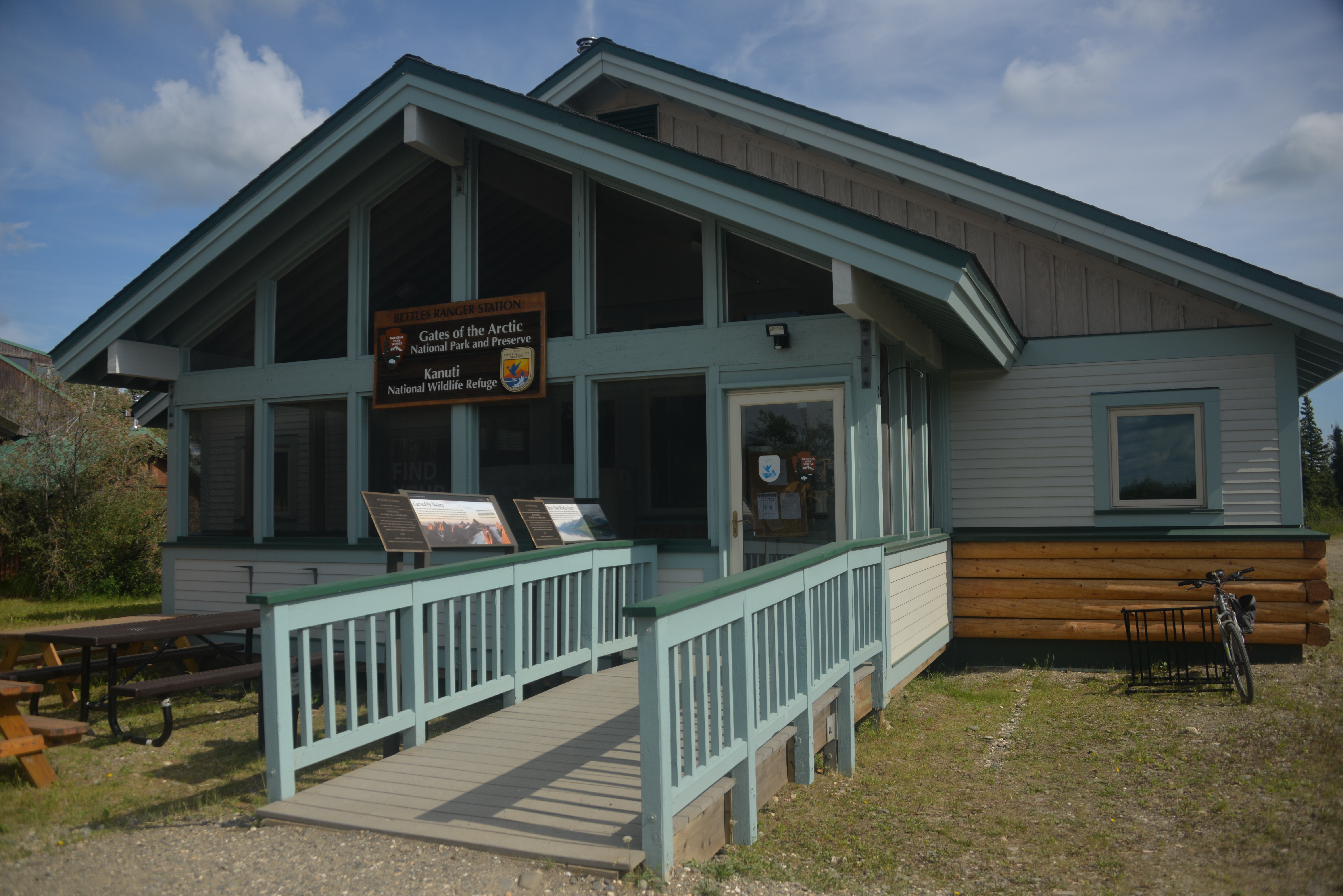
Bettles Ranger Station
Fairbanks Alaska Public Lands Information Center
Coldfoot Arctic Intergency Visitors Center
Anaktuvuk Pass Ranger Station
Ursacks are considered BRFCs and are permitted in the park but are not loaned from these locations and are not typically recommended. Multiple sizes of river barrels and backpack barrels are offered per availibility. If you have any more questions or require more information, visit the Fairbanks Alaska Public Lands Information Center or our Backcountry Trip Plan page.
Respect local cultures and subsistence lifestyle within the park
Do not disturb traps, hunting camps, or private property
Minimize noise and behavior that may conflict with others enjoyment of the resource
Pets must be on leash or physically restrained at all times
Leaving pets unattended is prohibited
Do not feed or approach wildlife
Use a telephoto lens
Avoid encroaching on nesting, breeding, or feeding areas or activities
Because of its endless summer sunlight, Gates of the Arctic National Park and Preserve is the summer destination of many migratory birds. In addition, there are a number of year-round residents such as the ptarmigan. A total of 145 species of birds have been observed in the Park and Preserve over the past 30 years. Aquatic birds, raptors, song birds, and many others can be seen and heard. Bird watching is a common activity for hikers and boaters in the Park. Others will find opportunities for bird-watching in Bettles, Anaktuvuk Pass and Coldfoot, as well as all along the Dalton Highway.
Nearly half of the birds recorded in Gates of the Arctic live and nest in aquatic habitats.
Like many animals, birds are often more active in the morning and evening. Because the sun never sets in the summertime, the earlier you start or the later you stay up, the more success you will have.
Free information about birding in Alaska and books for sale are available through the Fairbanks Alaska Public Lands Information Center .
Table of common birds found in Gates of the Arctic
There are no designated campsites in Gates of the Arctic National Park and Preserve. Camping usually takes place in conjunction with other recreational activities. Camping in the arctic requires planning, preparation and care in order to protect the visitor and the fragile arctic ecosystem.
Arctic tundra is surprisingly fragile and slow to recover. It is best to camp on durable surfaces. Gravel bars make excellent campsites since they often have fewer mosquitoes than other sites, and high water will erase signs of your presence. But if a site is already impacted, camp there. Remember that water levels can rise at any time, so locate your camp well above current water levels. If you must choose a vegetated site, select a location with hardier vegetation such as grasses and sedges, rather than more fragile lichens and mosses. You can also help preserve the ecosystem by moving camp every 2-3 days or before signs of your presence become noticeable. Wearing soft-soled shoes around camp gives your feet and the vegetation a break.
Select a durable surface for your campsite. Gravel bars work well, but be sure to camp above water level in case the river rises. When camping on the tundra, select a site that is not too dry and that will not be heavily impacted. Bring what you need. Do not trench for tents or cut branches for beds. Use lighter soled camp shoes to lessen your impact.
Before you leave, make every effort to return your campsite to a natural appearance. Leave all natural, cultural, and historical resources where you found them. For more information about reducing impact, leaving no trace, and other considerations in the park, please visit our Backpacking and Hiking page.
Food and Cooking
Self contained gas or propane stoves for cooking are strongly recommended. Fires are often impractical. Tree growth in the Arctic is very slow; a spruce tree only inches in diameter may be hundreds of years old. In some areas wood is scarce or nonexistent. A gas or propane stove is also good for emergencies since it is easy to light. If you have a campfire, ensure it is on a durable surface and that there is no sign of fire that will leave a lasting impact. Gravel bars are preferred.
Prepare and consume food at least 100 yards from your tent site and food storage area. Try to select cooking areas where you can see a comfortable distance to minimize the risk of a surprise encounter with a bear passing through the area. Be prepared to quickly stow all food back into the BRFC if a bear should suddenly approach. Keep your gear together — minimize the amount of space that you occupy. Always ask yourself, “Is there room for a bear to get around us?” Or, “Can I quickly get all this gear under my control?”
When you set up your campsite, keep in mind that you are in bear country. Both black and grizzly bears roam the park, so be alert and watch for signs. Even in your campground, keep your bear spray ready. Locate your cooking/eating area 100 yards away from the sleeping area. Stash all your food, trash, petroleum and other odorous items (toothpaste, lotions, etc.) in a separate area to create the backcountry triangle (tent, cook, and BRFC are all 100 yards apart in a triangle formation.
Keep a clean camp. Keep all food in the BRFC when not in use. Place any snacks, wrappers, lip balm, sunscreen, lotion, soap, and any scented products into the BRFC before entering your tent. Avoid food spills and other animal attractants. Proper food storage (certified bear resistant food container) is required in all Alaskan parks. It is not a good idea to store food in kayaks overnight. Bears that become accustomed to human food and products present a hazard to people traveling in the backcountry and often have to be destroyed. If we all do our part we can protect the fragile ecosystems and the bears that inhabit them while enjoying this vast wilderness.
At night, store your BRFC and clean cooking gear off of main animal trails, and at least 100 yards from your tent. Learn more on the Food Storage and Bear-Resistant Food Containers page or our Bear Safety page.
From wide glacial valleys to sweeping vistas in the headwaters, to rolling tundra, the wild rivers of Gates of the Arctic can take you on an adventure you’ll never forget. Rivers have been byways for wildlife and humans for centuries. They are the veins and arteries through the heart of the Gates of the Arctic wilderness. Glaciers sculpted large U-shaped valleys surrounded by serrated ridges. In other valleys, the rivers have carved steep V-shaped canyons. These rivers support the frantic summer explosion of life. Travelers here have the opportunity to be a part of nature, and to experience the solitude and isolation of wilderness.
For ease of air transportation, most river travel is done with rafts, inflatable canoes, packrafts, or other collapsible boats. Most charter operators will not haul rigid canoes. If you are going to rent watercraft from a local vendor, be sure to make arrangements with them before you arrive, as supplies and equipment are often limited.
Waters average Class I and II, with a few Class II-IV rapids, but river conditions constantly change. Challenges associated with arctic river travel include very cold water temperature, dramatically fluctuating water levels, logjams, strainers and sweepers, and some rapids. Generally, the highest water is in May and June. High water has its drawbacks - it can make it difficult to find suitable campsites. Many northern rivers have aufeis, sometimes called overflow ice. As rivers begin freezing in the fall, they flow up and over the new ice, creating layer upon layer of ice. By winter’s end, these layers may be more than 15 feet thick. Often covering extensive areas of northern rivers, aufeis can block river channels or calve into the river like icebergs, so constant awareness of the river conditions in front of you is important. Aufeis persists in some rivers until late summer.
Rivers change every spring during break-up, sometimes dramatically. And water levels also change constantly; a summer storm fifty miles upriver can cause a major rise in river levels where you are. Rivers in areas with permafrost react quickly to rain, as the water does not soak into the ground but is channeled directly to the rivers. Northern rivers can be low one day and be in flood stage two days later. Remember that this is a remote wilderness in an extreme environment and conditions can change rapidly.
The Six Wild & Scenic Rivers of Gates of the Arctic
Gates of the Arctic National Park has six designated Wild Rivers: the John River, Noatak River, Kobuk River, Alatna River, Tinyaguk River, and the North Fork of the Koyukuk River. These rivers are all commonly floated in addition to the Killik, Itkillik, and occasionally the Nigu. Each river has a variety of access and take-out points. Contact an air taxi operator to find out where they are able to drop you off and pick you up on each river. Wildlife viewing opportunities exist on all of the rivers.
West Gates of the Arctic, flows south
Central Gates of the Arctic, flows south
West Gates of the Arctic, flows west
East Gates of the Arctic, flows south through the 'Gates of the Arctic'
East Gates of the Arctic, flows south and into North Fork Koyukuk River
Learn about the NPS Wild and Scenic Rivers Program
Please view the State of Alaska Hunting Regulations and Game Management Units 23, 24, & 26 regulations for hunting in Gates of the Arctic National Preserve.
Sport hunting and trapping are permitted in Gates of the Arctic National Preserve, but not in Gates of the Arctic National Park.
To hunt and trap in the preserve, you must have all required licenses and permits and follow all other state regulations.
The National Park Service and the State of Alaska cooperatively manage the wildlife resources of the Preserve. An Alaska State hunting license is required for all hunters age 16 or older. Bag and possession limits vary by species and by area. Always check current Alaska state hunting regulations. In addition, some hunts require a federal or state registration permit or state harvest ticket.
For further information on Alaska hunting and where to get a license, visit the Alaska Department of Fish and Game Website .
Please keep in mind that many areas within the preserve are private land. Do not enter private land without the landowner's permission.
Hunters are responsible for knowing current hunting regulations. Consult the federal subsistence regulation booklet to determine whether a federal registration permit is required for a particular area and animal. Hunters must carry valid driver's licenses or photo identification, hunting licenses, harvest tickets, and tags. Hunting licenses can be purchased at any license vendor or online at Hunting and Trapping Licenses and Permits, Alaska Department of Fish and Game . Hunting regulations are enforced by National Park Service Rangers and Alaska Fish and Wildlife Protection Troopers.
Commercial Activities
A business or an individual must obtain either a Concession Contract or a Commercial Use Authorization ( CUA ) prior to conducting any commercial activity in Gates of the Arctic National Park & Preserve.
These contracts and permits are issued and administered by the National Park Service (NPS).
Visit our webpage Do Business With Us to download a list of authorized commercial guides in Gates of the Arctic or to obtain a permit to conduct business in the park. Contact the visitor center in Bettles with further questions at 907-692-5494.
Subsistence Hunting
News about Hunting in Gates of the Arctic National Preserve
Official NPS features and USGS park boundaries, imported 2026-10-17. An inventory snapshot, not live trail or parking availability.
Loading official park features…
TrailsPoints of interestParkingZoom with buttons or pinch. Toggle layers on the map.
Map coverage varies. Trail names may represent segments, connectors, or shared park units; mapped lines are not a hiking recommendation. Use official conditions and navigation resources before heading out.
NPS public GIS inventory, imported 2026-10-17. “Existing” is an inventory classification, not confirmation that a trail is open. Segment counts are not route distances. Parking records do not indicate space availability, fees, or accessibility certification. View government source ↗
Climate for Fairbanks, 411 km from the park reference point. 1991–2020 normals. Source elevation: 136 m.
This climate location is distant from the park. Use these values as regional context only. Do not use its climate ranking to choose park travel dates.
Daytime highNighttime lowOctober: 33° / 22°
Daytime high33°
Precipitation20 mm
Daylight9.2 hrs
Wind7.9 km/h
Mountain, rim, valley, and coastal conditions can differ sharply from the source town. Check park forecasts and current conditions before travel.
Monthly climate data 12 months · °F
Month
High
Low
Rain / snow water
Wet days
Daylight
3°
-9°
11 mm
3.5
4.6 h
12°
-3°
10 mm
3.1
7.8 h
25°
5°
8 mm
2.4
11.2 h
44°
24°
10 mm
2.8
14.7 h
60°
41°
19 mm
5.3
18.1 h
70°
53°
52 mm
10.2
20.6 h
71°
55°
61 mm
11.0
19.6 h
65°
50°
61 mm
10.9
16.2 h
54°
39°
40 mm
7.9
12.7 h
33°
22°
20 mm
5.4
9.2 h
14°
3°
16 mm
4.4
5.8 h
6°
-6°
11 mm
3.7
3.3 h
RESEARCH WITH THE SOURCE IN VIEW
The practical field guide.
Official NPS excerpts imported 2026-10-17. Fees, permits, road access, and operations can change; use the source link to confirm the latest information.
Gates of the Arctic National Park and Preserve was created to preserve and protect 8.4 million acres of the diverse arctic ecosystems of Alaska's central Brooks Range. It is acknowledged as the premier Wilderness park in the national park system and serves as the headwaters for six Wild Rivers .
It protects a functioning arctic, mountain ecosystem in its entirety and provides habitat of world importance for naturally occurring plant and animal populations.In consultation with local rural residents Gates of the Arctic protects habitats and resources to provide subsistence opportunities on lands that have supported traditional cultures and local residents.
While the park provides visitors with opportunities for solitude and challenging wilderness adventures within a remote and vast arctic landscape, it also preserves and supports a 12,000-year record of human cultural adaptations to high latitude mountain environments and an unbroken tradition of living on the land. While it may seem untouched, you are not the first one to travel here.
That said, traveling in a remote wilderness park requires visitors to be self sufficient and flexible. You're on your own. This is the number one message preserve visitors must know and apply to their visit to Gates of the Arctic. There is no cell phone service and there are no amenities or services in the preserve. When you depart Fairbanks, Bettles, or Coldfoot, you may not see another person until your return to civilization or your pilot comes to pick you up. Visitors must be self-reliant and able to execute self-extraction and communication, should an emergency situation arise.
Permits & Reservations
Permits may be required for certain activities but are not required to enter the park.
Backcountry trip planning must be done in preparation for your trip. If your trip involves hiking or crossing waterways, from small creeks to major rivers, research safe techniques to get you to the other side and back again. Access
If you are relying on air travel for your visit, be aware that air taxis are often times unable to fly in inclement weather. Bring a few extra days of food and allow for 'weather days' in your trip plan to accommodate poor weather. Learn more about air transportation to public lands in Alaska and how to charter aircraft .
Many visitors to Gates of the Arctic travel by boat during the fall hunting season. Learn about Hunting in the Preserve and Floating Rivers to learn more about planning a successful and enjoyable trip to the preserve.
We recommend having two forms of communication while in the backcountry. Satellite phones are an excellent method of two-way communication in Alaska's backcountry, as they function on satellites that orbit the earth north to south and vice versa, providing excellent coverage in Alaska's wilderness areas. A satellite messaging device can also be used. Many come with an SOS feature that can be activated in the case of emergency. Consider renthing these in Fairbanks before your trip to the park.
Explore the National Park Service's staying safe in bear country website to learn safe and responsible practices for recreating on Alaska's wild lands.
Bear-resistant food containers are required for your overnight visit to Gates of the Arctic and are provided free of charge at the Anaktuvuk Pass, Bettles, Coldfoot, and Fairbanks Visitor Centers. No reservations can be taken as they are provided first come, first serve . Gates of the Arctic provides both steel drum BRFCs with locking lids for river travel and backpacker BRFCs.
There are no designated campsites in Gates of the Arctic National Park and Preserve. Camping usually takes place in conjunction with other recreational activities. Camping in the arctic requires planning, preparation and care in order to protect the visitor and the fragile arctic ecosystem.
Arctic tundra is surprisingly fragile and slow to recover. It is best to camp on durable surfaces. Gravel bars make excellent campsites since they often have fewer mosquitoes than other sites, and high water will erase signs of your presence. But if a site is already impacted, camp there. Remember that water levels can rise at any time, so locate your camp well above current water levels. If you must choose a vegetated site, select a location with hardier vegetation such as grasses and sedges, rather than more fragile lichens and mosses. You can also help preserve the ecosystem by moving camp every 2-3 days or before signs of your presence become noticeable. Wearing soft-soled shoes around camp gives your feet and the vegetation a break.
Select a durable surface for your campsite. Gravel bars work well, but be sure to camp above water level in case the river rises. When camping on the tundra, select a site that is not too dry and that will not be heavily impacted. Bring what you need. Do not trench for tents or cut branches for beds. Use lighter soled camp shoes to lessen your impact.
Before you leave, make every effort to return your campsite to a natural appearance. Leave all natural, cultural, and historical resources where you found them. For more information about reducing impact, leaving no trace, and other considerations in the park, please visit our Backpacking and Hiking page.
Food and Cooking
Self contained gas or propane stoves for cooking are strongly recommended. Fires are often impractical. Tree growth in the Arctic is very slow; a spruce tree only inches in diameter may be hundreds of years old. In some areas wood is scarce or nonexistent. A gas or propane stove is also good for emergencies since it is easy to light. If you have a campfire, ensure it is on a durable surface and that there is no sign of fire that will leave a lasting impact. Gravel bars are preferred.
Prepare and consume food at least 100 yards from your tent site and food storage area. Try to select cooking areas where you can see a comfortable distance to minimize the risk of a surprise encounter with a bear passing through the area. Be prepared to quickly stow all food back into the BRFC if a bear should suddenly approach. Keep your gear together — minimize the amount of space that you occupy. Always ask yourself, “Is there room for a bear to get around us?” Or, “Can I quickly get all this gear under my control?”
When you set up your campsite, keep in mind that you are in bear country. Both black and grizzly bears roam the park, so be alert and watch for signs. Even in your campground, keep your bear spray ready. Locate your cooking/eating area 100 yards away from the sleeping area. Stash all your food, trash, petroleum and other odorous items (toothpaste, lotions, etc.) in a separate area to create the backcountry triangle (tent, cook, and BRFC are all 100 yards apart in a triangle formation.
Keep a clean camp. Keep all food in the BRFC when not in use. Place any snacks, wrappers, lip balm, sunscreen, lotion, soap, and any scented products into the BRFC before entering your tent. Avoid food spills and other animal attractants. Proper food storage (certified bear resistant food container) is required in all Alaskan parks. It is not a good idea to store food in kayaks overnight. Bears that become accustomed to human food and products present a hazard to people traveling in the backcountry and often have to be destroyed. If we all do our part we can protect the fragile ecosystems and the bears that inhabit them while enjoying this vast wilderness.
At night, store your BRFC and clean cooking gear off of main animal trails, and at least 100 yards from your tent. Learn more on the Food Storage and Bear-Resistant Food Containers page or our Bear Safety page.
Gates of the Arctic is a vast wilderness area without trails or any developed infrastructure, designated by Congress to remain a "primitive" area in most respects. The National Park Service strives to make the parks' visitor centers as universally accessible as possible. The remote wilderness of this park means that most access is backcountry and may be difficult to get to. Park staff are here to assist you with your trip planning to experience this special place.
No entrance fees or registration are required to enter the park; however visitors are requested to stop at one of the park's visitor centers to attend a backcountry orientation. During an orientation you can get valuable information about current weather, fire and wildlife alerts, backcountry safety, bear safety and Leave No Trace camping techniques. Every visitor center has Bear Resistant Food Containers to loan out to backcountry visitors. Group size limits exist. If you are traveling in a group (i.e. nonprofit, educational, commercial, guided, etc.) please contact the park several months before your travel dates for permit issuance and requirements.
NOTE: Commercial transporters are required to ensure that all of their clients get the opportunity to receive a backcountry orientation from park rangers prior to entering the park and preserve. Please take a moment to complete our voluntary registration form prior to your trip into the backcountry.
An entrance pass is not required to access Gates Of The Arctic National Park & Preserve.
Other National Park Service sites may require an entrance pass or fee. Depending on your trip plans, an interagency pass may save you money.
2026 Free Entrance Days in the National Parks
Come experience the national parks! All National Park Service sites that charge an entrance fee will offer free admission to US citizens and residents (other fees, including timed entry or reservation fees, may apply). Mark your calendar for these entrance fee-free dates:
February 16 : Presidents Day (Washington's Birthday)
May 25 : Memorial Day
June 14: Flag Day/President Trump's birthday
July 3–5: Independence Day weekend
August 25: 110th Birthday of the National Park Service
Gates of the Arctic is a wilderness park, with no roads or trails into the park lands, so visitors must fly or hike into the park. Access to the park begins in Fairbanks, Alaska. There are several small airlines in Fairbanks that provide daily flights into the gateway communities of Bettles and Anaktuvuk Pass , and flag stops to Coldfoot .
Most visitors access the park by air taxi, in small aircraft equipped with floats or tundra tires. Another option for accessing the park is to hike in from the Dalton Highway or from the village of Anaktuvuk Pass . There are no trails into the park and preserve from any location, and river crossings are necessary from both Anaktuvuk Pass and the Dalton Highway. A list of authorized air taxi providers operating in Gates of the Arctic National Park is available here .
From Bettles : It is necessary to take one of the daily flights from Fairbanks, as there is no road to this small 'bush' village. There are several air taxis, outfitters and lodges in Bettles, and a tiny store and post office. A park visitor center is located here. Visitors can fly into the park from Bettles.
From Anaktuvuk Pass : There is no road into Anaktuvuk Pass. Fly into this small Nunamuit village on one of the daily flights from Fairbanks and walk into the park from the airstrip. Native land surrounds the airstrip and extends for several miles. Visitors to the park are welcome to cross those lands to access the park but should ask for permission before camping on native land. Anaktuvuk Pass has a very fine Nunamuit History Museum, a small store and a post office.
From Coldfoot : Drive 280 miles north from Fairbanks up the Dalton Highway or fly in using one of the small commercial air carriers in Fairbanks. Coldfoot has an air taxi, motel, store, cafe, post office and there are trails and campsites available. There are two lodges in the neighboring community of Wiseman. Visitors can fly into the park, or hike in from the highway.
Bureau of Land Management - Alaska
The Dalton Highway : The highway parallels the eastern boundary of the park and it is possible to hike into the park from the road. The Dalton Highway runs through some spectacular scenery but it is not without its own challenges. It's a mostly unpaved, two lane industrial road, with no amenities or services between Fairbanks and Coldfoot.
You're on your own. This is the number one message visitors must know and apply to their visit to Gates of the Arctic. There is no cell phone service and there are no amenities, services, or other infrastructure in the preserve. When you depart Fairbanks, Bettles, Coldfoot, or Anaktuvuk Pass you may not see another person until your return to civilization or your pilot comes to pick you up. Visitors must be self-reliant and able to execute self-extraction and communication, should an emergency situation arise.
Leave a detailed backcountry trip plan with friends & family and describe to them what you are doing, where you are going, and what to do if you do not return by a certain date. Make sure they understand the inherent unpredictability of remote Alaskan transportation in regards to weather. Bring a completed trip plan with you, and leave another with your pilot, if you are flying.
If you are relying on air travel for your visit, be aware that air taxis are often times unable to fly in inclement weather. Bring a few extra days of food and allow for 'weather days' in your trip plan to accommodate poor weather.
Many visitors to Gates of the Arctic arrive & travel by boat during the fall hunting season. Visit our Hunting webpage to learn more about planning a successful and enjoyable trip to the preserve.
We recommend having two forms of communication while in the backcountry. Satellite phones are an excellent method of two-way communication in Alaska's backcountry, as they function on satellites that orbit the earth north to south and vice versa, providing excellent coverage in Alaska's wilderness areas. A satellite messaging device can also be used. Many come with an SOS feature that can be activated in the case of emergency. Consider renting these in Fairbanks before your trip to the park.
Follow the wilderness ethic of others and leave this wild land as you found it, or better, for future generations.Visitors in the park must practice minimum impact camping techniques by adhering to Leave No Trace principles, follow backcountry safety guidelines, and be aware of the fragile ecosystems and private lands within the park.
Read about staying safe in bear country to learn safe and responsible practices for recreating on Alaska's wild lands.
Bear-resistant food containers are required for your overnight visit to Gates of the Arctic and are provided free of charge at any of the park's visitor centers . No reservations can be taken as they are provided first come, first serve .
Traveling through the park on foot affords opportunities of exploration and discovery. Mountain ridges and passes reveal splendid vistas and can take you to the most remote and least traveled areas of the Park and Preserve.
Detailed route planning is not addressed on this website, because Congress set this land aside as a trail-less wilderness area, specifically so that each visitor can find their own experience here. The park does not provide route planning for several other reasons: Due to the fragile nature of the arctic groundcover, repeated use of a route tends to impact it very quickly, and it can take a long time to recover. Also, we cannot effectively evaluate the skill-level of our visitors, and the fluctuating conditions of the area will have a great effect on the route chosen. Experienced hikers in the Gates of the Arctic National Park & Preserve consider six miles a good day's travel. There are no established trails, and the dense vegetation, tussocks, boggy ground and frequent stream and river crossings significantly slow your progress and pose multiple safety concerns, alongside the unpredictable and diverse weather conditions.
It is recommended that visitors have at least one alternate route planned. In the event of bad weather, high or low water, or smoke from wildfires, visitors have a better chance having an enjoyable trip if there is some flexibility built into their itinerary. Risks to keep in mind when planning your trip are harsh weather, rugged terrain, wildlife, swift rivers, cold water, extreme isolation, mental/physical exhaustion, hypothermia, and giardia. Firearms are legal in the park but can only be discharged in the defense of life or property. You will be held accountable for inappropriate dischargement.
Crossing rivers is one of the most dangerous activities done in the park. You will find easiest walking above the tree line or in the streambeds, if the water level is low. There are so many rivers in this area that you are likely to have to cross one or more during your trip. The water levels fluctuate continuously due to weather conditions, but the highest levels are generally in the spring during the run-off. The best strategy is to take your time, wait for the river to ebb, use group crossing techniques, utilize eddies and gravel bars, and face upstream if crossing solo.
The water temperature is always cold and a swim in the river can be deadly. Highest risks when boating include sweepers, strainers, and deceptive rapids. Always wear a PFD, always carry a throw bag, always secure your boat, and never camp on an island.
Gates is home to a variety of dangerous wildlife, including both grizzly and black bears. It is important to know bear safety rules, what to do in the case of an encounter, and how to use bear spray and/or a firearm. Visit our Bear Safety page for the best tips and information in order to be fully prepared. If you have a negative encounter with a bear, fill out a Bear-Human Encounter Report Form at a visitor center. BRFCs are required in gates. Scroll down to the Reducing Impact section for more information on BRFCs.
Communication and Wayfinding
Cell phones do not work in Gates. Ground to air radios, Iridium satellite phones, and Personal Locator Beans may provide help in emergency communication. Two-way communication devices are strongly recommended. Search and Rescue (SAR) is not readily available and is not initiated until a missing person is reported. It is important to file a Backcountry Visitor Registration and leave it with a dependable person in order for your safety. Topographic maps are essential in planning your course of travel. Carry your maps and a good compass (and a GPS unit is strongly encouraged if you have access to one) with you in the field. Aside from necessary devices, planning your route ahead is also essential. Air taxi operators should also be consulted before finalizing a route, since they have specific places that they can pick up and drop off people and gear. For visitors who are not comfortable looking at a topo map and devising a route, there are several guides and outfitters who take visitors into the park. A complete list of guides, outfitters, and air taxis is available on our website .
Reducing Impact
This ecosystem is extremely fragile and easily impacted. Damaged lands may never recover. It is important to:
Travel and camp on durable surfaces including gravel bars and hardy plants like grasses and sedges, not fragile lichens and mosses
Wear soft soled shoes around camp
Move camp every 2-3 days
Leave the site as you found it
If a site is already impacted, camp there
Leave all natural, cultural, and historical resources where you found them
When disposing of waste:
Pack it in, pack it out
Do not burn or bury garbage
Check with residents before disposing of waste in rural communities
Strain the food bits from your cooking gray water and scatter the fluid, pack out the food
Bathe and wash dishes 100 feet from water sources
If you use soap, use only biodegradable products
For human waste, dig a cat hole in soil, 200 feet from any water source 6-8 inches deep
Pack out or safely burn the toilet paper
Group size limit is 10 people, to minimize impacts to the environment. There are no official trails in Gates of the Arctic, but there are countless 'game trails' established by animals. When feasible, use game trails as much as possible, not only for minimizing your impacts on the vegetation, but also for ease of travel. When hiking where no game trails exist, walk in a fan formation, rather than a single file straight line, to avoid creating social trails. Trekking poles are very useful on the uneven and tussock-covered terrain. Self contained camp stoves leave no trace and are often the most efficient option due to the lack of firewood (which only includes dead and down wood). Campfires are allowed only on durable surfaces, except in the case of emergency. Ensure that no sign of the fire is a lasting impact on the land. BRFCs are required in the park. They can be purchased on your own accord or may be loaned for free on a first-come, first-serve basis at the following locations:
Bettles Ranger Station
Fairbanks Alaska Public Lands Information Center
Coldfoot Arctic Intergency Visitors Center
Anaktuvuk Pass Ranger Station
Ursacks are considered BRFCs and are permitted in the park but are not loaned from these locations and are not typically recommended. Multiple sizes of river barrels and backpack barrels are offered per availibility. If you have any more questions or require more information, visit the Fairbanks Alaska Public Lands Information Center or our Backcountry Trip Plan page.
Respect local cultures and subsistence lifestyle within the park
Do not disturb traps, hunting camps, or private property
Minimize noise and behavior that may conflict with others enjoyment of the resource
Pets must be on leash or physically restrained at all times
Leaving pets unattended is prohibited
Do not feed or approach wildlife
Use a telephoto lens
Avoid encroaching on nesting, breeding, or feeding areas or activities
Gates of the Arctic National Park and Preserve encompasses 8.4 million acres of wilderness. Because there are no established trails in the Park and Preserve, good maps are extremely important.
Download the Gates of the Arctic park brochure map
View maps of the Anaktuvuk Pass Area
View an online Land Status Map of Gates of the Arctic
General-purpose and Thematic Maps - National Park Service
The Trails Illustrated map of Gates of the Arctic offers an excellent large-scale overview of the Park and Preserve. This map is available through Alaska Geographic . Once you have established where you are going in the Park and Preserve, USGS topographical maps are crucial to help you plan your route. The 1:250,000 (1 inch to four miles) maps provide a good overview of specific areas while the 1:63,360 (1 inch to 1 mile) are larger scale and allow for in-depth route planning. Select USGS maps are available at the Fairbanks Alaska Public Lands Information Center .
View USGS Topographical Maps for Gates of the Arctic online
Detailed route planning is not addressed on this website, because Congress set this land aside as a trail-less wilderness area, specifically so that each visitor can find their own experience here. The park does not provide route planning for several other reasons: Due to the fragile nature of the arctic groundcover, repeated use of a route tends to impact it very quickly, and it can take a long time to recover. Also, we cannot effectively evaluate the skill-level of our visitors, and the fluctuating conditions of the area will have a great effect on the route chosen.
Air taxi operators should also be consulted before finalizing a route, since they have specific places that they can pick up and drop off people and gear.
It is recommended that visitors have at least one alternate route planned. In the event of bad weather, high or low water, or smoke from wildfires, visitors have a better chance having an enjoyable trip if there is some flexibility built into their itinerary.
For visitors who are not comfortable looking at a topo map and devising a route, there are several guides and outfitters who take visitors into the park. A complete list of guides, outfitters, and air taxis is available on our website .
Winter is long and summer is short in the 8.4 million acre Gates of the Arctic National Park & Preserve in northern Alaska. Flanked to the north by the North Slope and Arctic Coastal Plain, and to the south by the Yukon River upland drainages of northern Interior boreal forest and wetlands, the climate of the area is a land of extremes.
Your ability to deal with the rapidly changing weather in and around Gates of the Arctic National Park & Preserve could well determine the level of satisfaction you derive from your trip into the Arctic. Be prepared for rapid, severe changes in the weather. One sudden rainstorm, in or near your travel region, can cause streams and rivers to rise suddenly. In the mountains, far from the trees of the lowlands where wildfires create their own weather, rising thermals can cause severe lightning, hail, and torrential rain storms. Since most travel in the park and preserve involves river and stream crossings, it is important to consider potential changes in water levels. Choose your clothing, gear, and amount of food with great care, as the weather often changes rates of travel, routes, and pickup schedules.
On the south side of the Brooks Range below timberline at about 2500 feet, the climate is generally classified as sub-arctic, with exceptionally cold winters far below zero degrees, relatively warm summers, low annual precipitation, and generally high winds. Precipitation averages 12-18 inches in the west and 8-12 inches in the east.
Moving north and across the Continental Divide in the Brooks Range, the northernmost mountain chain in Alaska, the elevational range of the park (1,000 to 8,000+ feet) produces local variations in weather and climate. On the north side of the Brooks Range above timberline, at about 2,500 feet,, the climate is generally classified as arctic with cooler summers, slightly warmer winters (-20 to 0ºF at higher elevations due to prevailing cold air inversions), even less precipitation, and increased winds, compared to the sub-arctic landscape below and within timberline on the south side of the park. Precipitation is extremely light, about 5-10 inches per year, making it essentially an “arctic desert.”
Generally speaking, winter temperatures range from 0 to -50ºF, the warmth of the sun returns in March, rivers are usually free of ice and runnable in mid-June, snow and freezing conditions happen in every month of the year, and the first significant snows return to the mountain slopes in late-August, blanketing them by mid-September. Always be prepared for colder-than-expected conditions.
February through April is a good time for winter travel with skis, snowshoes, or dogs. Thawing generally begins in late April. The month of May is considered ‘break-up’, when the ice on the rivers is getting soft and mushy and starting to break apart. It is not possible to do any backcountry travel that involves river crossings during break-up. The exact time of break-up is dependent on weather and the amount of ice and snow accumulated over the winter. Depending on weather and elevation, snow cover is mostly gone by June, although it can persist in some areas.
Mid-June to September is usually the best time for backpacking and hiking. July through August is generally the best time to take float trips. The central Brooks Range has and relatively short, cool summers. The entire region receives continuous sunlight during the summer for at least 30 days, and there are long days of daylight for months on either end. Thunderstorm activity is common during June and July. July through September is the wettest time of year and prevailing winds are out of the north. Freezing temperatures may occur at any time of the year, but particularly from mid-August on. Be prepared for wet ground and possible cold weather in June. July may be the only month that snow does not fall. Insect protection is a must during the summer months.
Fall is usually very brief, and filled with vibrant colors. Freezing temperatures start occurring in mid-August and rivers generally freeze by mid-September to early-October. Local air taxi operators pull their float planes out of service on September 23.
November through March is the best time for viewing the Aurora Borealis. The central Brooks Range has long, severe winters. Snow falls during 8 or 9 months of the year, averaging 60-80 inches. Average minimum and maximum winter temperatures are -67F and 33F. Snow has been recorded in every month of the year and the annual average is 45 inches. Winter travel presents additional difficulties, such as ice crossings, potential avalanche conditions and extreme temperatures (-50F or colder). As always, be sure you’re prepared with the properly rated equipment and skills necessary to deal with these extreme conditions.
National Weather Service Forecasts
View the current conditions at the following locations in Gates of the Arctic:
Upper North Fork Koyukuk Upper John River Arrigetch Killik Pass Noatak River
Be prepared for weather fluctuations throughout most of the year, both from day to day and within any given 24-hour time frame. This information is a broad generalization of climactic conditions in the Brooks Range. Be aware that you can experience extremes of temperature even in the summer months.
Other Forecasts
River Flow Forecasts by the National Weather Service for Gates of the Arctic.
Koyukuk River flow reading below John River (at Old Bettles) provided by the river gage cooperatively managed by the National Park Service and US Fish and Wildlife Service.
Alaska Aviation Weather Forecasts by the National Weather Service.
Alaska Weather Webcams , including Anaktuvuk Pass, Bettles, and Coldfoot.
Alaska Aurora Forecast by the University of Alaska - Fairbanks Geophysical Institute.
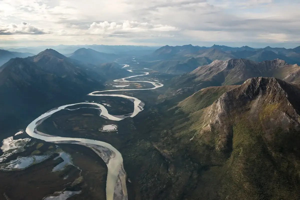
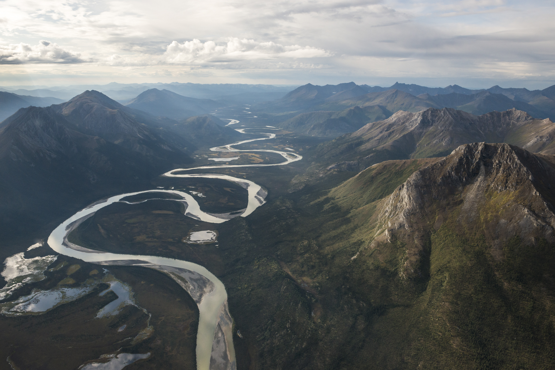
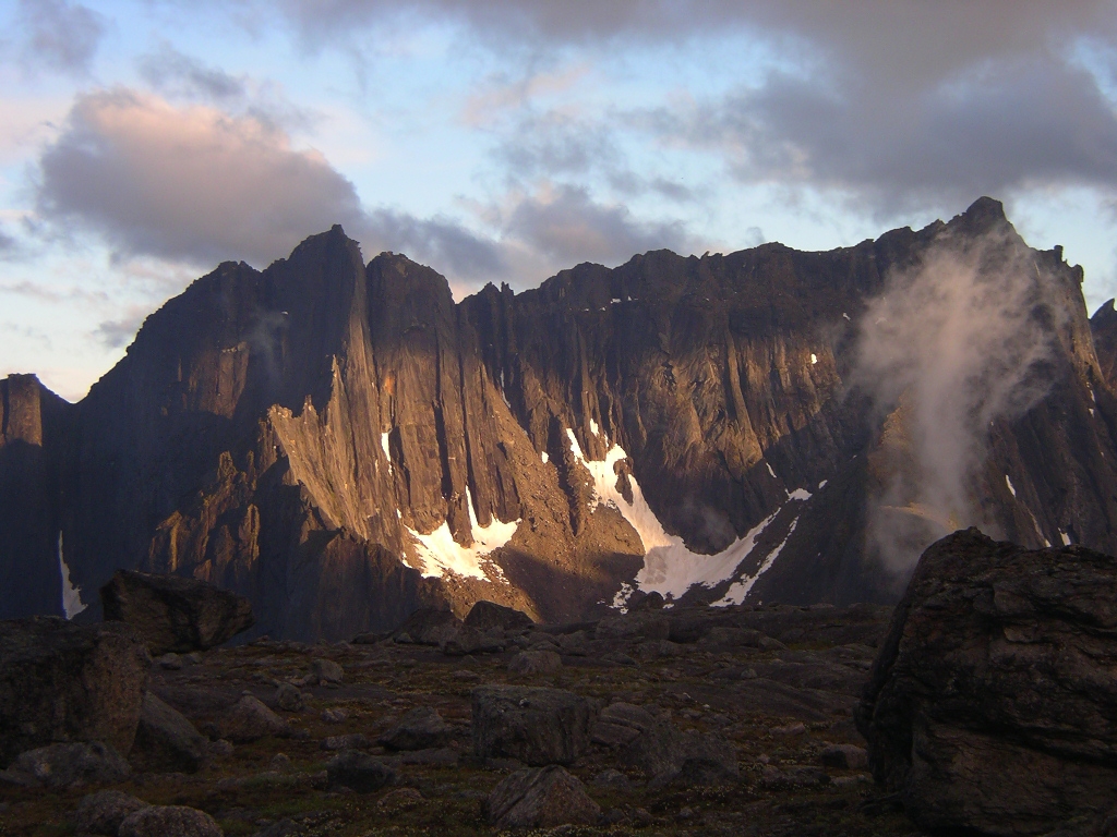
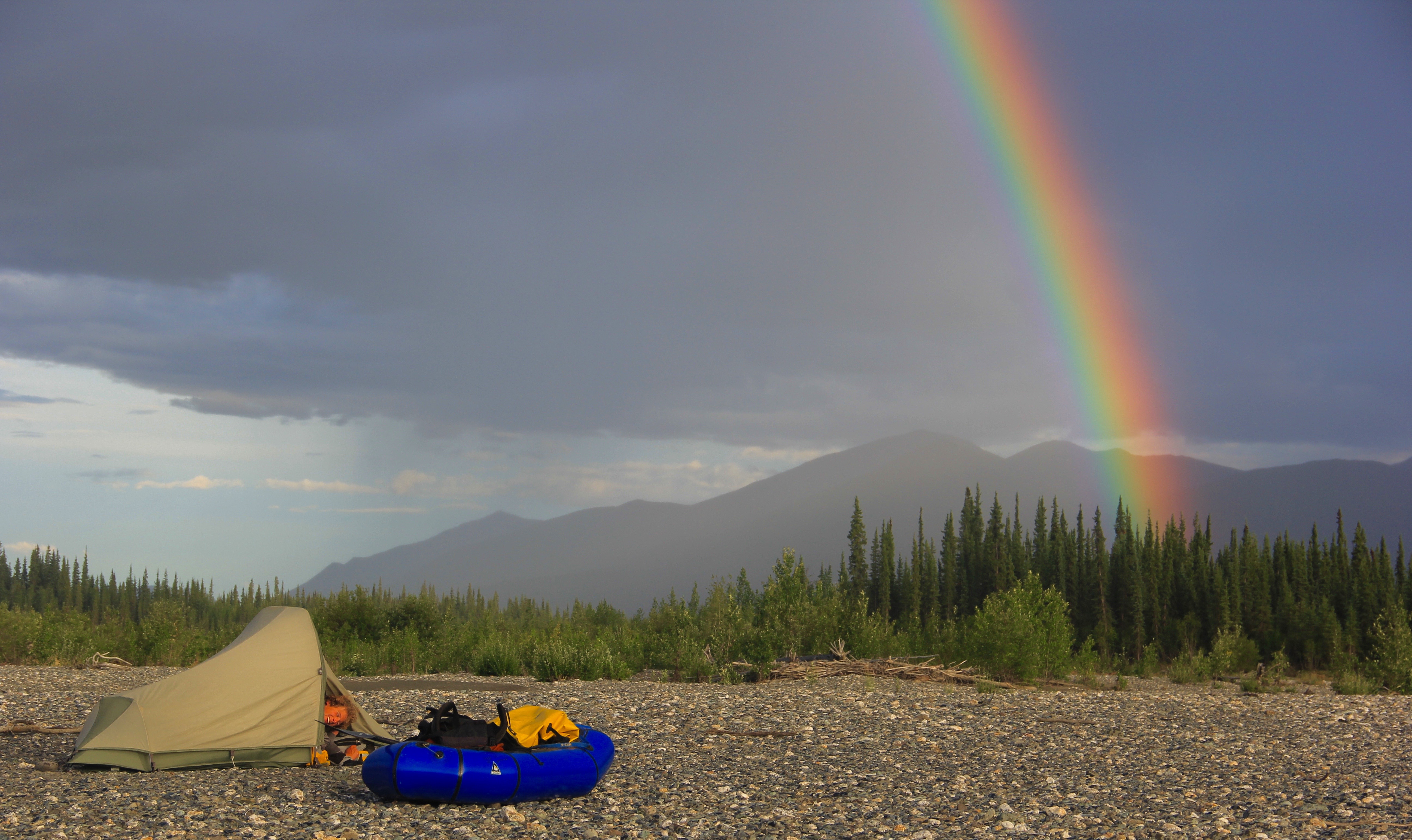
Aerial view of the Alatna River as it winds through a valleyNPS Photo / Sean Tevebaugh Images link to the original government source.A spring alpenglow brightens the granite walls of the Arrigetch PeaksNPS Photo The Bettles Ranger Station has a wheelchair-accessible ramp that leads to its entrance.NPS/ Claire Dal Nogare Woman paddling a canoe towards sunset on a forested riverNPS Photo/Josh Spice Arctic Tern NestNPS Photo / Teri Balser A rainbow appears ahead of an incoming rainstorm for campers along the Tinayguk Wild River.NPS/Ken Ilgunas Minimum impact cooking.NPS Photo Backpacker in a mountain valleyNPS/Josh Spice Common backpacking conditions and scenery in Gates of the ArcticNPS/Josh Spice
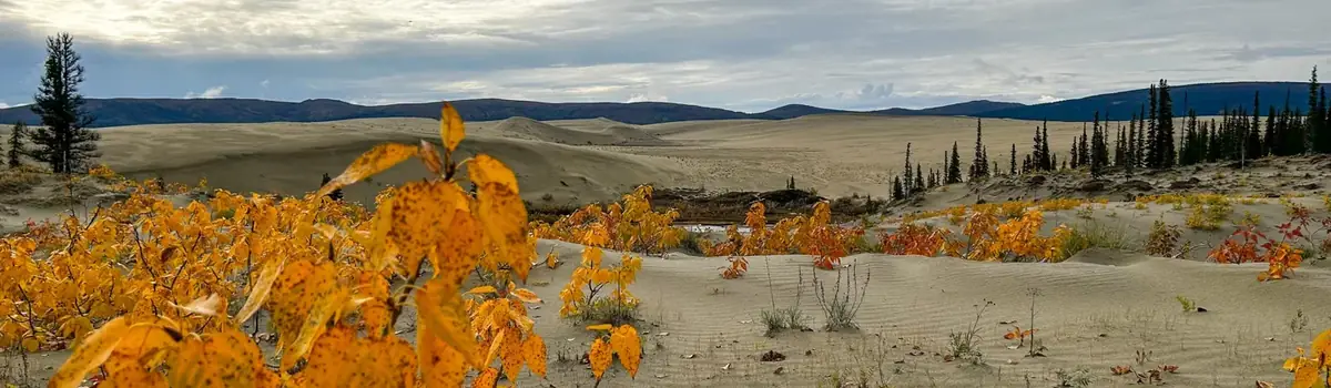
Caribou, sand dunes, the Kobuk River, Onion Portage - just some of the facets of Kobuk Valley National Park. Thousands of caribou migrate through, their tracks crisscrossing sculpted dunes. The Kobuk River is an ancient and current corridor for people and wildlife. For 9000 years, people came to Onion Portage to harvest caribou as they swam the river. Even today, that rich tradition continues.
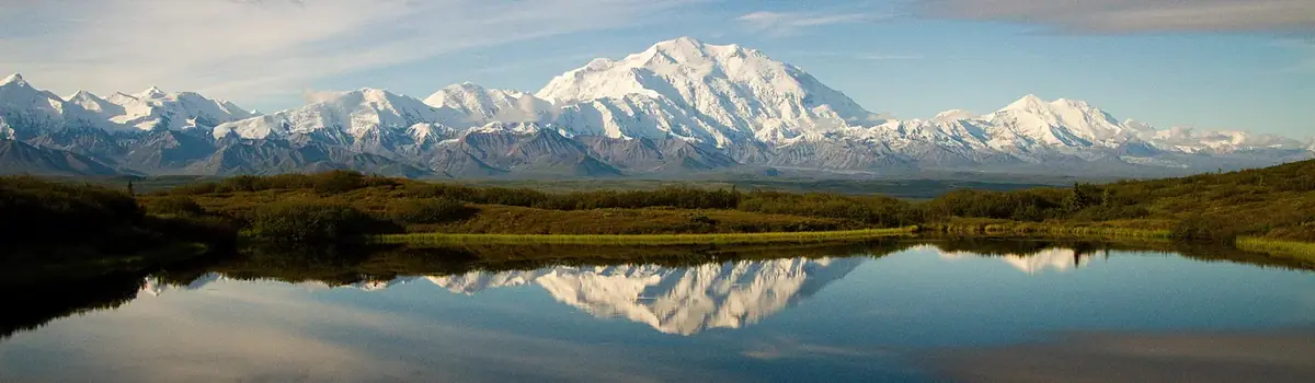
Denali is six million acres of wild land, bisected by one ribbon of road. Travelers along it see the relatively low-elevation taiga forest give way to high alpine tundra and snowy mountains, culminating in North America's tallest peak, 20,310' Mount McKinley. Wild animals large and small roam un-fenced lands, living as they have for ages. Solitude, tranquility and wilderness await.
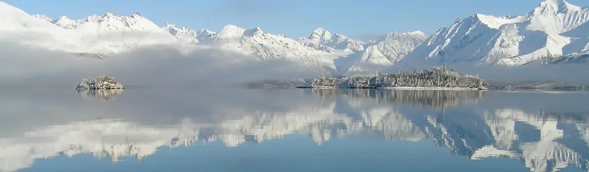
Lake Clark National Park and Preserve is a land of stunning beauty. Volcanoes steam, salmon run, bears forage, and craggy mountains reflect in shimmering turquoise lakes. Here, too, local people and culture still depend on the land and water. Venture into the park to become part of the wilderness.




 Lakes & rivers