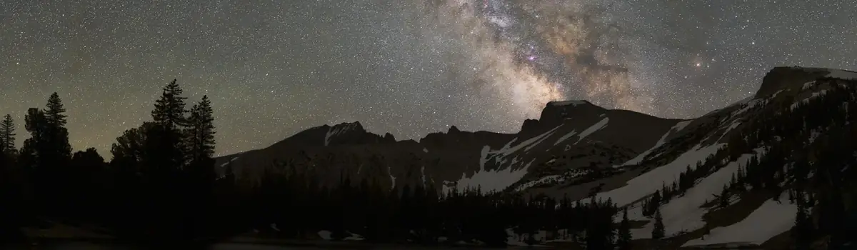
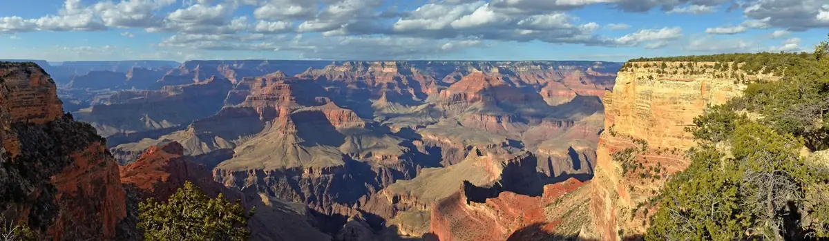
In this below-sea-level basin, steady drought and record summer heat make Death Valley a land of extremes. Yet, each extreme has a striking contrast. Towering peaks are frosted with winter snow. Rare rainstorms bring vast fields of wildflowers. Lush oases harbor tiny fish and refuge for wildlife and humans. Despite its morbid name, a great diversity of life thrives in Death Valley.
3.4Macres of parkland
1.3Mrecreation visits, 2025
Apr · May · Octnearby climate picks
Seasonal access & reservations
No reviewed guidance for this selection. Check the park's official planning pages; missing coverage does not establish access.
Selected guidance only; separate from climate comfort and current conditions.
Official conditions Not checked
The conditions feed has not been connected for this park.
Editorial recommendations, reviewed 2026-10-17. Full park days, excluding travel to and from the region. A first-visit outline for a general traveler; adapt to mobility, fitness, season, reservations, and current conditions. These are suggested days, not reserved activities or guaranteed routes.
Death Valley National Park contains the largest wilderness in the contiguous United States (over 3,190,400 acres or roughly 93% of the park!). Death Valley Wilderness, a designated wilderness area , was created by the California Desert Protection Act in 1994 and has grown over the years with the passing of additional acts and with new land aquisitions. Today, nearly a thousand miles of paved and dirt roads intersect the wilderness, providing access to all but the most remote locations. In fact, many of the most popular places in the park, such as Mesquite Flat Sand Dunes and Badwater Basin are designated wilderness and are accessible by paved road!
The History of Wilderness
Wilderness, as defined in the Wilderness Act of 1964 , is land "protected and managed so as to preserve its natural conditions and which generally appears to have been affected primarily by the forces of nature, with the imprint of man's work substantially unnoticeable."
During the late 1800s, Americans became concerned with the rapid development of natural resources and disappearance of wild places, which led to government protection of early national parks such as Yellowstone and Sequoia. These parks were primarily set aside for their scenic qualities. By the 1930s, the complexity and importance of entire ecosystems was being studied. Parks such as Everglades in Florida were created to preserve wildlife habitat and the natural processes which support them. As technologies of the 1950s made it easier for more people to access backcountry locations, the federal government, working with conservation groups, sought ways to expand protection of the nation's ever-decreasing wilderness lands. These efforts resulted in the passing of The Wilderness Act of 1964, which protects designated areas with wilderness characteristics from development.
The Wilderness Act of 1964 protects natural places from development
"In order to assure that an increasing population, accompanied by expanding settlement and growing mechanization, does not occupy and modify all areas within the United States and its possessions, leaving no lands designated for preservation and protection in their natural condition, it is hereby declared to be the policy of the Congress to secure for the American people of present and future generations the benefits of an enduring resource of wilderness."
The Wilderness Act of 1964 established the National Wilderness Preservation System, a national network of more than 800 federally-designated wilderness areas. These wilderness areas are managed by the National Park Service, Bureau of Land Management, US Fish and Wildlife Service, and US Forest Service.
Today, there are more than 109 million acres of federally protected wilderness in 44 states. Although this may seem like a huge area, it is only about 5% of the land in the United States. Check out the maps on Wilderness Connect to see the extent of wilderness in Death Valley National Park or to find a wilderness area near you.
Why is Wilderness Important?
The benefits of wilderness have been cited for centuries. William Shakespeare noted that " one touch of nature makes all the world kin " and nineteenth century American philosopher Henry David Thoreau declared "in wilderness is the preservation of the world."
Wilderness areas provide beauty, solitude and inspiration and can invoke a sense of responsibility to protect the Earth while providing opportunities for discovery and wonder. Time spent in wilderness and outdoor places has been tied with improved mental health and reduction of stress. Unaffected by humans, natural processes in wilderness provide us with clean air, soil and water. Large expanses of undisturbed habitat are important to the survival of plant and animal species and provide an ecological baseline from which to understand the impact of humans on nature. Many important historic and cultural sites and artifacts are protected from disturbance in wilderness. Wilderness can also lead to economic benefits as it often brings tourism to local communities.
How to Explore Death Valley Wilderness
People started exploring the Death Valley area long before wilderness was given the definition we have today. The Timbisha Shoshone people have been here since time immemorial, miners have search for riches in the valleys and mountains and early tourists came to experience "Hell on Earth." Now you have an opportunity to become part of the story of Death Valley Wilderness! Wilderness means many things to many people. Some consider a trip into the park’s remote and undeveloped backcountry the only way to seek wilderness, while others may consider a picnic on the dunes at Mesquite Flats the perfect way to enjoy wilderness. What is your ideal wilderness experience? Check out these resources to help plan your next wilderness adventure:
Backcountry and Wilderness Access Map
Backcountry Driving
Backcountry Car Camping
Although there are few maintained trails, the well-prepared traveler will find a lifetime's worth of exploring in Death Valley National Park. Even a short walk away from the road will immerse you in the solitude and silence that defines the Death Valley wilderness experience. If you're planning a longer trip, be sure to tell someone outside the park where you're going and fill out a free Wilderness/Backcountry Permit .
Follow a group of students from the University of California Merced on their first overnight trip into the wilderness of Death Valley National Park.
What Degrades Wilderness?
Off Road Driving
Just a few minutes of off road driving can leave scars which last decades.
Prohibited Activity
Illegal fire rings, drones, graffiti, pets and trash can take away from wilderness.
Non-native Species
Some plant and animal species not naturally found in Death Valley are having negative impacts on native species.
How Can You Help Protect Wilderness?
You can be a good steward of wilderness by following Leave No Trace , teaching others how to behave respectfully in wilderness and reporting illegal actvity to park rangers.
If you choose to travel on backcountry roads, be aware that rescue is likely to be extremely delayed. Travel prepared to survive, with 2 full size spare tires and extra food and water.
Park Roads & Current Conditions
Current information about roads and other current conditions, delays, and closures in the park.
Backcountry & Wilderness Access Map
Start your backcountry trip planning today. This map will help you decide where you can legally camp, which roads to take, and more!
Death Valley has more miles of roads than any other national park. Though over 93% of the park's 3.4 + million acres are protected in roadless Wilderness areas, nearly one thousand miles of paved and dirt roads provide ample opportunities for recreation and exploration! Check out the Backcountry & Wilderness Access Map for trip planning information.
This is remote territory. Using the following tools and doing your homework before venturing out into the wilderness could save your life.
Don't rely on GPS, instead take a map. Detailed maps are available from the Death Valley Natural History Association .
Warning: Weather changes the road conditions regularly. Check the currently known conditions before your trip.
Travel Prepared to Survive
Things can go wrong quickly in the backcountry. Pre-trip planning could save your life. Bring basic tools, a shovel, extra water, and food with you. In the higher elevations, snow and ice conditions may require tire chains. Top off your gas tank before starting a trip. Flat tires are a common problem for backcountry visitors due to rough road conditions or from having unsuitable tires. Make sure your vehicle is equipped with "off-road" tires rather than highway or street tires. Carry at least one inflated spare tire (preferably two), a can of fix-a-flat or tire plug kit, a 12-volt air-compressor, a lugwrench, and be sure all parts of your jack are on hand. Know how to use your equipment before you head out.
Bring water Always carry extra water for you and your vehicle. In hot weather you need at least a gallon per person per day. A 5-gallon container of water is standard emergency backup. Springs and other natural water sources may be dry or contaminated. Do not depend on them.
If your vehicle breaks down It is best to stay with your vehicle if it breaks down. On main roads, another traveler should come along sooner than you could walk for help. Leave the car's hood up and/or mark the road with a large X visible to aircraft. If you decide to walk out, stay on the main roads-do not cut cross-country. If it's hot, walk out only if you can carry sufficient water and wait until after sundown. Leave a dated note describing your plan with your vehicle. Dial 911 in case of emergencies, but remember, cell phone reception is non-existant in most areas of the park. Towing charges are high and AAA often doesn't cover tows on dirt roads.
Be a good road neighbor Stop to help those in need. Report anyone in trouble to the nearest ranger. You may need help yourself some time.
Safety in numbers Travel in a group of two or more 4WD vehicles in remote areas and on rough roads. If that is not possible, leave a trip plan with a reliable person that will do follow-up on your safe return.
Don't expect road signs Most backcountry road junctions are unmarked, so carry good maps and study them in advance. Be alert for washouts and other road damage.
Stay on established roads Driving off roads is prohibited . The desert environment is extremely fragile and slow to recover from vehicle damage. Honor road closures. If in doubt, do not drive. Operating a motor vehicle in a manner that causes unreasonable damage to the surface of a park road or route is prohibited.
Vehicles All motorized vehicles and drivers must be properly licensed. Off-road vehicles are prohibited from operating on all park roads, paved or dirt. These types of vehicles include, but are not limited to, ATVs, dirt or motocross bikes, and golf carts, Rhino or Polaris multiple passenger vehicles. Dual sport motorcycles are allowed on paved or dirt roads as long as the vehicle is registered and street legal according to California state laws.″ Vehicles with off-road registration "green stickers" may not be operated in the park.
Bicycles Bicycles are allowed on paved and dirt roads and the bike path near the Furnace Creek Visitor Center. Bikes are not allowed off roads, on trails, on closed roads, or in the wilderness areas of the park.
Wilderness The wilderness boundary is 50 feet from the center line of most backcountry dirt roads. Only foot or horseback traffic is allowed within the park's wilderness.
Rental Vehicles
Most vehicle rental agreements restrict vehicles to paved roads. Check your contract and be aware that the rental company can charge you for damage to the vehicle outside of the contract agreement specifications. Be sure that your rental vehicle has a good spare tire, that the tire is accessible and not "locked" into a keyed holder, and that the tools to change the tire, including jacks and wrenches, are in the vehicle and accessible.
Farabee's Jeep Rentals now have an outlet located in Furnace Creek. These jeeps are outfitted for rugged backcountry road use.
Visitors come to Death Valley to experience the stark and lonely vastness of the valley; the panorama of rugged canyons and mountains; the pleasures of the dry, moderate winter climate; the challenge of the hot, arid summer; the relief of the cooler mountains; and the reminders of frontier and Native American ways of life. Yet, Death Valley National Park's greatest value is as an outdoor natural history museum.
It contains fine examples of most of the earth's geological eras and the forces that expose them. Plant and animal species, some of which occur nowhere else in the world, have adapted to the harsh Mojave Desert environment here in remarkable ways. Extremes of climate and geography make it the ultimate showcase of an American desert. Death Valley National Park includes all of Death Valley, a 156-mile-long north/south-trending trough that formed between two major block-faulted mountain ranges: the Amargosa Range on the east and the Panamint Range on the west. Telescope Peak, the highest peak in the Park and in the Panamint Mountains, rises 11,049 feet above sea level and lies only 15 miles from the lowest point in the United States in the Badwater Basin, 282 feet below sea level. The California Desert Protection Act added most of the Saline, Eureka, northern Panamint, and Greenwater valleys to the Park.
Faulting is the one of the main reasons Death Valley exists.
Death Valley NP is renowned world-wide for its exposed, complex, unique tectonics and diverse geologic resources.
Death Valley is famous as the hottest place on earth and driest place in North America.
Wetland and riparian areas have a unique scientific value.
Death Valley National Park show-cases the subtle beauty and uniqueness of desert environments.
The sand dunes of Death Valley National Park are excellent places for nature study and recreation.
The salt flats in Badwater Basin cover nearly 200 square miles, among the largest protected salt flats in the world.
Devils Hole--a detached unit of Death Valley National Park--is habitat for the only naturally occurring population of the endangered Devils
Nestled in a remote valley between the Cottonwood and Last Chance Ranges, the Racetrack is a place of stunning beauty and mystery.
Inn at Death Valley The historic Inn at Death Valley, was originally named Furnace Creek Inn and opened in 1927. It was built by the Pacific Coast Borax Company and played a pivotal role in the transformation of Death Valley from mining wasteland to treasured national park.
Keane Wonder Mine Once the most productive and richest gold mine in Death Valley, the Keane Wonder Mine is temporarily closed to public access due to mine safety hazards.
Rhyolite Ghost Town 100 years ago, Rhyolite was the largest city in southern Nevada with more than 10,000 residents. Yet after only a decade, the town became a ghostly remnant of itself.
Barker Ranch Barker Ranch was built by recreational ranchers who wanted to live in solitude and enjoy the simplicities of life. Bluth and Helen Thomason aquired the property in the 1930s in a location where they both wished to try their luck at mining. In 1940, a stone cabin was built that had a spring nearby for drinking water and electricity was generated by a windmill. After Jim and Arlene Barker purchased the ranch in 1955 they enlarged the house to have large family gatherings. The infamous Manson family occupied this ranch for a brief period of time from 1968 to 1969. Some of the family members burned an NPS tractor which caught the attention of law enforcement officials. After Barker Ranch was raided and the Manson family members were jailed for vandalism, it became apparant they were involved with horrific murders in Los Angeles. In May 2009, Barker Ranch was destroyed in an accidental fire.
Despite its reputation as a lifeless wasteland, Death Valley National Park contains a great diversity of plants. The park covers over 3 million acres of Mojave and Great Basin desert terrain. With over 11,000 feet of elevation change, and annual precipitation varying from 1.9 inches on the valley floor to over 15 inches in the higher mountains, there are a variety of different environments within the park for a great diversity of plants to thrive!
Vegetation zones include creosote bush, desert holly, and mesquite at the lower elevations up through shadscale, blackbrush, Joshua tree, pinyon-juniper, to sub-alpine limber pine and bristlecone pine woodlands. The saltpan is devoid of vegetation, and the rest of the valley floor and lower slopes have sparse cover, yet where water is available, an abundance of vegetation is usually present.
Spring wildflower blooms are a popular attraction in this desert park. Most years will have at least a few flowers, while others can have spectacular "superblooms." For more information on blooms and insight into the current year's bloom predictions, visit our Wildflower Seasons page.
Surviving a Harsh Environment
How have plants adapted to survive the extremes of Death Valley? Here are a few broad strategies: Escaper plants- (ex: wildflowers) wait for favorable growing conditions such as rain and cool temperatures and avoid growing during the extreme heat and dry periods. Resister plants- are able to resist the extreme temperatures and dryness of Death Valley and live year-round. An example of this are mesquite trees, which have roots up to 80 feet long that allow them to reach water deep underground. Evader plants- (ex: pickleweed) evade the extreme conditions by living near water sources like springs and streams.
Learn more about wildflowers and get an update on current blooming in the park.
Cacti and Desert Succulents
Death Valley is home to many different types of cacti and other desert succulents- learn more about them!
Hottest, Driest, Lowest: How do Desert Animals Survive?
NPS - Robb Hannawacker
While there are advantages to being nocturnal in the desert, there are still creatures who brave the daytime heat. Animals like the sidewinder rattlesnake and scorpion are known for being active in the desert, but other animals also get spotted in the Death Valley heat. These animals have specific physical adaptations which allow them to be out in the heat longer. Roadrunners, for instance, can operate in the heat of the day because their body temperatures are naturally high (104 °F). The jackrabbit, another common desert creature, stays cool by releasing heat from its over-sized ears. When the rabbit retreats into the shade, warm blood from its core circulates through blood vessels in its ears, releasing body heat into the surrounding air. Desert living is no easy task, but all animals that make their home in Death Valley have found a way to survive and thrive. Their adaptations overcome the daily challenges of finding food, water, and staying cool. “Helping” an animal by giving it food or other interactions can disrupt its way of life and usually does more harm than good. Desert dwellers are perfectly designed to live in Death Valley National Park. It is important that humans, as visitors to these creatures’ home, respectfully observe and enjoy from a distance.
Did you know that Death Valley National Park has no closing time and that it is just as spectacular at night as it is during the day? Consider these ideas for ways to experience the park at night:
Far from cities and carefully managed to protect darkness, Death Valley National Park is an excellent place to view the night sky. Nights in Death Valley are so dark that the park is classified at the highest (Gold Tier) level by the International Dark-Sky Association ; many celestial objects which can be viewed from Death Valley are not visible elsewhere in the world! While most places in the park away from lodging/campgrounds and major roads will provide good night-sky viewing opportunities, the top ranger suggestions for star gazing locations are: Mesquite Flat Sand Dunes, Harmony Borax Works , Badwater Basin and Ubehebe Crater.
Hints for seeing the most stars:
Visit during the new moon — this is when the moon is not visible which means the sky will be darkest and you can see the most stars.
Know what to look for — check out a night sky almanac to get an idea of what might be visible and where.
Avoid light pollution — pick a place to view the night sky away from developed areas.
Stay out long enough — it takes about 30 minutes for your eyes to adjust to the night sky to see the most stars.
Use a red light —or put a piece of red cellophane on your flashlight. This will minimize the effect of the light on your adjusting eyes.
Look at the horizon — Death Valley has large, towering mountains. If you pick a low place to view the night sky, like Badwater Basin, some of the stars will be blocked by mountain ranges. Pick a large open area with some elevation to see the most stars.
Bring binoculars — a simple pair of binoculars is a great way to get a closer look!
Use NASA's Spot the Station app to receive notifications when the International Space Station is visible.
Get the Spot the Station app
Ranger Programs
Interested in learning more about the night sky? Join a Ranger for an introduction to the cosmos at a famous Death Valley location. Programs are offered during the winter; check at a visitor center or on our park calendar for the schedule.
Night Photography
Dark nights mean ample opportunity to photograph the stars. While there is no one “best” location, astrophotographers often choose places such as Zabriskie Point, Mesquite Flat Sand Dunes or Harmony Borax Works to capture their night images. Please note that while you may park along major roadways while photographing, camping along paved roads is prohibited.
Full Moon Night Hiking
While we don’t recommend a hike at night in an area with obstacles such as rocks, a casual stroll at a place like Mesquite Flat Sand Dunes or Badwater Basin can be quite rewarding. Visit during a full moon (see NASA's Moon Phases webpage ) for the best natural lighting. Make sure to pause to view the stars and to listen for wildlife. Always bring a flashlight and water and remember that nighttime temperatures can still be over 100 F (38 C) during the summer.
Dark Sky Festival
Death Valley National Park holds an annual event each spring, where visitors are invited to come and learn about space. The event lasts multiple days and includes special ranger programs, guest speakers from organizations such as NASA, and hands-on activities. Check the park calendar or ask a ranger at the Furnace Creek Visitor Center for upcoming event dates.
Logo: Tyler Nordgren
Park to Park in the Dark
Interested in extending your trip to discover more dark places? Check out Nevada’s first Astro-tourism route, Park to Park in the Dark, which connects two International Dark Sky Parks: Death Valley National Park and Great Basin National Park. Motorists along this route will be able to ponder life’s biggest questions as they travel through some of the darkest areas in the country and gaze up into star-studded skies. The route winds its way through rural Nevada and California and offers countless opportunities for star gazing, telescope viewing and astrophotography, along with plenty of daytime activities. Services are limited to the towns of Beatty, Goldfield, Tonopah, Ely and Baker, which are separated by long stretches without cell service, restrooms, or gas stations. Establishing the route was a collaborative effort between local communities, non-profit organizations, and various land management agencies including the National Park Service. This route promotes outdoor nighttime recreation while also highlighting the importance of preserving the dark.
Death Valley is the size of the state of Connecticut - yes, you read that right! Whether this is your first time to Death Valley and you don't know how to begin exploring this massive park, or this is your favorite place which you revisit year after year, attending a program or event listed below is sure to be a memorable experience. Ranger-led programs are offered daily during the winter season and cover topics ranging from history to geology to space! These do not require a reservation- just show up (we recommend arriving at least 5 minutes before the start of the program). We also have special ticketed tours requiring advance reservation which guide visitors to remote or closed areas of the park. Whatever experience you choose, we hope that through the connections you make, you will fall in love with this special place. Click through the collapsing panels below to find more information. You can also visit our calendar to check out upcoming events that will be happening during your visit.
Programs are typically offered mid-November to mid-April. No outdoor formal programs are scheduled during summer due to extreme heat (nightly lows can be over 100F/38C!). Limited indoor programs may be offered during the summer- check the calendar for a schedule.
Ranger-led Programs
Park rangers have created a variety of talks and walks to help you better understand and explore the wonders of Death Valley National Park.
Daily programs are offered December - March. Please check the calendar or posted flier at Furnace Creek Visitor Center for scheduled dates, including special events and programs. Schedules are available approximately one week in advance but are subject to change/cancellation based on emergencies, inclement weather and park staffing.
Program Descriptions:
Badwater Ranger Talk Explore the extremes of Death Valley below sea level! Location: Meet at the Badwater parking area Duration: 45 minutes Harmony Borax Works Ranger Walk Learn about borax and mining history. Walk is an easy 1/3 mile on a paved path. Location: Meet at the Harmony Borax Works parking area Duration: 45 minutes Golden Canyon Hike Hike with a ranger at Golden Canyon. Easy walk approximately 3/4 mile. Bring sun protection, water and hiking shoes. Location: Meet at the Golden Canyon parking area Duration: 1 hour Sand Dunes Walk Stroll through Death Valley Wilderness with a Park Ranger. Explore living and non-living parts of this unique landscape. Location: Meet at the Mesquite Flat Sand Dunes parking lot Duration: 1 hour Family Programs Join a park ranger for an interactive family-geared talk about the wonders of Death Valley! Topics will vary. Location: Furnace Creek Visitor Center Courtyard (behind building) Duration: 35 minutes History of Stovepipe Wells Discover the history and unique landscape of the Stovepipe Wells area. Rangers will be available with a touch table as well as formal talks. Location: Stovepipe Wells Ranger Station Duration: 15 minutes Indoor Evening Programs Join a ranger for an indoor evening presentation about Death Valley. Topics will vary. Location: Furnace Creek Auditorium Duration: 45 minutes Night Sky Talk Discover the wonders of Death Valley's incredible night sky with a park ranger. Location: Furnace Creek Visitor Center back parking lot - park in the main lot in front of the visitor center and follow the red lights to the viewing location Duration: 45 minutes -1 hour Optional items to bring: red light to protect night vision, binoculars, chair. Note: arrive early to ensure parking and to allow your eyes to adjust to the darkne
Accessible via paved roads. Limited services such as toilets and trash removal provided.
Accessible via unpaved roads, requiring high clearance 4 x 4. No services available, must provide own water and pack out all trash.
Privately owned campgrounds located within Death Valley National Park. These campgrounds accept reservations.
Summer: Mid-April to Mid-October
There are only a few campgrounds open in the summer months due to the extreme temperatures ( midnight temperatures can still be over 100 degrees!) so most visitors find these sleeping conditions unfavorable.
Lower elevation campgrounds such as Sunset, Texas Springs, and Stovepipe Wells regularly close in mid-April, when temperatures typically begin to soar. What campgrounds remain open may fill quickly if cooler temperatures linger through late April into May and over holiday weekends (Memorial Day, July 4th, Labor Day). The higher elevation campgrounds can be full on most weekends throughout the summer.
Campgrounds that remain open are all first-come, first-served and are not staffed. You will need to travel to the campground to find an empty spot and then pay your campground fee at the automated, self-help kiosk with a credit or debit card.
Due to excessive summer heat, it is recommended to stay in developed campgrounds only - Furnace Creek (with limited capacity), Emigrant, and Mesquite Spring. Travel on primitive, unpaved roads increases the risk of vehicle breakdowns, exposure to elements, poor cell service and lack of water.
To escape Death Valley’s famous summer heat, consider our higher elevation campgrounds for more pleasant overnight options: Mesquite Spring, Emigrant, or Wildrose.
Winter/Spring: Mid-October to Mid-April
The popular campgrounds (Furnace Creek and Texas Springs) are typically full on weekends and holidays. The park's largest campground, Sunset, almost always has sites available, even in peak season.
Reservations: Furnace Creek Campground takes reservations for October 15th - April 15th season. Sites can be booked through recreation.gov up to 6 months in advance. All other NPS campgrounds within Death Valley are first-come, first-served. You can arrive anytime and pay at the first-come, first-served campgrounds with an automated machine (credit or debit card needed).
Furnace Creek Campground takes reservations for October 15th - April 15th season. Sites can be booked through recreation.gov up to 6 months in advance.
All other NPS campgrounds within Death Valley are first-come, first-served. You can arrive anytime and pay at the first-come, first-served campgrounds with an automated machine (credit or debit card needed).
Furnace Creek Campground is open year-round. Sunset Campground, Stovepipe Wells Campground, and Texas Springs Campgrounds typically open late fall and close April 15.
Camping/Campground Rules
Number of People/Vehicles:
Campsites are limited to no more than eight people and two vehicles or one recreational vehicle plus secondary vehicle per site.
Larger groups wishing to camp together can reserve group sites at the Furnace Creek Campground.
All vegetation in the park is protected . Firewood is available at Furnace Creek and Stovepipe Wells General Stores or you can bring your own supply.
Ash-producing fires (wood, charcoal, etc.) may only be made in National Park Service metal fire pits.
All stoves and grills must be gas burning with an on/off switch.
Fires are prohibited in the summer months or other periods of high fire danger at Mahogany Flat, Thorndike, and Wildrose Campgrounds.
Camping Limits:
Furnace Creek Campground has a limit of 14 days per calendar year.
The rest of Death Valley National Park has a 30-day per calendar year camping limit.
Generator Hours:
From 7 a.m. to 7 p.m., unless otherwise posted.
Generators are prohibited in Texas Springs Campground.
Pets must never be left unattended. There is a maximum limit of 4 pets per campsite and pets must be kept on a leash no longer than 6 feet at all times. Pet owners are responsible for cleanup and cleanup supplies.
Check-out Time:
Check-out time for all park campgrounds is 12 pm.
Recreational Vehicle (RV) Length Restrictions:
Mahogany Flats Campground, Thorndike Campground, and Wildrose Campground have a length restriction of 25 feet in total length.
Emigrant Campground is a tent-only campground, no RVs permitted.
Texas Springs Campground and Mesquite Springs Campground can accommodate up to 35ft in total length.
Furnace Creek Campground has sites that can accommodate up to 100ft in total length. See recreation.gov for campsite specific details. Not all sites can accommodate that length.
Sunset Campground and Stovepipe Wells Campground do not have RV length restrictions
Coyotes and ravens are scavengers - keep your campsite clean! Do NOT feed or disturb wildlife.
Backcountry Camping
Interested in dispersed or backcountry camping? It is permitted in some places within the park - find out more about the Backcountry Camping Rules . Death Valley is a large, remote place without cell phone service in most areas. Backcountry camping is a great option for those who prepare properly and follow Leave No Trace principles.
Want to visit Tatooine? If so, take a trip to Death Valley National Park! The famous Star Wars movie series filmed scenes in the park for Episode IV - A New Hope and Episode VI - Return of the Jedi. Download the free NPS App to enjoy a guided driving audio tour of the spectacular Death Valley locations featured in Star Wars.
One of the most beautiful times to see the desert is when the sun is close to the horizon. The soft colors of sunrise and sunset reveal the many different moods of Death Valley. Some of the most dramatic photographs of Death Valley have been shot during the early morning and late evening. Visit the Death Valley National Weather Service page for today's sunrise/sunset times. While the official sunrise and sunset times indicate when the sun will pass behind the curve of the earth, the actual time will vary according to your location due to features such as mountains. Check out these top ranger recommended sunrise and sunset locations:
If you choose to travel on backcountry roads, be aware that rescue is likely to be extremely delayed. Travel prepared to survive, with 2 full size spare tires and extra food and water. Current Road Conditions
There are few constructed trails here, but in a place this desolate you usually don't need them. Most hiking routes in the park are cross-country, up canyons, or along ridges.
Hiking Seasons The best time to hike in Death Valley is from November through March. Summer temperatures can be dangerous in the park's lower elevations. Even during spring and autumn the heat can be unbearable for most people. Save the low elevation hikes for the cooler winter days. The high peaks are a pleasant escape from the heat in summer, but are usually covered with snow in the winter and spring. If you must climb them during winter season, be sure to be properly equipped with adequate winter clothing, an ice axe and crampons.
Water Due to the dry climate of Death Valley, you must drink more water here than in other places, even in the cooler winter months. Always carry adequate water (at least 2 liters for a short winter dayhike, 1 gallon or more for longer warm season hikes and overnighters). Springs are rare and should not be considered reliable. Boil or treat water from these sources before using.
Loading results...
Difficult Hikes
Harmony Borax Works
Badwater Salt Flat
Mesquite Flat Sand Dunes
Ubehebe Crater Loop
Golden Canyon, Gower Gulch, and Badlands Loop
Golden Canyon trailhead located 2 miles south of CA-190 on Badwater Road.
Zabriskie Point on CA-190 located 3.5 miles east of Badwater Road.
Desolation Canyon
Sidewinder Canyon
Length: 8 miles (12.8km) out and back Time: 4-5 hours round trip Difficulty: Moderately difficult Elevation Gain: 1,028 ft (313m) Location: Unmarked cross country route off the unpaved Lake Hill road, approximately 4.5 miles east of Panamint Springs on the north side of CA-190. Access to the trailhead requires a high clearance vehicle. Parking: Small gravel lot. Closest Restroom: Panamint Springs Resort or Emigrant Canyon Rest Station. No restroom along the trail, follow principle 3 of Leave No Trace (LNT) . GPS Data: 36° 27.673'N, -117° 27.331'W (the highest dune) Route: From the prominent bend on Lake Hill Road approximately 5.5 miles (8.9km) from CA-190 take a direct route toward the dunes to the north. The unmarked route is uneven, sandy, and partially rocky. The elevation gain is gradual until you reach the dunes at approximate 3 miles in. From there, sandy and strenuous to the tops of 4 different dunes.
If you choose to travel on backcountry roads, be aware that rescue is likely to be extremely delayed. Travel prepared to survive, with 2 full size spare tires and extra food and water. Current Road Conditions
Backpacking in Death Valley National can be challenging, but the opportunities for experiencing solitude, sweeping vistas, dark night skies, and awesome geology abound within the three million acres of designated wilderness in the park. There are few established trails in the park, but hikers can follow canyon bottoms, open desert washes, alluvial fans, and abandoned dirt roads to get around.
Backpackers on the Cottonwood-Marble Canyon Loop are required to obtain a backcountry permit online, in person at Furnace Creek Visitor Center or the Stovepipe Wells Ranger Station during business hours, or at the 24-hour self-service drop box outside Stovepipe Wells Ranger Station.
Backpackers in other areas are recommended (but not required) to get a permit.
Leave No Trace guidelines should be followed to minimize impacts on the fragile desert environment.
Overnight group size is limited to 12 people and no more than 4 vehicles. Larger groups will need to split up and camp at least 1/2 mile apart.
Campfires are not allowed in the backcountry. Use a campstove instead.
Pets are not allowed on trails or in the wilderness. However, pets are allowed on the Furnace Creek bike path and hundreds of miles of backcountry dirt roads.
Water at springs can be dry or contaminated. These fragile, sensitive habitats are also vital to wildlife. Plan to carry your own water or stash it ahead of time. During hot spring, summer, and fall months, one gallon of water or more per person per day is needed.
Difficulty: strenuous
Type of hike: no trail; walk gravel wash and cross-country, some rock scrambling.
Distance: 10 miles from Scotty's Castle Road to upper dry fall
Elevation gain: 4000 feet
Start: 3.9 miles south of Grapevine Ranger Station on Scotty's Castle Road.
Vehicle needed: all vehicles
Maps: Tin Mountain and Whitetop Mountain 7.5 minute topos
Comments: From the Scotty's Castle Road, hike down to Death Valley Wash then follow main drainage up alluvial fan to canyon. Several small dry falls are easily passed, but at upper end of gorge an 80 foot dry fall requires scrambling up talus slope on north side to continue beyond. No camping within 2 miles of the road.
Cottonwood-Marble Canyon Loop (permit required)
Type of hike: walk dirt road; no trail; gravel wash and cross-country; some brushy areas.
Distance: 26 miles (42km). Road walk may make the hike longer. See map.
Elevation gain: 3882 feet (1183m)
Water: Seasonal springs in upper Cottonwood Canyon and Deadhorse Canyon.
Start: 8 to 10 miles from Stovepipe Wells on Cottonwood Canyon Road.
Vehicle needed: high-clearance to canyon mouth; 4x4 beyond.
Comments: Hike the loop by following Cottonwood Canyon Road to its end, then continue up the Cottonwood drainage. Below the spring, trees line a small stream but brush can be thick. In the valley above the spring, hike northeast to cross over into Deadhorse Canyon and follow it down into Marble Canyon to return to your vehicle. Potential flash flood hazard. Take map and compass.
Type of hike: informal path first mile, then gravel wash and rock scrambling.
Distance: 3 miles to first dry fall; 6 miles to second dry fall.
Elevation gain: 2,460 feet to first dry fall
Start: parking area at mouth of Titus Canyon (west end)
Maps: Fall Canyon 7.5 minute topo
Comments: Narrow canyon with high walls, similar to Titus. From parking area, hike north along base of mountains ½ mile to large wash , then up into Fall Canyon. At 3 miles you reach a dry fall, which can be passed on the south side with moderate difficulty. Day -use is heavy below dry falls. Backpackers should plan on camping beyond that point. No camping within 2 miles of the road.
Red Amphitheater
Difficulty: moderate to strenuous
Type of hike: no trail; gravel wash and cross-country
Distance: 2 to 10 miles
Elevation gain: 300 to 1500 feet
Start: Hole-in-the-Wall
Vehicle needed: high-clearance to Hole-in-the-Wall; 4x4 beyond
Maps: Echo Canyon 7.5 minute topo
Comments: Many variations possible. In the large "amphitheater" between Schwaub and Pyramid Peaks many small side canyons make good loop hikes by crossing low divides and returning via another canyon. Several rugged canyons in Funeral Mountains just above Hole-in-the-Wall can be explored depending on your climbing ability. No camping within 2 miles of the paved road.
Hungry Bill's Ranch
Type of hike: informal path and cross-country.
Distance: 2 miles to ranch site from road end; 7 miles to Panamint City.
Elevation gain: 1100 feet to ranch site; 4100 feet to pass
Start: end of Johnson Canyon Road
Vehicle needed: high-clearance to canyon mouth; 4x4 on last 4 miles to road end
Maps: Panamint and Galena Canyon 7.5 minute topos
Comments: Historic ranch site from 1870's contains rock terraces, corral and orchard. It is possible to continue over pass (no trail) to ghost town of Panamint City.
Type of hike: no trail; walk gravel wash and cross-country.
Distance: 6 miles to springs; 8 miles to pass.
Elevation gain: 3000 feet to pass
Water: yes, in canyon
Start: 6.5 miles north of Furnace Creek Visitor Center on Hwy 190.
Maps: Nevares Peak 7.5 minute topo
Comments: Follow wash bearing left (north) staying in drainage nearest ridge; head for low pass in mountains to the east. Last four miles in canyon. No camping within 2 miles of the road or 200 yards from springs.
Owlshead Mountains
Difficulty: moderate
Type of hike: cross-country and gravel wash
Distance: 7 miles to upper Through Cyn, 16 mile loop to return via Granite Canyon
Elevation gain: 1900 feet
Start: Confidence Mill site, 6.6 miles from Ashford Junction on Harry Wade Road
Vehicle needed: high-clearance
Maps: Confidence Hills East and Confidence Hills West 7.5 minute topo.
Comments: The east side of the Owlshead Mountains have several nice canyons for hikers to explore. Through Canyon is one of the largest and passes through to a hidden basin at the heart of the mountains. A small stand of smoke trees are found here. A possible loop trip is return via Granite Canyon.
Type of hike: no trail; cross-country
Distance: 3 miles to dunes
Elevation gain: 1000 feet
Start: 5 miles north of Hwy 190 on unmarked dirt road leading past Lake Hill.
Maps: Dunes 7.5 minute topo or Trails Illustrated Map of Death Valley
Comments: Hike across the gently rising upper end of Panamint Valley to star-shaped dunes. These remote dunes are more impressive than they look from a distance. Military jets often use Panamint Valley to practice low elevation flight maneuvers, but are less likely on weekends
Surprise Canyon
Type of hike: wet canyon with remnants of old jeep road, some rock scrambling.
Distance: 5 miles to ghost town
Elevation gain: 4000 feet to ghost town
Start: 6 miles northeast of Ballarat.
Vehicle needed: high-clearance; 4x4 final 2 miles to trailhead
Maps: Panamint and Ballarat 7.5 minute topos
Comments: Old jeep road washed out in 1980s and officially closed to vehicles but makes a great hiking trail. Ghost town of Panamint City is a good goal but mountain scenery, abundant springs and bighorn sheep all make it a worthy hike. Another 7 miles of mostly trailless hiking over pass leads to Johnson Canyon Road.
Type of hike: maintained trail
Distance: 7 miles to summit
Elevation gain: 3000 feet
Start: Mahogany Flat Campground
Vehicle needed: High-clearance
Maps: Telescope Peak 7.5 minute topo
Comments: Spectacular views of Death Valley and Sierra Nevada. Camping is good in Arcan Meadows between Rogers Peak and Telescope Peak. Grade is steep for last mile of ascent; ice axe and crampons are often necessary in winter. No camping within 2 miles of the road.
Titanothere Canyon
Distance: 4.5 miles to Lostman Spring; 12 miles to Scotty's Castle Road.
Elevation loss: 1700 down to spring; 4700 feet down to road
Water: maybe, at Lostman Spring
Start: 11 miles from start of Titus Canyon Road (do not block road)
Maps: Thimble Peak 7.5 minute topo
Comments: With a 2-car shuttle you can hike all the way through to Scotty's Castle Road, but a more practical way is to hike to Lostman Spring and return to your car. No camping within 2 miles of the road or 100 yards from springs.
Check our Alerts and Conditions page for current road conditions.
NPS - Kurt Moses
Bicycles can be used on all park roads that are open to public vehicular traffic. They can also be used on routes that have been designated for bicycle use in developed areas such as the path between the visitor center and the Harmony Borax Works. They are not allowed on service roads, off roadways , in the wilderness , or on any trails. Riding a bicycle abreast of another bicycle on the park's narrow roads is dangerous and is also prohibited.
Death Valley has more than 785 miles of roads including hundreds of miles suitable for Mountain Biking.
It is not advised to bring pets to Death Valley from late Spring through early Fall. DO NOT leave pets in your vehicle.
Are you visiting the park with your pet? Learn from Bark Ranger Frosty where you can take your pet for a safe and fun visit.
Where can I take my pet? 🐾
Leashed pets are permitted in developed areas, such as paved roads, unpaved roads, parking lots, campgrounds, and outside of federal buildings. The following are appropriate options nearby popular attractions:
If you’re visiting...
you can walk your pet at...
Devil’s Golf Course Road
Zabriskie Point
20 Mule Team Canyon
Mesquite Flat Sand Dunes
Cottonwood-Marble Access Road
Greenwater Valley Road
Harmony Borax Works
Upper Wildrose Road
Father Crowley Vista Point
Father Crowley Point road to Padre Point
Know Where You Can Go
Pets are not permitted on trails, in designated wilderness areas, or inside of federal buildings, even when carried in backpacks, purses, or strollers. This includes: Badwater Basin boardwalk and trail Zabriskie Point paved trail Harmony Borax Works loop trail Mesquite Flat Sand Dunes beyond the parking lot Inside the Furnace Creek Visitor Center and Stovepipe Wells Ranger Station
Pets are not permitted on trails, in designated wilderness areas, or inside of federal buildings, even when carried in backpacks, purses, or strollers. This includes:
Badwater Basin boardwalk and trail
Zabriskie Point paved trail
Harmony Borax Works loop trail
Mesquite Flat Sand Dunes beyond the parking lot
Inside the Furnace Creek Visitor Center and Stovepipe Wells Ranger Station
Why are some areas closed to pets?
Pets face several dangers when they leave developed areas, including adverse wildlife interactions, unstable historic structures, and hazardous plants. Limiting the areas in which pets can explore also helps limit their exposure to high temperatures and potential for dehydration.
Not all visitors are comfortable being around pets, especially dogs. The presence of pets in national parks can promote conflict among visitor use activities and detract from other visitors’ enjoyment of the resource.
Wildlife Safety
Domesticated animals are known to alter the movements and reactions of wildlife in the park. Native animals can be disturbed and even displaced by the scent of dogs and their excrement. Pet excrement (i.e. urine and feces) can also transmit diseases to wildlife, some of which can be fatal.
For a Safe Visit, Follow the B.A.R.K. Ranger Code 🐶
B ag Your Pet’s Waste Pet owners are responsible for the prompt removal and disposal of pet waste in trash receptacles. A lways Leash Your Pet Pets must be restrained on a leash no longer than 6 feet. R espect Wildlife Pets can harass or harm wildlife by making noise or scaring wildlife away. K now Where You Can Go Pets are welcome in developed areas; essentially, wherever a car can go. If the activities you have planned for your visit do not allow for pets or are unsafe, consider leaving them at home.
B ag Your Pet’s Waste Pet owners are responsible for the prompt removal and disposal of pet waste in trash receptacles.
A lways Leash Your Pet Pets must be restrained on a leash no longer than 6 feet.
R espect Wildlife Pets can harass or harm wildlife by making noise or scaring wildlife away.
K now Where You Can Go Pets are welcome in developed areas; essentially, wherever a car can go. If the activities you have planned for your visit do not allow for pets or are unsafe, consider leaving them at home.
Other Public Lands: The Hidden Gems for You and Your Furry Sidekick!
Hold onto your leashes, folks! 🐕✨ National Parks might get all the attention, but surrounding Death Valley National Park are some awesome public lands just waiting for you and your critters!
Think of these lands managed by the Bureau of Land Management or the U.S.Forest Service as the cool cousins who roll out the welcome mat for your pets. Before you and your four-legged friend embark on your journey, do a quick check of the pet regulations.
Official NPS features and USGS park boundaries, imported 2026-10-17. An inventory snapshot, not live trail or parking availability.
Loading official park features…
TrailsPoints of interestParkingZoom with buttons or pinch. Toggle layers on the map.
Map coverage varies. Trail names may represent segments, connectors, or shared park units; mapped lines are not a hiking recommendation. Use official conditions and navigation resources before heading out.
Bighorn Gorge Inventory record · 1 source segments; not a route distance.
Native
Unknown
Chloride Cliff Inventory record · 1 source segments; not a route distance.
Native
Unknown
Corkscrew Peak Inventory record · 1 source segments; not a route distance.
Native
Unknown
Corridor Canyon Inventory record · 1 source segments; not a route distance.
Native
Unknown
Cottonwood-Marble Inventory record · 1 source segments; not a route distance.
Native
Unknown
Dantes Peak Inventory record · 1 source segments; not a route distance.
Native
Unknown
Page 1 of 6
NPS public GIS inventory, imported 2026-10-17. “Existing” is an inventory classification, not confirmation that a trail is open. Segment counts are not route distances. Parking records do not indicate space availability, fees, or accessibility certification. View government source ↗
Climate for Pahrump, 75 km from the park reference point. 1991–2020 normals. Source elevation: 822 m.
Daytime highNighttime lowOctober: 74° / 52°
Daytime high74°
Precipitation13 mm
Daylight11.1 hrs
Wind8.5 km/h
Mountain, rim, valley, and coastal conditions can differ sharply from the source town. Check park forecasts and current conditions before travel.
Monthly climate data 12 months · °F
Month
High
Low
Rain / snow water
Wet days
Daylight
53°
35°
21 mm
3.7
9.8 h
56°
38°
28 mm
4.8
10.6 h
63°
43°
17 mm
3.5
11.7 h
70°
49°
10 mm
2.1
12.9 h
79°
57°
5 mm
1.5
13.9 h
89°
67°
3 mm
0.4
14.4 h
94°
73°
13 mm
2.8
14.2 h
93°
72°
9 mm
2.1
13.4 h
86°
65°
7 mm
1.4
12.2 h
74°
52°
13 mm
1.9
11.1 h
61°
41°
9 mm
1.8
10.1 h
52°
34°
19 mm
3.2
9.6 h
RESEARCH WITH THE SOURCE IN VIEW
The practical field guide.
Official NPS excerpts imported 2026-10-17. Fees, permits, road access, and operations can change; use the source link to confirm the latest information.
Accessible via paved roads. Limited services such as toilets and trash removal provided.
Accessible via unpaved roads, requiring high clearance 4 x 4. No services available, must provide own water and pack out all trash.
Privately owned campgrounds located within Death Valley National Park. These campgrounds accept reservations.
Summer: Mid-April to Mid-October
There are only a few campgrounds open in the summer months due to the extreme temperatures ( midnight temperatures can still be over 100 degrees!) so most visitors find these sleeping conditions unfavorable.
Lower elevation campgrounds such as Sunset, Texas Springs, and Stovepipe Wells regularly close in mid-April, when temperatures typically begin to soar. What campgrounds remain open may fill quickly if cooler temperatures linger through late April into May and over holiday weekends (Memorial Day, July 4th, Labor Day). The higher elevation campgrounds can be full on most weekends throughout the summer.
Campgrounds that remain open are all first-come, first-served and are not staffed. You will need to travel to the campground to find an empty spot and then pay your campground fee at the automated, self-help kiosk with a credit or debit card.
Due to excessive summer heat, it is recommended to stay in developed campgrounds only - Furnace Creek (with limited capacity), Emigrant, and Mesquite Spring. Travel on primitive, unpaved roads increases the risk of vehicle breakdowns, exposure to elements, poor cell service and lack of water.
To escape Death Valley’s famous summer heat, consider our higher elevation campgrounds for more pleasant overnight options: Mesquite Spring, Emigrant, or Wildrose.
Winter/Spring: Mid-October to Mid-April
The popular campgrounds (Furnace Creek and Texas Springs) are typically full on weekends and holidays. The park's largest campground, Sunset, almost always has sites available, even in peak season.
Reservations: Furnace Creek Campground takes reservations for October 15th - April 15th season. Sites can be booked through recreation.gov up to 6 months in advance. All other NPS campgrounds within Death Valley are first-come, first-served. You can arrive anytime and pay at the first-come, first-served campgrounds with an automated machine (credit or debit card needed).
Furnace Creek Campground takes reservations for October 15th - April 15th season. Sites can be booked through recreation.gov up to 6 months in advance.
All other NPS campgrounds within Death Valley are first-come, first-served. You can arrive anytime and pay at the first-come, first-served campgrounds with an automated machine (credit or debit card needed).
Furnace Creek Campground is open year-round. Sunset Campground, Stovepipe Wells Campground, and Texas Springs Campgrounds typically open late fall and close April 15.
Camping/Campground Rules
Number of People/Vehicles:
Campsites are limited to no more than eight people and two vehicles or one recreational vehicle plus secondary vehicle per site.
Larger groups wishing to camp together can reserve group sites at the Furnace Creek Campground.
All vegetation in the park is protected . Firewood is available at Furnace Creek and Stovepipe Wells General Stores or you can bring your own supply.
Ash-producing fires (wood, charcoal, etc.) may only be made in National Park Service metal fire pits.
All stoves and grills must be gas burning with an on/off switch.
Fires are prohibited in the summer months or other periods of high fire danger at Mahogany Flat, Thorndike, and Wildrose Campgrounds.
Camping Limits:
Furnace Creek Campground has a limit of 14 days per calendar year.
The rest of Death Valley National Park has a 30-day per calendar year camping limit.
Generator Hours:
From 7 a.m. to 7 p.m., unless otherwise posted.
Generators are prohibited in Texas Springs Campground.
Pets must never be left unattended. There is a maximum limit of 4 pets per campsite and pets must be kept on a leash no longer than 6 feet at all times. Pet owners are responsible for cleanup and cleanup supplies.
Check-out Time:
Check-out time for all park campgrounds is 12 pm.
Recreational Vehicle (RV) Length Restrictions:
Mahogany Flats Campground, Thorndike Campground, and Wildrose Campground have a length restriction of 25 feet in total length.
Emigrant Campground is a tent-only campground, no RVs permitted.
Texas Springs Campground and Mesquite Springs Campground can accommodate up to 35ft in total length.
Furnace Creek Campground has sites that can accommodate up to 100ft in total length. See recreation.gov for campsite specific details. Not all sites can accommodate that length.
Sunset Campground and Stovepipe Wells Campground do not have RV length restrictions
Coyotes and ravens are scavengers - keep your campsite clean! Do NOT feed or disturb wildlife.
Backcountry Camping
Interested in dispersed or backcountry camping? It is permitted in some places within the park - find out more about the Backcountry Camping Rules . Death Valley is a large, remote place without cell phone service in most areas. Backcountry camping is a great option for those who prepare properly and follow Leave No Trace principles.
Get an entrance pass All visitors must have one of these entrance passes: Pass Price Standard Pass $15.00–$30.00 Annual Pass $55.00 America the Beautiful Pass (includes Senior Passes) FREE–$250.00 Help me choose an entrance pass
Plan to go cashless This park does not accept cash.
Choosing an Entrance Pass
Do you have or qualify for a discounted America the Beautiful Pass?
If you already have an America the Beautiful—the National Parks and Federal Recreational Lands Pass, that's the only entrance pass you need. Seniors, military, visitors with a permanent disability, and families with a 4th grader are eligible for a free or discounted America the Beautiful pass.
America the Beautiful Pass
How often do you plan to visit national parks in the next 12 months?
If you don't qualify for a discounted America the Beautiful pass, we recommend choosing an entrance pass based on your trip plans.
Entrance Passes
Standard Entrance Pass
If you enter the park in a motorized vehicle, your entrance pass covers both you and your passengers. Your passengers do not need a separate pass.
Costs for vehicles with more than 15 passengers are listed below under Organizations and Businesses .
Private Vehicle $30.00
In-person Purchase Locations
Furnace Creek Visitor Center Credit/Debit Only
Stovepipe Wells Ranger Station Credit/Debit Only
Zabriskie Point Credit/Debit Only
Grapevine Ranger Station Credit/Debit Only
Ryan Kiosk Credit/Debit Only
Badwater Basin Credit/Debit Only
Hell's Gate Credit/Debit Only
Furnace Creek Campground Credit/Debit Only
Sunset Campground Credit/Debit Only
Texas Springs Campground Credit/Debit Only
Stovepipe Wells Campground Credit/Debit Only
Mesquite Spring Campground Credit/Debit Only
Motorcycle $25.00
For Individuals without a Vehicle
If you enter the park on a bicycle or on foot and are at least 16 years old, you need your own entrance pass. Children under the age of 16 don't need an entrance pass.
Per Person $15.00
For Organizations & Businesses
Education/Academic Group $0.00
Commercial Group (Per Person) $15.00
Commercial Mini-bus (16-25 seats) $100.00
Commercial Motor Coach (26+ seats) $200.00
Non-commercial Group (16+ persons) $15.00
Annual Entrance - Park
This pass allows all persons traveling with the pass holder in one single private, non-commercial vehicle (car/truck/van) or those on a motorcycle to leave and re-enter the park as many times as they wish for 12 months from the month of purchase.
US citizens and residents
America the Beautiful—the National Parks and Federal Recreational Lands Pass
Covers entrance fees and standard amenity (day-use) fees at lands managed by
National Park Service
US Fish & Wildlife Service
US Forest Service
Bureau of Land Management
Bureau of Reclamation
US Army of Corps of Engineers
Depending on the type of entrance fee charged at a site, covers One private vehicle fee or Four per person fees
America the Beautiful Passes are non-refundable, non-transferable and cannot be replaced if lost or stolen . Passholders must show valid photo identification (ID) with each pass.
How to Get an America the Beautiful Pass
Physical passes can be purchased or picked up at over 1,000 federal recreation sites.
Purchase and pickup locations
To receive your pass by mail, order online at the USGS Online Store . Online orders are for physical passes, not digital passes, and may take up to three weeks to be processed and delivered. Order receipts may not be used in place of a physical pass. We recommend ordering at least three weeks in advance of your visit, or picking up a pass in person instead.
Skip the wait! Get a Digital America the Beautiful Pass through recreation.gov. Your digital pass can be saved to a mobile device and used immediately.
Get a Digital America the Beautiful Pass
2026 Free Entrance Days in the National Parks
Come experience the national parks! All National Park Service sites that charge an entrance fee will offer free admission to US citizens and residents (other fees, including timed entry or reservation fees, may apply). Mark your calendar for these entrance fee-free dates:
February 16 : Presidents Day (Washington's Birthday)
May 25 : Memorial Day
June 14: Flag Day/President Trump's birthday
July 3–5: Independence Day weekend
August 25: 110th Birthday of the National Park Service
September 17: Constitution Day
October 27 : Theodore Roosevelt's birthday
November 11: Veterans Day
How to Pay Your Fee
Death Valley National Park only accepts debit/credit cards or digital payments for entrance and campground fees. If cash will be your only option when visiting the park, consider purchasing your pass online before your visit or see below for authorized third-party vendors. No reservation is required to enter the park.
In-person payment
In-person payment of the park entrance fee and purchase of annual or lifetime passes may be done at these locations during business hours:
Furnace Creek Visitor Center
Stovepipe Wells Ranger Station
Furnace Creek Campground kiosk (when staffed October 15 to April 15)
Payment of park entrance fees using a physical credit card may be done at fee machines 24/7 (weekly fee only- no America the Beautiful Pass sales at fee machines) at these locations:
Grapevine Ranger Station
Ryan Kiosk (east entrance to park on Hwy 190)
Zabriskie Point
Hell's Gate (Daylight Pass Road)
Furnace Creek Campground (April 16 to October 14)
Sunset Campground (when open)
Texas Springs Campground (when open)
Stovepipe Wells Campground (when open)
Mesquite Springs Campground
Note: Fee machines do not accept payment via digital wallets.
Authorized Third-Party Vendors (cash or card)
Charles Brown Store, CA-127 Shoshone, CA ($30 vehicle pass only)
Death Valley Marketplace, 3280 W Bell Vista Ave, Pahrump, NV ($30 vehicle pass only)
Lone Pine Interagency Visitor Center, CA-136 Lone Pine, CA ($30 vehicle pass only)
Ridgecrest Area Convention & Visitors Bureau 880 N. China Lake Blvd, Ridgecrest, CA ($30 vehicle pass, $55 Death Valley Annual Pass, $80 Interagency Annual)
Death Valley Natural History Association inside Furnace Creek Visitor Center ($30 vehicle pass only)
Panamint Springs Resort ($30 vehicle pass only)
Campground Fee Information
4 th Graders from California can receive a free Adventure Pass for access to some California state parks.
5 th Graders from Nevada can receive a free 5th Grade Discovery Pass for access to all Nevada State parks, historic sites and recreation areas.
Pass
Price
Standard Pass
$15.00–$30.00
Annual Pass
$55.00
America the Beautiful Pass (includes Senior Passes)
FREE–$250.00
I'm visiting...
We recommend
This park, once
Standard Pass
This park, multiple times
Annual Pass
More than one national park or federal recreation site
America the Beautiful Pass
Type
Available to
Price
Resident Annual Pass
US citizens and residents
$80.00
Non-Resident Annual Pass
Non-US residents
$250.00
Senior Annual Pass
US citizens and residents 62+ years old
$20.00
Senior Lifetime Pass
US citizens and residents 62+ years old
$80.00
Military Annual Pass
Current US military and dependents
Free
Military Lifetime Pass
Gold Star Family members and veterans
Free
Access Pass
US citizens and residents with permanent disability
Free
4th Grade Pass
US 4th graders
Free
Volunteer Pass
Federal recreation site volunteers with 250 service hours
Free
Pass
Price
Standard Pass
$15.00–$30.00
Annual Pass
$55.00
America the Beautiful Pass (includes Senior Passes)
FREE–$250.00
I'm visiting...
We recommend
This park, once
Standard Pass
This park, multiple times
Annual Pass
More than one national park or federal recreation site
America the Beautiful Pass
Type
Available to
Price
Resident Annual Pass
US citizens and residents
$80.00
Non-Resident Annual Pass
Non-US residents
$250.00
Senior Annual Pass
US citizens and residents 62+ years old
$20.00
Senior Lifetime Pass
US citizens and residents 62+ years old
$80.00
Military Annual Pass
Current US military and dependents
Free
Military Lifetime Pass
Gold Star Family members and veterans
Free
Access Pass
US citizens and residents with permanent disability
Free
4th Grade Pass
US 4th graders
Free
Volunteer Pass
Federal recreation site volunteers with 250 service hours
Most visitors to Death Valley National Park explore the park by private vehicle or as part of a permitted tour group. There is no public transportation to or within the park. There is no cell phone service along most park roads. Help may be many hours away; travel prepared to self-rescue.
There are three gas stations in the park:
The Oasis at Death Valley (located in Furnace Creek) sells two grades of gasoline and diesel.
Panamint Springs Resort sells gasoline and diesel.
Stovepipe Wells Resort sells 87-octane gasoline, but does not sell diesel.
Electric vehicles (EV): There are no rapid chargers inside the park. The closest rapid chargers are in Beatty, Nevada, 43 miles from Furnace Creek. It is unwise to expect to be able to use these to charge during peak visitation times when many other EV-drivers may be in the park (such as holidays in fall, winter, and spring).
As of December 2023, the two chargers at The Inn at Death Valley are not working and two of the 4 chargers at The Ranch at Death Valley are working and have adapters, instructions available at the front desk.
208/240V, center grounded 60Hz supply
30A maximum, 7.2kW@240VAC
2-pole, common trip, 40AMP
SAE J1772(TM) EV Connector via 18ft capable
1% at 5min intervals; 0.5% capable
Stovepipe Wells:
Four chargers are located at Stovepipe Wells adjacent to the General Store.
Up to19.2kW (@240VAC) or 16.64kW (@208VAC) Max per port
Two-pole common trip 100A breaker, dedicated circuit per port
Paved Entrances
East Side : CA 190 from Death Valley Junction, CA SR 374 from Beatty, NV CA 178 from Shoshone, CA SR 267 from US 95, NV
CA 190 from Death Valley Junction, CA
SR 374 from Beatty, NV
CA 178 from Shoshone, CA
SR 267 from US 95, NV
West Side: CA 190 from Olancha, CA (SR 136 from Lone Pine, CA) SR 178 (Panamint Valley Rd) from Trona, CA
CA 190 from Olancha, CA (SR 136 from Lone Pine, CA)
SR 178 (Panamint Valley Rd) from Trona, CA
Dirt Road Entrances
Many dirt roads enter the park. Popular entrances include: Wildrose Canyon Road, Harry Wade Road, Titus Canyon Road, Death Valley/Big Pine Road, and Saline Valley Road. See the Death Valley Backcountry and Wilderness Access Map for a list of roads and general road conditions. Note that no services exist along these roads for many miles and there is no cell phone service. Help may be many hours away; travel prepared to self-rescue. Visitors entering the park on a dirt road can pay the entry fee in advance on Recreation.gov and display a printed pass on their vehicle dashboard.
Using GPS Navigation
DO NOT DEPEND ONLY ON YOUR VEHICLE GPS NAVIGATION SYSTEM. GPS Navigation to remote locations like Death Valley National Park are notoriously unreliable. Numerous travelers have been directed to the wrong location and dead-end or closed roads by following incorrect GPS information. Travelers should always carry up-to-date road maps to check the accuracy of GPS directions. There is no specific street address for the park or the Furnace Creek Visitor Center.
Map coordinates for Furnace Creek Visitor Center are: N 36°27.70, W 116°52.00 Consider downloading the free National Park Service App prior to your visit and save Death Valley for "Offline Use" to view the locations of popular points of interest in the park.
By Private Plane
There is a small public airport at Furnace Creek. Fuel is NOT available at the airport. You must provide your own tie downs.
There is also a rough paved strip at Stovepipe Wells. No fuel is available.
We recommend airport information manuals for further details.
Check out the park map and download the park newspaper.
Traveling Safely
Many of Death Valley's roads were built in the 1930s. They are narrow and serpentine and cannot be driven at high speed. The most dangerous thing in Death Valley is not the heat - it is the single car rollover.
Cell phones do not work in most areas of Death Valley National Park and wifi is only available for purchase at the Furnace Creek Ranch (Hotel).
Backcountry Travel
Travel on the park's hundreds of miles of backcountry roads requires the correct type of vehicle for the road conditions, tools and replacement parts for your vehicle, and experience driving on rough dirt, gravel and 4-wheel drive roads. Backcountry travel in the summer months (April through mid-October), can be dangerous and requires additional water and supplies and knowledge of how to survive if your vehicle becomes disabled in desert summer conditions!
AC Power Source
208/240V, center grounded 60Hz supply
Power to Electric Vehicle
30A maximum, 7.2kW@240VAC
Branch Circuit Protector
2-pole, common trip, 40AMP
Vehicle-to-Charger Connection
SAE J1772(TM) EV Connector via 18ft capable
Energy Metering Accuracy
1% at 5min intervals; 0.5% capable
Standby Power
5 mA typical
Blink Series 8 Plus
Power
Up to19.2kW (@240VAC) or 16.64kW (@208VAC) Max per port
Service Panel Breaker
Two-pole common trip 100A breaker, dedicated circuit per port
Vehicle-to-Charger Connection
SAE J1772
Energy Metering Accuracy
+/- 1%
Standby Power
6.5 W Typical
AC Power Source
208/240V, center grounded 60Hz supply
Power to Electric Vehicle
30A maximum, 7.2kW@240VAC
Branch Circuit Protector
2-pole, common trip, 40AMP
Vehicle-to-Charger Connection
SAE J1772(TM) EV Connector via 18ft capable
Energy Metering Accuracy
1% at 5min intervals; 0.5% capable
Standby Power
5 mA typical
Blink Series 8 Plus
Power
Up to19.2kW (@240VAC) or 16.64kW (@208VAC) Max per port
Service Panel Breaker
Two-pole common trip 100A breaker, dedicated circuit per port
Remember, your safety is your responsibility! Check out these tips to stay safe during your visit to the park.
Know Before You Go!
Check the park website ( Alerts & Conditions) for the most accurate information on closures, road statuses, and other important information. Check the weather forecast! Although Death Valley is known for being hot, the park can experience all types of weather, including high winds and flooding. Check out Death Valley’s weather page to learn more: Weather .
Plan Like a Ranger - Visit the Furnace Creek Visitor Center, open daily from 8 AM – 5 PM, to talk with a park ranger to plan your trip. You can also contact park rangers via our park website: Contact Us.
Be prepared for hot, arid conditions:
Heat Exhaustion – Signs and symptoms include nausea, vomiting, fatigue, headaches, cramps, and pale, cool, clammy skin.
Heat Stroke – Signs and symptoms are like heat exhaustion, but also include changes in behavior (like confusion or disorientation.)
No Need for Speed!
Welcome to the Wilderness
Have a clear plan! Write down your planned itinerary and designate an emergency contact to share it with. Be clear about when you plan to be out of the backcountry and make sure to let your contact know when you plan to get in touch!
Bring the 10 Essentials ( Ten Essentials ) We also recommend having some sort of communication device, like a spot device or satellite to make emergency phone calls. In case you become stranded, it is also wise to bring extra amounts of food and water, as well as shelter/blankets.
We also recommend having some sort of communication device, like a spot device or satellite to make emergency phone calls.
In case you become stranded, it is also wise to bring extra amounts of food and water, as well as shelter/blankets.
Practice good “Leave No Trace” ( Leave No Trace Seven Principles)
Keep Wildlife Wild!
DO NOT FEED wildlife! Not only is human food bad for many animals, but it can also habituate animals to humans. If animals rely solely on humans, they often do not survive or can be aggressive and have to be dispatched by park rangers.
Hantavirus is a respiratory disease that is spread through contact with rodent feces and urine. When these materials dry out and are disturbed, they can become airborne, and that is when the highest chance of infection occurs. Do not spend time in old buildings and structures that have excessive evidence of rodents.
Be careful what you touch – Be mindful of where you place your hands and feet! Creatures like snakes, lizards, and scorpions can hide in small holes and crevices. While most are not life threatening, there are venomous critters that can harm you!
Know where you can go with PETS – many animals are sensitive to the presence of animals like dogs. For more information on pets in the park, please see: Pets - Death Valley National Park .
If you choose to travel on backcountry roads, be aware that rescue is likely to be extremely delayed. Travel prepared to survive, with 2 full size spare tires and extra food and water. Current Road Conditions
There are few constructed trails here, but in a place this desolate you usually don't need them. Most hiking routes in the park are cross-country, up canyons, or along ridges.
Hiking Seasons The best time to hike in Death Valley is from November through March. Summer temperatures can be dangerous in the park's lower elevations. Even during spring and autumn the heat can be unbearable for most people. Save the low elevation hikes for the cooler winter days. The high peaks are a pleasant escape from the heat in summer, but are usually covered with snow in the winter and spring. If you must climb them during winter season, be sure to be properly equipped with adequate winter clothing, an ice axe and crampons.
Water Due to the dry climate of Death Valley, you must drink more water here than in other places, even in the cooler winter months. Always carry adequate water (at least 2 liters for a short winter dayhike, 1 gallon or more for longer warm season hikes and overnighters). Springs are rare and should not be considered reliable. Boil or treat water from these sources before using.
Loading results...
Difficult Hikes
Harmony Borax Works
Badwater Salt Flat
Mesquite Flat Sand Dunes
Ubehebe Crater Loop
Golden Canyon, Gower Gulch, and Badlands Loop
Golden Canyon trailhead located 2 miles south of CA-190 on Badwater Road.
Zabriskie Point on CA-190 located 3.5 miles east of Badwater Road.
Desolation Canyon
Sidewinder Canyon
Length: 8 miles (12.8km) out and back Time: 4-5 hours round trip Difficulty: Moderately difficult Elevation Gain: 1,028 ft (313m) Location: Unmarked cross country route off the unpaved Lake Hill road, approximately 4.5 miles east of Panamint Springs on the north side of CA-190. Access to the trailhead requires a high clearance vehicle. Parking: Small gravel lot. Closest Restroom: Panamint Springs Resort or Emigrant Canyon Rest Station. No restroom along the trail, follow principle 3 of Leave No Trace (LNT) . GPS Data: 36° 27.673'N, -117° 27.331'W (the highest dune) Route: From the prominent bend on Lake Hill Road approximately 5.5 miles (8.9km) from CA-190 take a direct route toward the dunes to the north. The unmarked route is uneven, sandy, and partially rocky. The elevation gain is gradual until you reach the dunes at approximate 3 miles in. From there, sandy and strenuous to the tops of 4 different dunes.
The map shown above can be changed between "park tiles" and "brochure" maps by using the drop down menu in the upper left hand corner of the map. Click on the map type and select either "park tiles" or "brochure".
It is not advised to bring pets to Death Valley from late Spring through early Fall. DO NOT leave pets in your vehicle.
Are you visiting the park with your pet? Learn from Bark Ranger Frosty where you can take your pet for a safe and fun visit.
Where can I take my pet? 🐾
Leashed pets are permitted in developed areas, such as paved roads, unpaved roads, parking lots, campgrounds, and outside of federal buildings. The following are appropriate options nearby popular attractions:
If you’re visiting...
you can walk your pet at...
Devil’s Golf Course Road
Zabriskie Point
20 Mule Team Canyon
Mesquite Flat Sand Dunes
Cottonwood-Marble Access Road
Greenwater Valley Road
Harmony Borax Works
Upper Wildrose Road
Father Crowley Vista Point
Father Crowley Point road to Padre Point
Know Where You Can Go
Pets are not permitted on trails, in designated wilderness areas, or inside of federal buildings, even when carried in backpacks, purses, or strollers. This includes: Badwater Basin boardwalk and trail Zabriskie Point paved trail Harmony Borax Works loop trail Mesquite Flat Sand Dunes beyond the parking lot Inside the Furnace Creek Visitor Center and Stovepipe Wells Ranger Station
Pets are not permitted on trails, in designated wilderness areas, or inside of federal buildings, even when carried in backpacks, purses, or strollers. This includes:
Badwater Basin boardwalk and trail
Zabriskie Point paved trail
Harmony Borax Works loop trail
Mesquite Flat Sand Dunes beyond the parking lot
Inside the Furnace Creek Visitor Center and Stovepipe Wells Ranger Station
Why are some areas closed to pets?
Pets face several dangers when they leave developed areas, including adverse wildlife interactions, unstable historic structures, and hazardous plants. Limiting the areas in which pets can explore also helps limit their exposure to high temperatures and potential for dehydration.
Not all visitors are comfortable being around pets, especially dogs. The presence of pets in national parks can promote conflict among visitor use activities and detract from other visitors’ enjoyment of the resource.
Wildlife Safety
Domesticated animals are known to alter the movements and reactions of wildlife in the park. Native animals can be disturbed and even displaced by the scent of dogs and their excrement. Pet excrement (i.e. urine and feces) can also transmit diseases to wildlife, some of which can be fatal.
For a Safe Visit, Follow the B.A.R.K. Ranger Code 🐶
B ag Your Pet’s Waste Pet owners are responsible for the prompt removal and disposal of pet waste in trash receptacles. A lways Leash Your Pet Pets must be restrained on a leash no longer than 6 feet. R espect Wildlife Pets can harass or harm wildlife by making noise or scaring wildlife away. K now Where You Can Go Pets are welcome in developed areas; essentially, wherever a car can go. If the activities you have planned for your visit do not allow for pets or are unsafe, consider leaving them at home.
B ag Your Pet’s Waste Pet owners are responsible for the prompt removal and disposal of pet waste in trash receptacles.
A lways Leash Your Pet Pets must be restrained on a leash no longer than 6 feet.
R espect Wildlife Pets can harass or harm wildlife by making noise or scaring wildlife away.
K now Where You Can Go Pets are welcome in developed areas; essentially, wherever a car can go. If the activities you have planned for your visit do not allow for pets or are unsafe, consider leaving them at home.
Other Public Lands: The Hidden Gems for You and Your Furry Sidekick!
Hold onto your leashes, folks! 🐕✨ National Parks might get all the attention, but surrounding Death Valley National Park are some awesome public lands just waiting for you and your critters!
Think of these lands managed by the Bureau of Land Management or the U.S.Forest Service as the cool cousins who roll out the welcome mat for your pets. Before you and your four-legged friend embark on your journey, do a quick check of the pet regulations.
Many campgrounds are seasonal. Please check specific campground information before traveling.
Reservations for Furnace Creek Campground
Reservations for the Furnace Creek Campground are available for the camping season of October 15 to April 15 by calling 1-877-444-6777 or visiting recreation.gov .
Reservations must be made at least 2 days in advance, but can be made up to 6 months in advance.
In recent years, recreation.gov reservations have booked Furnace Creek Campground to capacity most days.
All other National Park campgrounds are first-come, first-served (no reservations) when open. The National Park Service reserves the right to administratively hold sites in all campgrounds.
RV - Hookup sites
Furnace Creek Campground has only 18 sites with full hookups. These sites are often booked 6 months in advance. These are 30/50 amp hookups (both types at each site) and water/sewer hookups.
Electric Vehicle/EV charging is NOT supported in Furnace Creek Campground. Plugging your EV into these pedestals could permanently damage your vehicle and the campground's electrical system. You could be liable for any damage done to the system. There are EV charging stations at the Oasis Ranch and Inn, a short drive away.
There are multiple dump stations located within the Furnace Creek area, as well as at Stovepipe Wells Campground and Mesquite Spring Campground.
RV hookup sites are also available at the concession-run Stovepipe Wells RV Park and the privately owned Panamint Springs Resort .
The following campgrounds are accessible by paved roads.
These campgrounds are accessible by high clearance 4 x 4 vehicles only. Campers must provide their own water and pack out all trash. No camper services are available.
Privately operated campgrounds within the park also accept reservations year round at Ohyü RV Park , The Ranch at Death Valley , and Panamint Springs Resort
A FEW REASONS TO GO
A closer look.
43 official park photos
The Mesquite Dunes are known for dramatic shadows at sunrise and sunset, as ripples and edges in the dunes stand out in greater contrast.NPS Images link to the original government source.Home to some of the most unique and fascinating fishes in the world – the pupfish!NPS A short walk up a canyon brings hikers to a natural rock bridge formation spanning the canyon.NPS Badwater Basin is the lowest point in North America at -282 feet.NPS photo Golden flowers cover a typically rocky and dry valley floor in the spring.NPS Zabriskie Point is a popular place to view sunrise over the badlands.NPS Photo With little light pollution, Death Valley National Park is an excellent place to view the Milky Way.NPS Sweeping views of mountains surround the valley.NPS A mile above the salt flats in the valley below, Dantes View provides breathtaking vistas.NPS / Jan Vanderlay Backpackers in Marble CanyonNPS Photo - Dan Kish Cyclists enjoy the unobstructed beauty of the valley.NPS - Kurt Moses Ranger Rick McIntyre stands with C3PO during Star Wars, A New Hope, filming in Death Valley.NPS photo
Follow the paths where people have walked for thousands of years. Gaze up at massive sandstone cliffs of cream, pink, and red that soar into a brilliant blue sky. Experience the tall, stretching walls of a narrow slot canyon. Zion’s unique array of plants and animals will enchant you as you absorb the rich history of the past and enjoy the excitement of present-day adventures.
From the 13,063-foot summit of Wheeler Peak to the sagebrush-covered foothills, Great Basin National Park hosts a sample of the incredible diversity of the larger Great Basin region. Come and partake of the solitude of the wilderness, walk among ancient bristlecone pines, bask in the darkest of night skies, and explore mysterious subterranean passages. There's a lot more than just desert here.
Entirely within the state of Arizona, the park encompasses 278 miles (447 km) of the Colorado River and adjacent uplands. Located on the ancestral homelands of 11 present day Tribal Communities, Grand Canyon is one of the most spectacular examples of erosion anywhere in the world—a mile deep canyon unmatched in the incomparable vistas it offers visitors from both north and south rims.

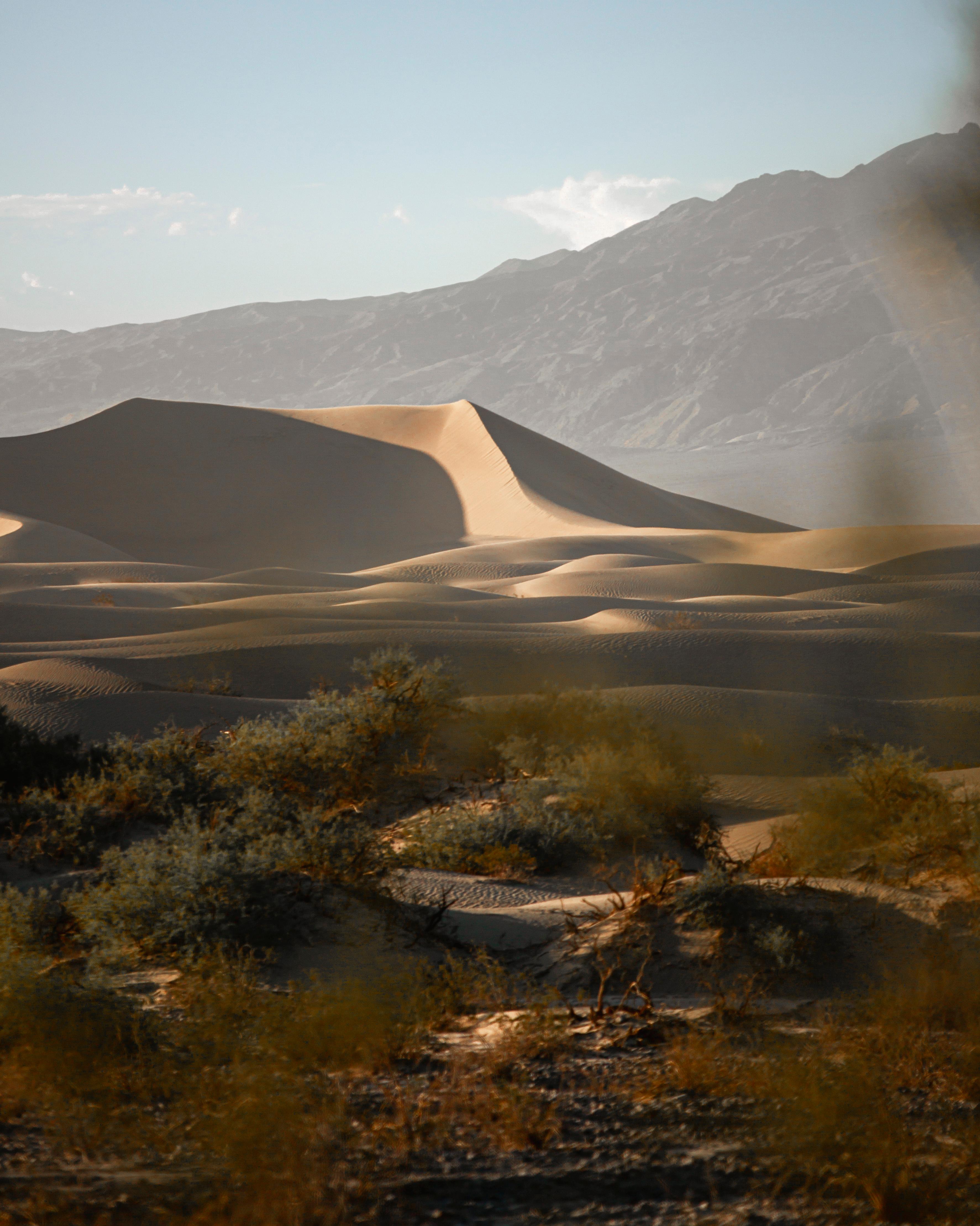
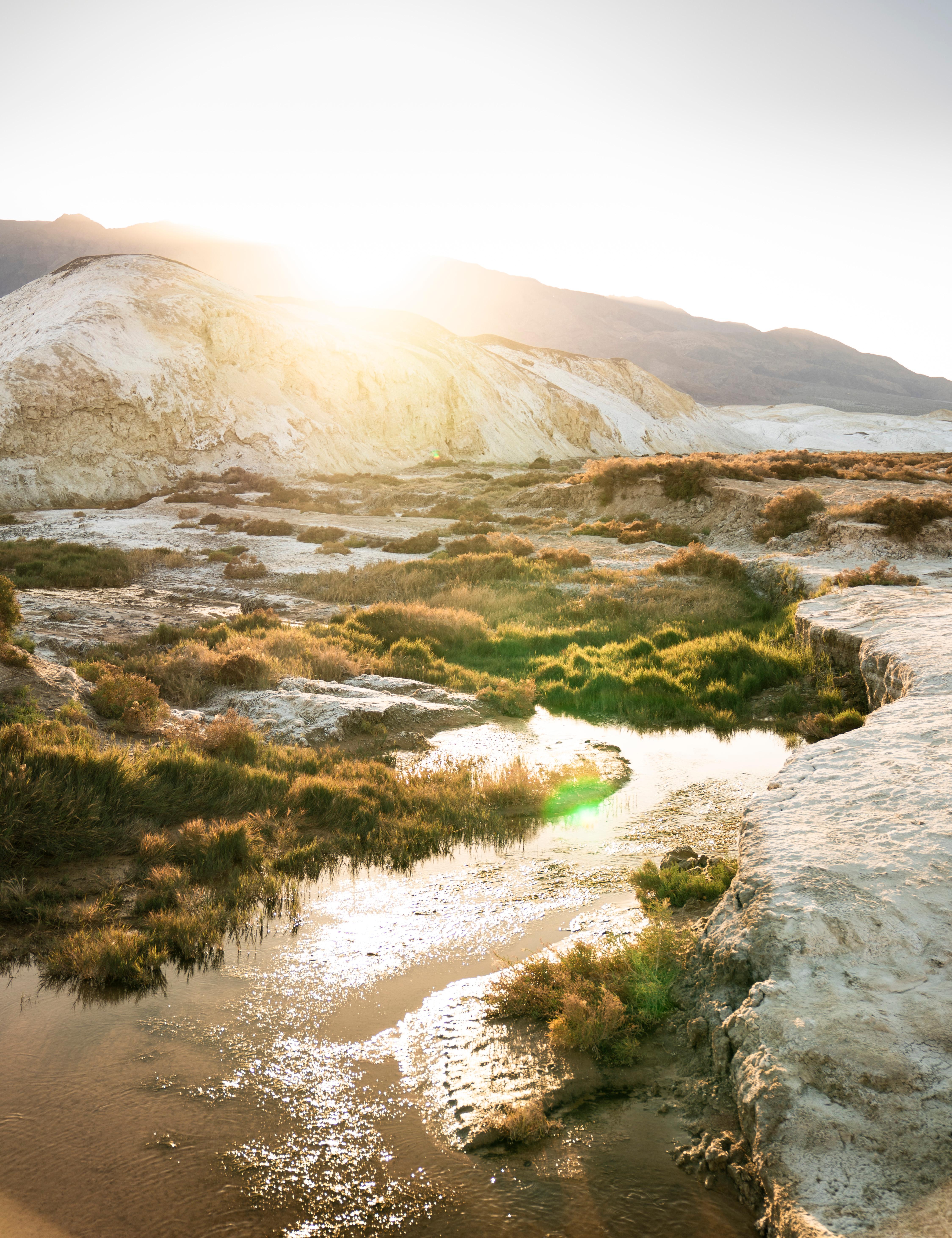
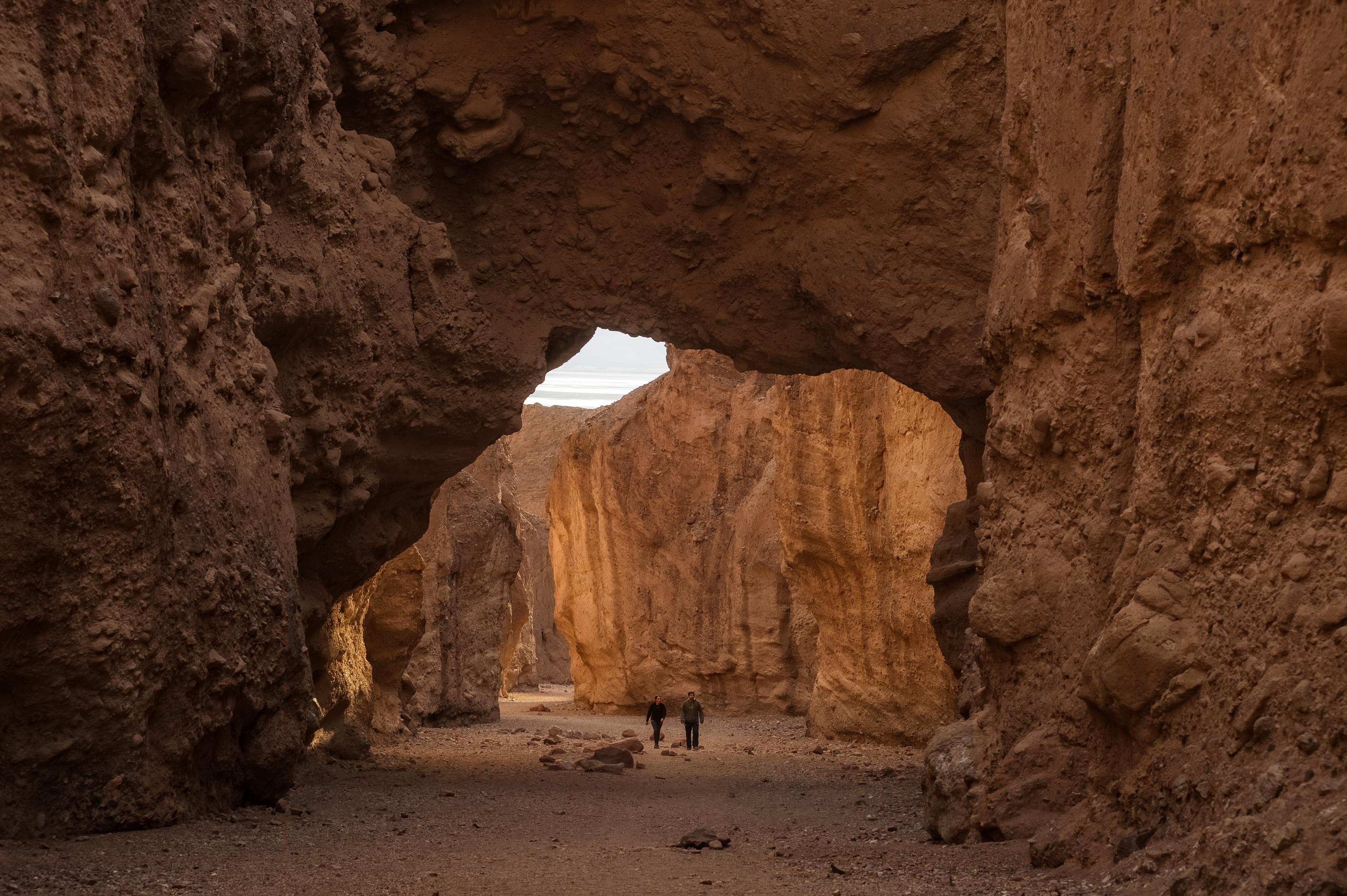
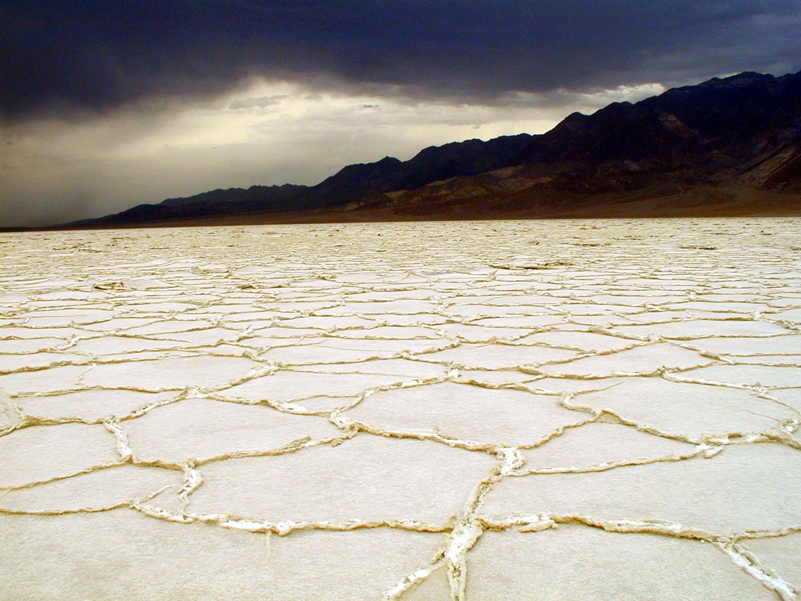
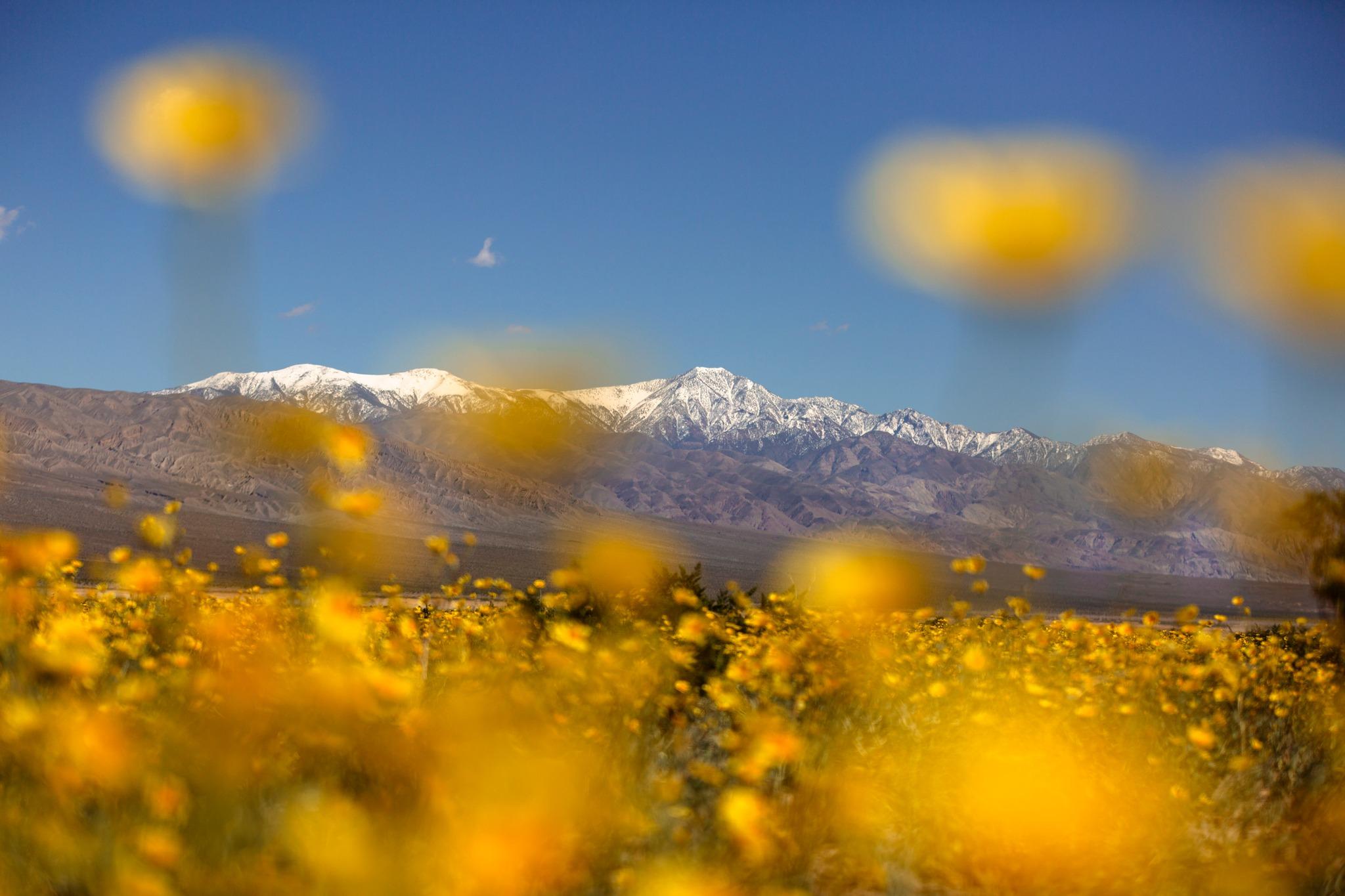
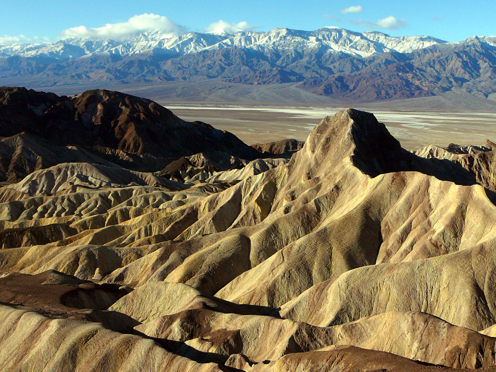
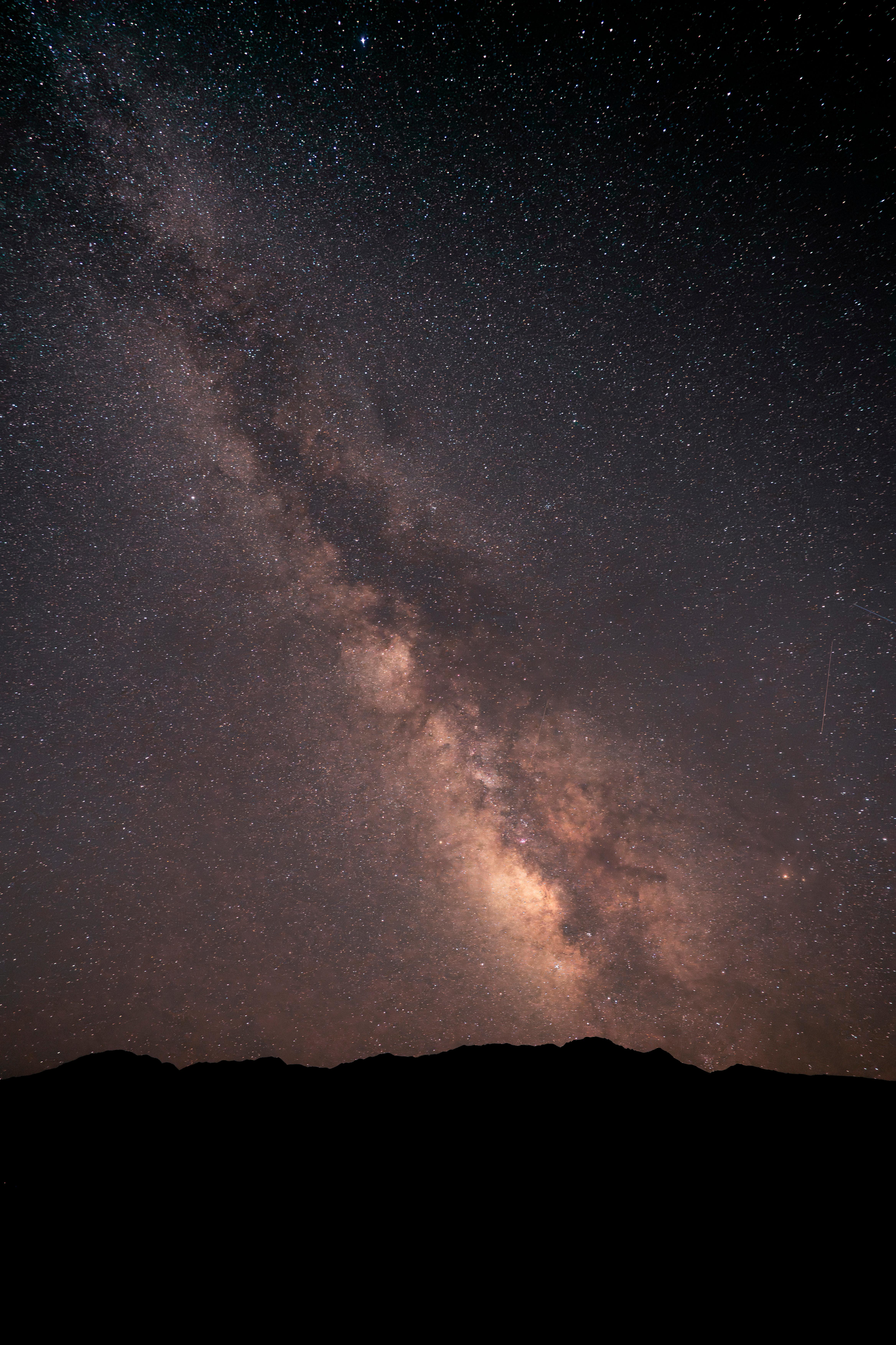

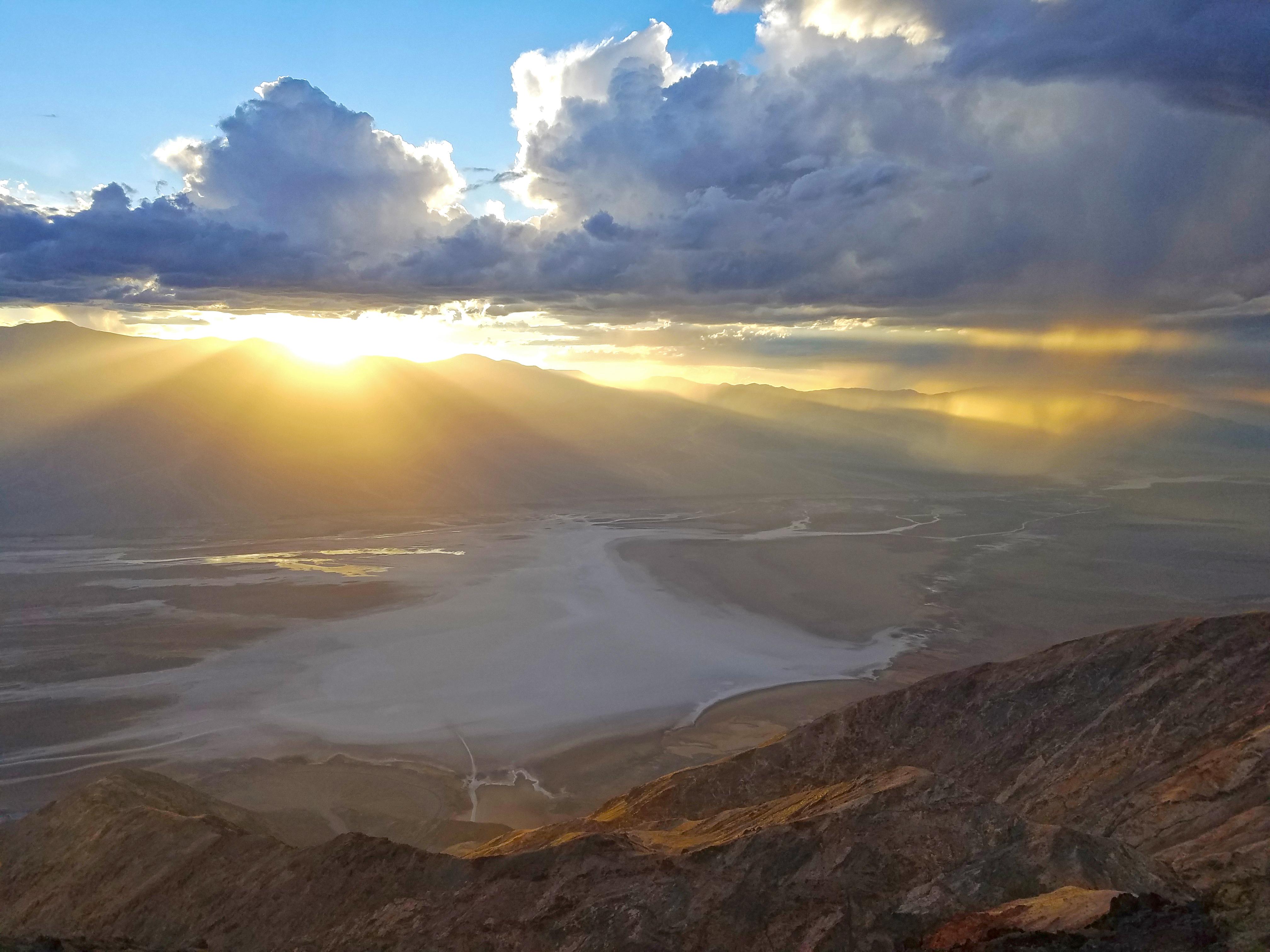


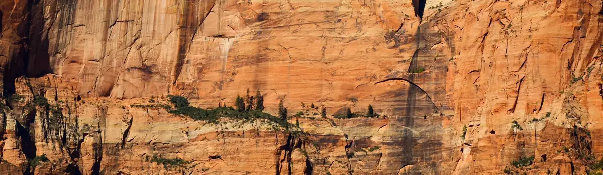 Canyons